HISTORIX Vintage 1892 Map of Pittston & West and 50 similar items


Free Shipping
HISTORIX Vintage 1892 Map of Pittston & West Pittston Pennsylvania - 18x24 Inch
$39.99 - $59.99
View full item details »

Shipping options
Seller handling time is 1 business day Details
FREE via to United States
Return policy
Full refund available for DOAs
Details
Purchase protection
Payment options
PayPal accepted
PayPal Credit accepted
Venmo accepted
PayPal, MasterCard, Visa, Discover, and American Express accepted
Maestro accepted
Amazon Pay accepted
Nuvei accepted
View full item details »
Shipping options
Seller handling time is 1 business day Details
FREE via to United States
Return policy
Full refund available for DOAs
Details
Purchase protection
Payment options
PayPal accepted
PayPal Credit accepted
Venmo accepted
PayPal, MasterCard, Visa, Discover, and American Express accepted
Maestro accepted
Amazon Pay accepted
Nuvei accepted
Item traits
| Category: | |
|---|---|
| Quantity Available: |
16 in stock |
| Condition: |
New |
| ASIN: |
B09SC22JHM |
| Item Name: |
1892 Pittston and West Pittston, Pennsylvania Poster Print |
| Item Type Keyword: |
prints |
| sizes: |
Listing details
| Seller policies: | |
|---|---|
| Shipping discount: |
Seller pays shipping for this item. |
| Posted for sale: |
April 21 |
| Item number: |
1741420461 |
Item description
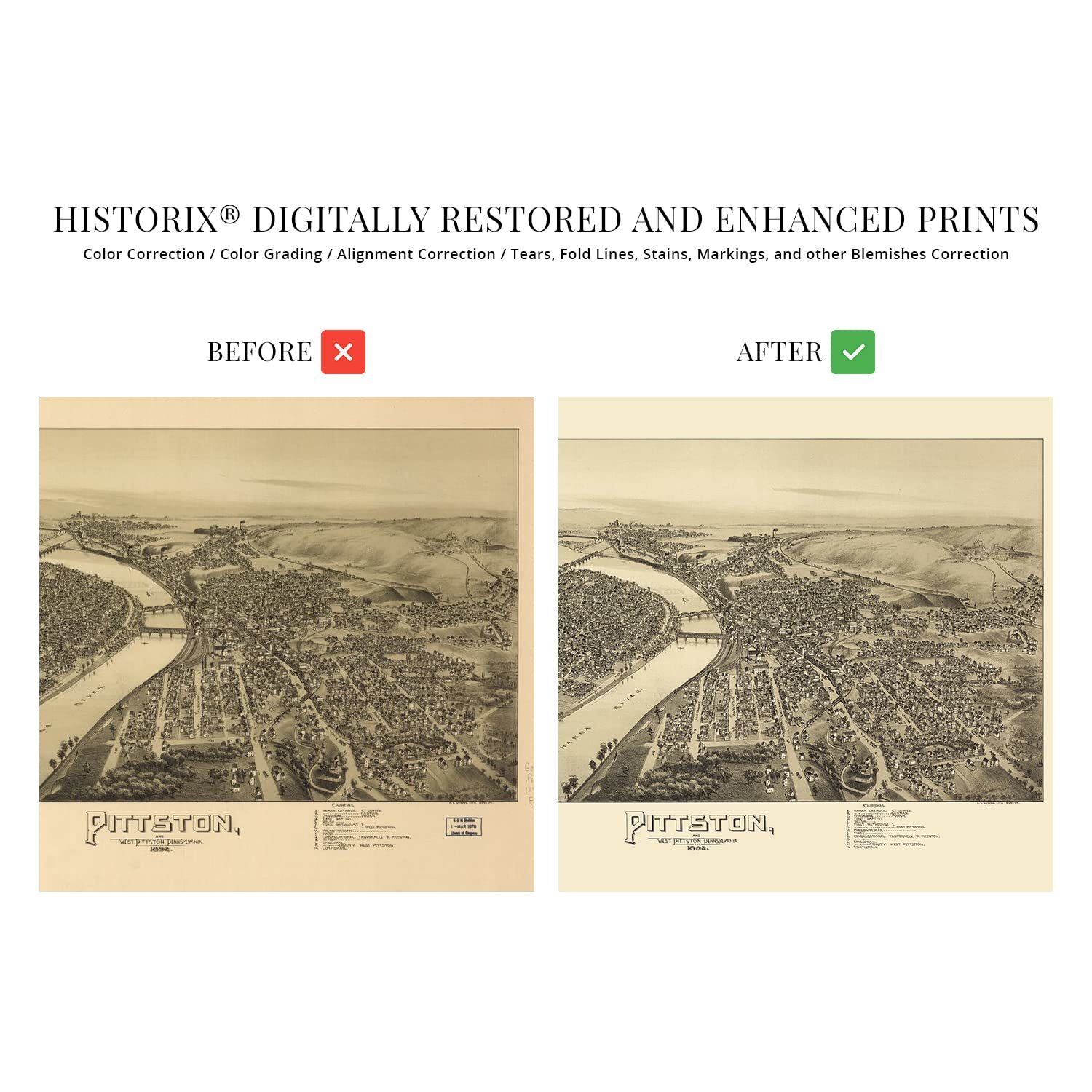
Produced and published by Thaddeus Mortimer Fowler, who is considered the most prolific illustrator of birds eye perspective, focused on cities across Pennsylvania. Fowler’s works are held in the collections of Yale University, the Boston Public Library, and Pennsylvania State University and are considered historical representations of life in the nineteenth century. Their unique aesthetic and distinctive style immediately transport the viewer back in time, creating an indelible bond between the past and present. Panoramic maps were used as marketing materials and featured prominent civic buildings, economic features, and natural attractions as well to entice residents and industrialists alike.
Originally founded in 1770, Pittston is located between the Susquehanna and the Lackawanna Rivers in the Wyoming Valley. The area was an active site for battles during the American Revolution and saw numerous clashes between Patriots and British Forces. The discovery of coal in the late eighteenth century transformed the region economically and led to the construction of a canal in the 1830s, which made the already thriving coal industry able to more efficiently export the valuable commodity to major ports and markets in the Northeast and Europe. This attracted an influx of immigrants from Ireland, England, and Western Europe who established neighborhoods and communities based on cultural lines, many of which exist to this day.
This is an authentic piece of American cartographical history that illustrates Pittston in a period of significant prosperity and growth as the coal industry remained the primary source of fuel across the United States.
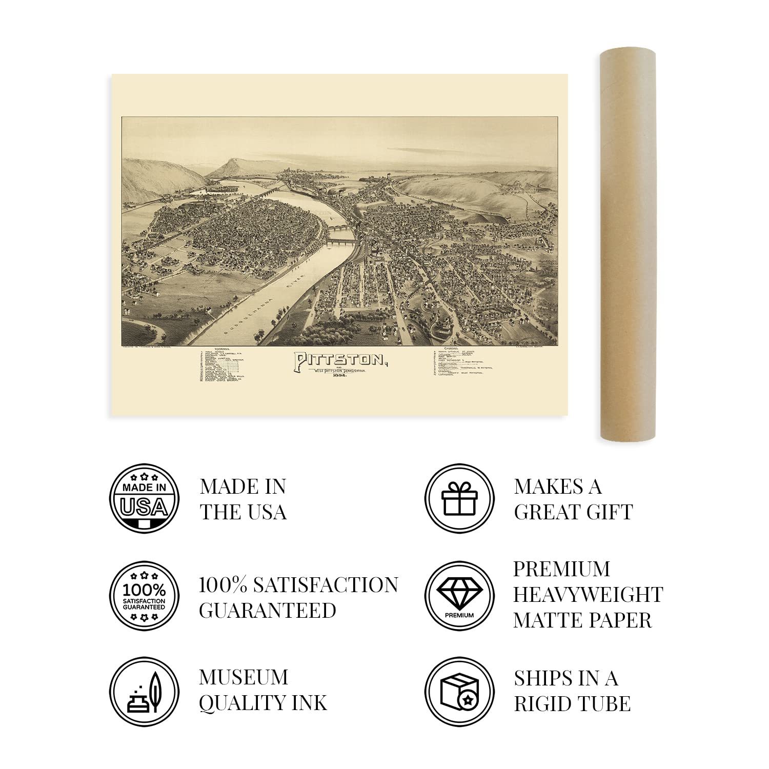
Our museum quality giclee print comes printed with archival ink on premium heavyweight matte paper. Shipped in a sturdy cardboard tube your print will arrive ready to be framed. This eye-catching vintage map reproduction print makes the perfect gift for anyone that loves history and imagery.
|
Why are we showing these items?
Booth
Historic Prints |

|


-
Refine your browsing experience
We can show you more items that are exactly like the original item, or we can show you items that are similar in spirit. By default we show you a mix.


This item has been added to your cart
 HISTORIX Vintage 1892 Map of Pittston & West Pittston Pennsylvania - 18x24 Inch added to cart.
16 available in stock
HISTORIX Vintage 1892 Map of Pittston & West Pittston Pennsylvania - 18x24 Inch added to cart.
16 available in stock
View Cart or continue shopping.
 Please wait while we finish adding this item to your cart.
Get an item reminder
We'll email you a link to your item now and follow up with a single reminder (if you'd like one). That's it! No spam, no hassle.
Already have an account?
Log in and add this item to your wish list.