HISTORIX Vintage 1876 Map of Oregon - 16x24 and similar items


Free Shipping
HISTORIX Vintage 1876 Map of Oregon - 16x24 Inch Vintage Map of Oregon Wall Art
$39.99 - $59.99
View full item details »

Shipping options
Seller handling time is 1 business day Details
FREE via to United States
Return policy
Full refund available for DOAs
Details
Purchase protection
Payment options
PayPal accepted
PayPal Credit accepted
Venmo accepted
PayPal, MasterCard, Visa, Discover, and American Express accepted
Maestro accepted
Amazon Pay accepted
Nuvei accepted
View full item details »
Shipping options
Seller handling time is 1 business day Details
FREE via to United States
Return policy
Full refund available for DOAs
Details
Purchase protection
Payment options
PayPal accepted
PayPal Credit accepted
Venmo accepted
PayPal, MasterCard, Visa, Discover, and American Express accepted
Maestro accepted
Amazon Pay accepted
Nuvei accepted
Item traits
| Category: | |
|---|---|
| Quantity Available: |
16 in stock |
| Condition: |
New |
| ASIN: |
B087N34M6G |
| Item Name: |
HISTORIX 1876 Oregon State |
| manufacturer: |
Historix |
| Item Type Keyword: |
prints |
| Brand: |
HISTORIX |
| Unspsc Code: |
52140000 |
| sizes: |
Listing details
| Seller policies: | |
|---|---|
| Shipping discount: |
Seller pays shipping for this item. |
| Posted for sale: |
April 21 |
| Item number: |
1741424499 |
Item description
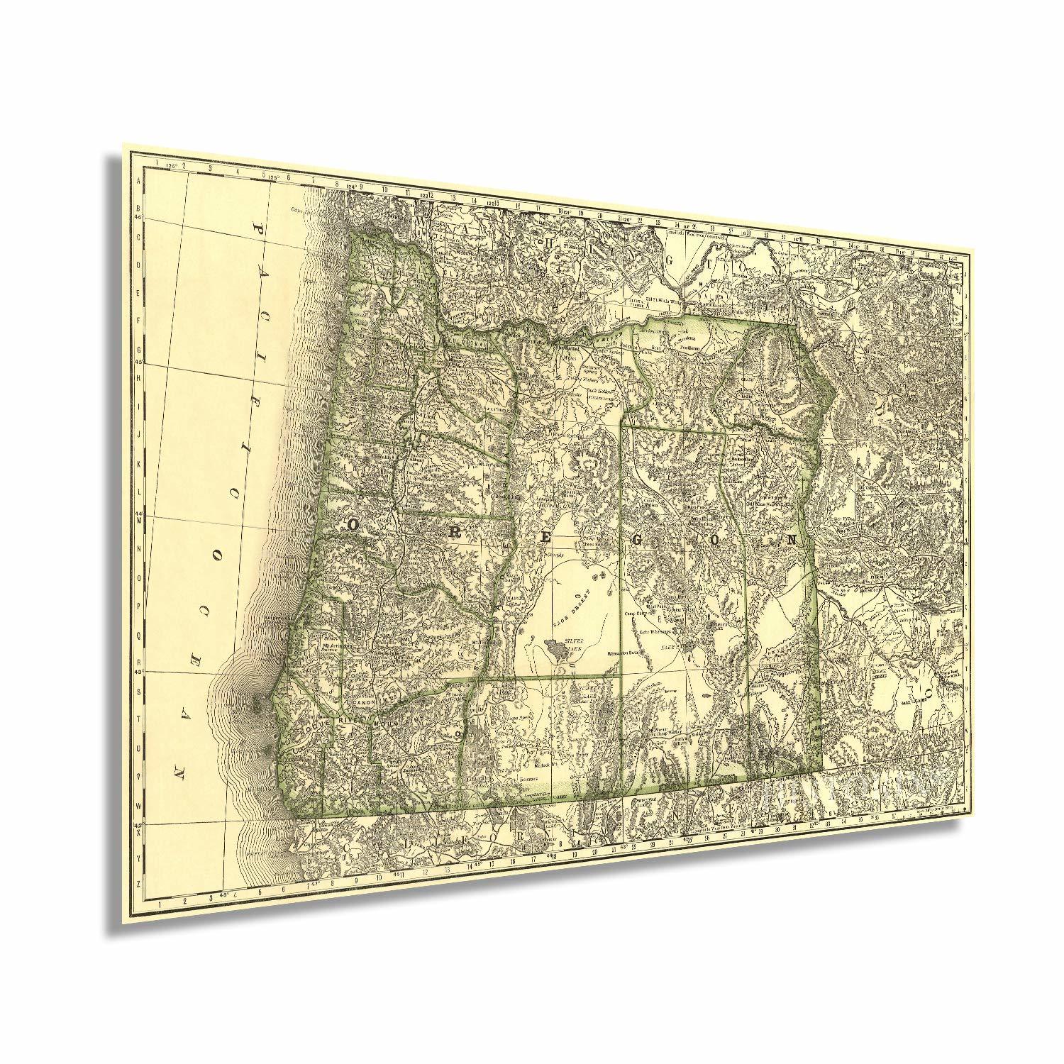
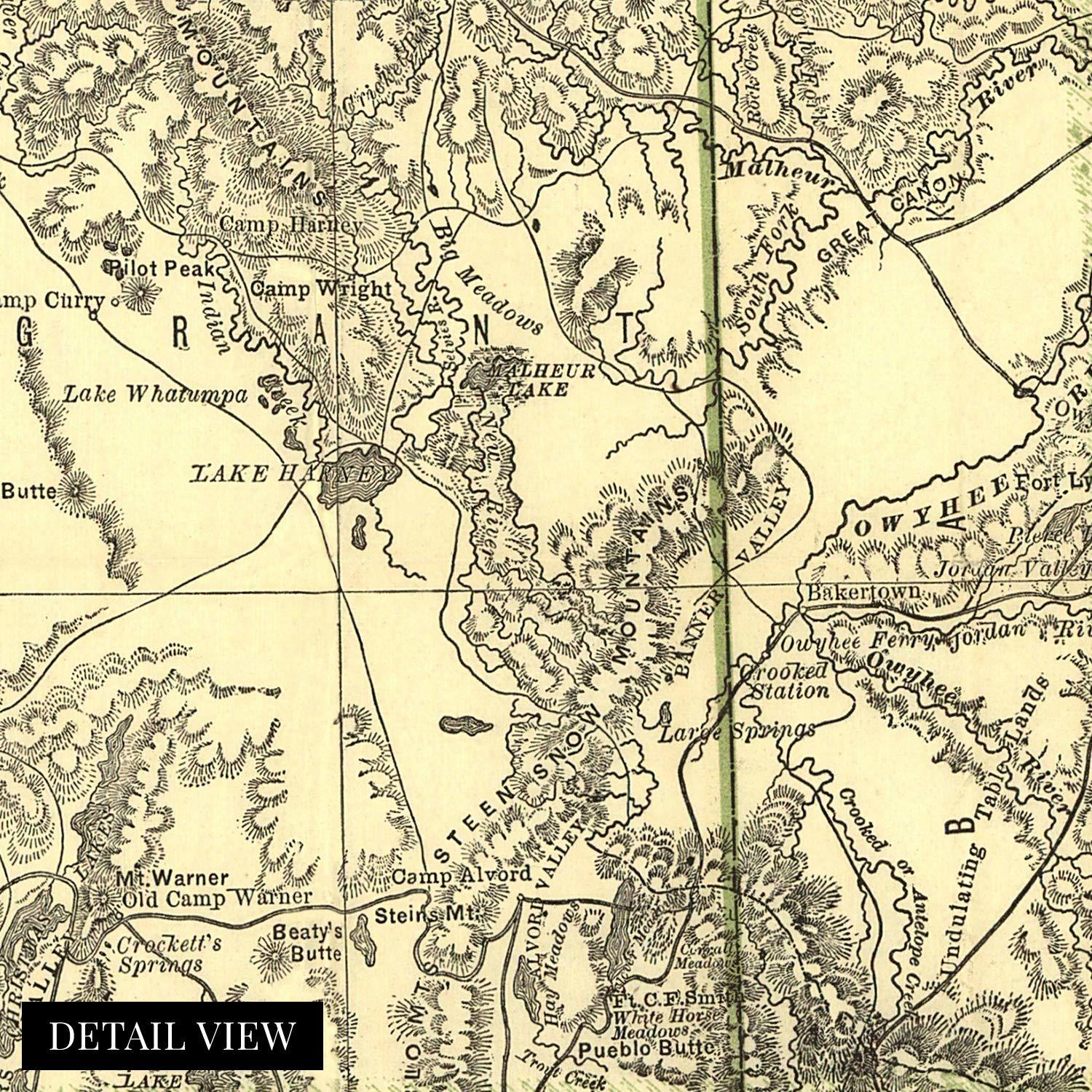
Published in 1876 by arguably the most prolific and recognizable mapmaker Rand McNally, this depiction of Oregon illustrates the vital links the railways provided as centralizing and dispersement tools. By this time, Oregon’s robust rail system allowed Portland to thrive. The City was experiencing a time of great prosperity, and the accessibility of raw materials made investors clamor to build. Portland was home to nearly twenty-thousand residents near the close of the decade.
Following the economic boom caused by the Oregon Gold Rush in the 1850s, the state was now primarily supported by the robust lumber industry. The ability to transport large timber from the region via the Willamette River allowed mills in Portland to process it into lumber, and the railroads would take it east to the heart of the country. This flourishing economy led to Portland’s enduring nickname “Stumptown.”
While the rest of the state remained mostly agrarian, Portland had become a contemporary city and was rivaled only by San Francisco to the South. The City had suffered from a significant fire in 1873 that destroyed much of the downtown area. The fire resulted in a change to the building codes creating many steel structures that have come to define the distinct aesthetic of the City.
Oregon found itself on the edge of modernity but still a rough and tumble western frontier in the 1870s. This distinctive map immediately transports the viewer back in time and is truly an authentic piece of cartographical history.
Our museum quality giclee print comes printed with archival ink on premium heavyweight matte paper. Shipped in a sturdy cardboard tube your print will arrive ready to be framed. This eye-catching vintage map print makes the perfect gift for anyone that loves history and imagery.
Loading
This item has been added to your cart
 HISTORIX Vintage 1876 Map of Oregon - 16x24 Inch Vintage Map of Oregon Wall Art added to cart.
16 available in stock
HISTORIX Vintage 1876 Map of Oregon - 16x24 Inch Vintage Map of Oregon Wall Art added to cart.
16 available in stock
View Cart or continue shopping.
 Please wait while we finish adding this item to your cart.
Get an item reminder
We'll email you a link to your item now and follow up with a single reminder (if you'd like one). That's it! No spam, no hassle.
Already have an account?
Log in and add this item to your wish list.