HISTORIX Vintage 1884 The Dalles Oregon Map and 50 similar items


Free Shipping
HISTORIX Vintage 1884 The Dalles Oregon Map - 16x24 Inch Old The Dalles Wasco Co
$39.99 - $59.99
View full item details »

Shipping options
Seller handling time is 1 business day Details
FREE via to United States
Return policy
Full refund available for DOAs
Details
Purchase protection
Payment options
PayPal accepted
PayPal Credit accepted
Venmo accepted
PayPal, MasterCard, Visa, Discover, and American Express accepted
Maestro accepted
Amazon Pay accepted
Nuvei accepted
View full item details »
Shipping options
Seller handling time is 1 business day Details
FREE via to United States
Return policy
Full refund available for DOAs
Details
Purchase protection
Payment options
PayPal accepted
PayPal Credit accepted
Venmo accepted
PayPal, MasterCard, Visa, Discover, and American Express accepted
Maestro accepted
Amazon Pay accepted
Nuvei accepted
Item traits
| Category: | |
|---|---|
| Quantity Available: |
16 in stock |
| Condition: |
New |
| UPC: |
737214980568 |
| Item Name: |
1884 Dalles, Wasco County, Oregon Poster Print |
| Item Type Keyword: |
prints |
| sizes: |
Listing details
| Seller policies: | |
|---|---|
| Shipping discount: |
Seller pays shipping for this item. |
| Posted for sale: |
April 21 |
| Item number: |
1741415633 |
Item description
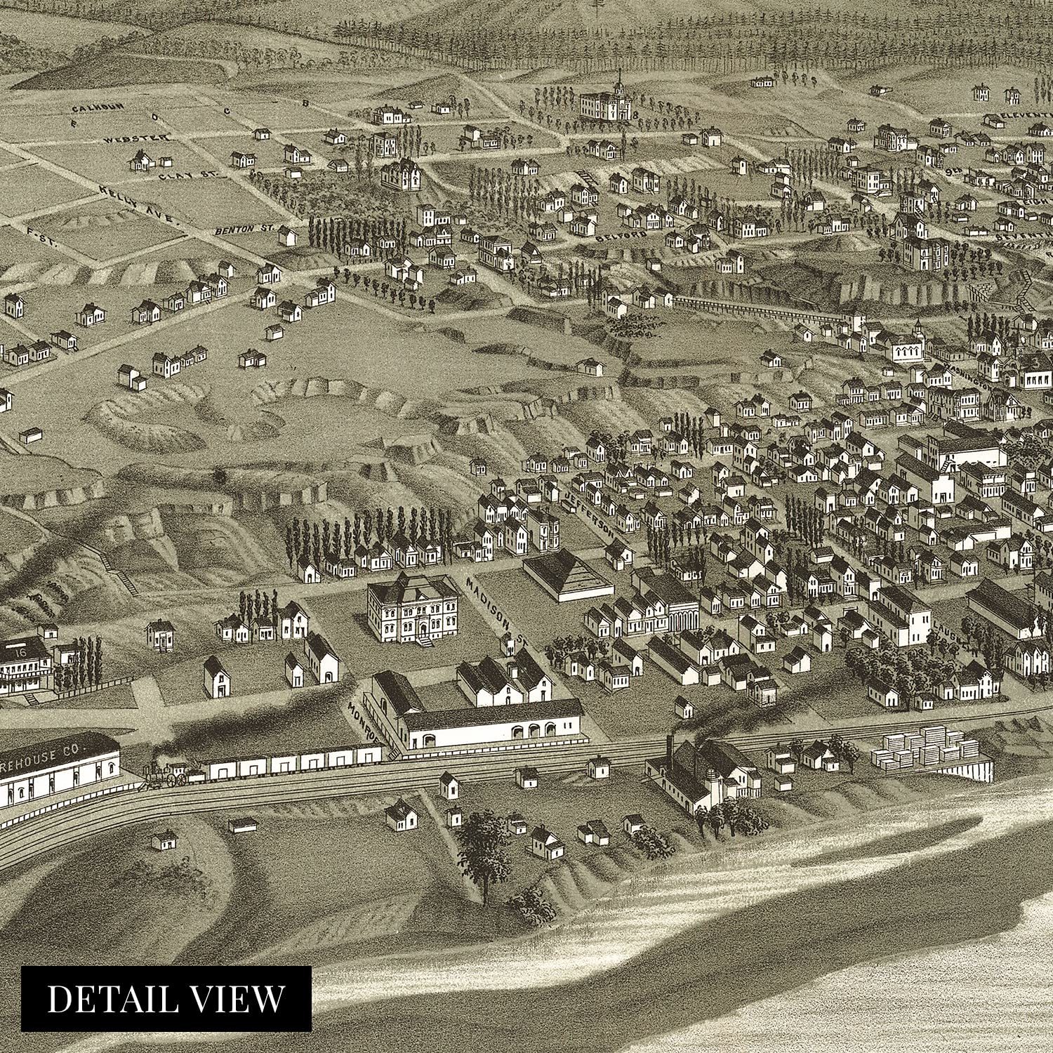
Located on the banks of the iconic Columbia River, The Dalles is the second-largest city on the Oregon bank, following Portland. Produced and published by prolific cartographer Henry Wellge, this stunning depiction captures the city in a period of significant growth and prosperity following its initial settlement in the 1840s. Wellge was among a small group of publishers and mapmakers responsible for creating more than half of the birds eye perspectives of towns and cities across the United States. These illustrations served as marketing materials to entice residents and merchants alike and featured prominent civic buildings, religious and educational institutions, as well as other geographic and economic attractions.
As the Northwest expanded in the nineteenth century, the Dalles became a popular destination as the culmination of the Oregon Trail at the steep cliffs that dropped into the Columbia River. Prior to the construction of the Barlow Road in 1846, the only way to reach the Willamette Valley from the town was via raft. Since the 1850s, it has become an important commercial center between Pendleton and Portland.
The area also remains one of North America’s most important archaeological regions. Initially, the city relied on fur trading and was the location of the longest and largest of the four portages on the Columbia River, which required cargo ships to unload their goods for safe transport through the shallow narrows. This is an authentic piece of American cartographical history with a distinctive aesthetic that immediately transports the viewer back in time.
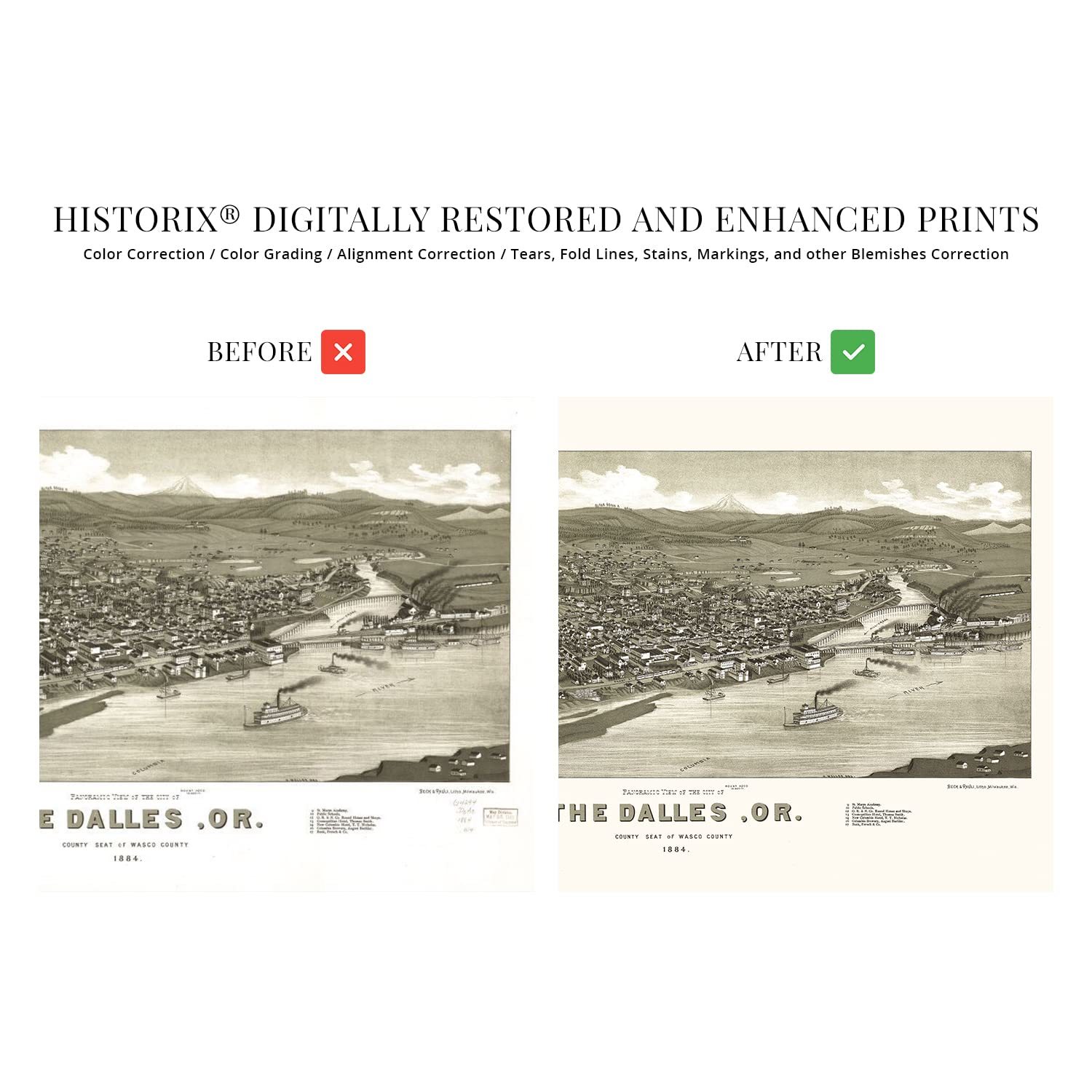
Our museum quality giclee print comes printed with archival ink on premium heavyweight matte paper. Shipped in a sturdy cardboard tube your print will arrive ready to be framed. This eye-catching vintage map reproduction print makes the perfect gift for anyone that loves history and imagery.
|
Why are we showing these items?
Booth
Historic Prints |

|


-
Refine your browsing experience
We can show you more items that are exactly like the original item, or we can show you items that are similar in spirit. By default we show you a mix.


This item has been added to your cart
 HISTORIX Vintage 1884 The Dalles Oregon Map - 16x24 Inch Old The Dalles Wasco Co added to cart.
16 available in stock
HISTORIX Vintage 1884 The Dalles Oregon Map - 16x24 Inch Old The Dalles Wasco Co added to cart.
16 available in stock
View Cart or continue shopping.
 Please wait while we finish adding this item to your cart.
Get an item reminder
We'll email you a link to your item now and follow up with a single reminder (if you'd like one). That's it! No spam, no hassle.
Already have an account?
Log in and add this item to your wish list.