Rendered at 13:22:55 08/06/25


Vintage Ravalli County Montana Road Index Map Book – 1st Edition 49 Pages 24"x18
$34.99

Shipping options
Estimated to arrive by Thu, Aug 14th.
Details
$20.05 via Standard shipping (1 to 5 business days) to United States
Offer policy
OBO - Seller accepts offers on this item.
Details
Return policy
Refunds available: See booth/item description for details
Purchase protection
Payment options
PayPal accepted
PayPal Credit accepted
Venmo accepted
PayPal, MasterCard, Visa, Discover, and American Express accepted
Maestro accepted
Amazon Pay accepted
Nuvei accepted
Item traits
| Category: | |
|---|---|
| Quantity Available: |
Only one in stock, order soon |
| Condition: |
Unspecified by seller, may be new. |
| Original/Reproduction: |
Vintage Original |
| Date Range: |
1980-1989 |
| Year: |
1980 |
| Country/Region: |
United States of America |
| US State: |
Montana |
| Format: |
Atlas Map |
| County: |
Ravalli County |
Listing details
| Shipping discount: |
No combined shipping offered |
|---|---|
| Posted for sale: |
More than a week ago |
| Item number: |
1747928270 |
Item description
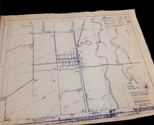
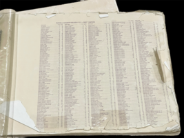
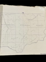
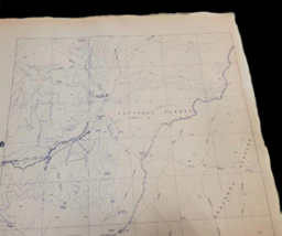
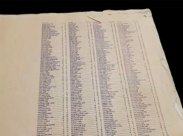
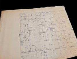
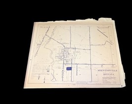
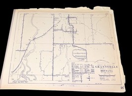
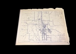
Vintage Ravalli County Montana Road Index Map Book ? 1st Edition 49 Pages 24"x18
This is a rare First Edition vintage Ravalli County Road Index Map Collection from Montana.
Includes approx. 49 detailed pages
Original clear cover and cardboard backing
Each page measures approx. 24" x 18"
Labeled with road names, township/range coordinates, landmarks, and Bitterroot National Forest details
Condition: Signs of wear, discoloration, edge tears, and yellowing consistent with age. Please review all photos carefully.
Ships rolled up for protection.
Ideal for collectors, local historians, or vintage map enthusiasts.
S/H is $20.05 within the US
Listing and template services provided by inkFrog
Added to your wish list!

- Vintage Ravalli County Montana Road Index Map Book – 1st Edition 49 Pages 24"x18
- 1 in stock
- Price negotiable
- Returns/refunds accepted
Get an item reminder
We'll email you a link to your item now and follow up with a single reminder (if you'd like one). That's it! No spam, no hassle.
Already have an account?
Log in and add this item to your wish list.