Rendered at 00:50:45 08/19/25

Shipping options
Estimated to arrive by Thu, Sep 11th.
Details
FREE via USPS Media Mail (2 to 9 business days) to United States
Return policy
Replacement product available within 30 days
Details
Purchase protection
Payment options
PayPal accepted
PayPal Credit accepted
Venmo accepted
PayPal, MasterCard, Visa, Discover, and American Express accepted
Maestro accepted
Amazon Pay accepted
Nuvei accepted
Item traits
| Category: | |
|---|---|
| Quantity Available: |
Only one in stock, order soon |
| Condition: |
New |
Listing details
| Seller policies: | |
|---|---|
| Posted for sale: |
More than a week ago |
| Item number: |
1732756981 |
Item description
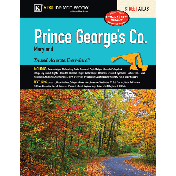
The Prince George's County, MD Atlas is a full-color street detail atlas, including: Berwyn Heights, Bladensburg, Bowie, Brentwood, Capitol Heights, Cheverly, College Park, Cottage City, District Heights, Edmonston, Fairmount Heights, Forest Heights, Glenarden, Greenbelt, Hyattsville, Landover Hills, Laurel, Morningside, Mt. Rainier, New Carrollton, North Brentwood, Riverdale Park, Seat Pleasant, University Park, and Upper Marlboro; and features: Airports, Block Numbers, Colleges and Universities, Downtown Washington, DC, Golf Courses, Metro Rail System maps, Old Town Alexandria, Parks and Rec Areas, Places of Interest, Regional Maps, the University of Maryland, and ZIP Codes
Added to your wish list!
- Prince George's County MD ADC Street Atlas
- 1 in stock
- Handling time 10 days. Estimated delivery: Thu, Sep 11th
- Returns/refunds accepted
Get an item reminder
We'll email you a link to your item now and follow up with a single reminder (if you'd like one). That's it! No spam, no hassle.
Already have an account?
Log in and add this item to your wish list.