Rendered at 05:55:54 08/14/25


Old Military Sketch croquis combate de las Coimas 1817 Argentina Consult Stock
Ships from
Argentina


Shipping options
Offer policy
OBO - Seller accepts offers on this item.
Details
Return policy
None: All purchases final
Details
Purchase protection
Payment options
PayPal accepted
PayPal Credit accepted
Venmo accepted
PayPal, MasterCard, Visa, Discover, and American Express accepted
Maestro accepted
Amazon Pay accepted
Nuvei accepted
Item traits
| Category: | |
|---|---|
| Quantity Available: |
Only one in stock, order soon |
| Condition: |
Unspecified by seller, may be new. |
| Type: |
Map/Atlas |
| Country/Region of Manufacture: |
Argentina |
Listing details
| Seller policies: | |
|---|---|
| Shipping discount: |
No combined shipping offered |
| Price discount: |
10% off w/ $150.00 spent |
| Posted for sale: |
More than a week ago |
| Item number: |
847944336 |
Item description
shipping by FEDEX certified
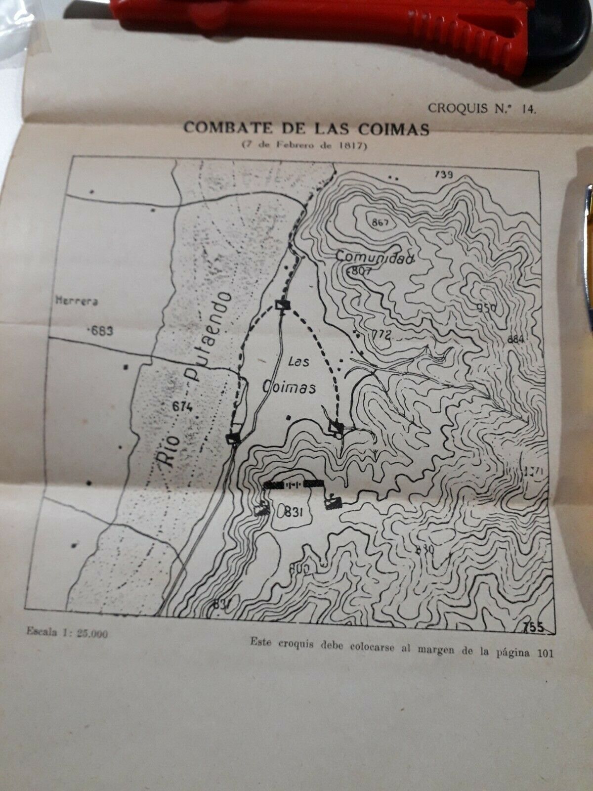
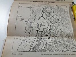
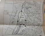
Old print Sketch map "combat of bribes" February 7, 1817
extracted for me from a book from 1930 to 1940
map measures 13 cm x 14 cm total sheet 24 cm x 19 centimeters
Croquis mapa combate de las coimas 7 de febrero 1817
extraído para mí de un libro de 1930 a 1940
medidas del mapa 13 cm x 14 cm total de la hoja 24 cm x 19 centímetros
Added to your wish list!
- Old Military Sketch croquis combate de las Coimas 1817 Argentina Consult Stock
- 1 in stock
- Price negotiable
- Handling time 2 days.
Get an item reminder
We'll email you a link to your item now and follow up with a single reminder (if you'd like one). That's it! No spam, no hassle.
Already have an account?
Log in and add this item to your wish list.