Rendered at 07:22:04 08/07/25


New Zealand, large first map Benard/Cook, 1774, Carte de la N.le Zelande
$999.00
Ships from
Spain

Shipping options
Estimated to arrive by Wed, Aug 13th.
Details
$20.00 via Standard shipping (1 to 5 business days) to United States
Ships from
Spain
Offer policy
OBO - Seller accepts offers on this item.
Details
Return policy
Full refund available within 30 days
Purchase protection
Payment options
PayPal accepted
PayPal Credit accepted
Venmo accepted
PayPal, MasterCard, Visa, Discover, and American Express accepted
Maestro accepted
Amazon Pay accepted
Nuvei accepted
Item traits
| Category: | |
|---|---|
| Quantity Available: |
Only one in stock, order soon |
| Condition: |
Unspecified by seller, may be new. |
| Type: |
Nautical Map |
| Original/Reproduction: |
Antique Original |
| Date Range: |
1700-1799 |
| Year: |
1774 |
| Country/Region: |
New Zealand |
| City: |
Wellington |
| Format: |
Atlas Map |
| Printing Technique: |
Copper Plate |
| Cartographer/Publisher: |
Thomas Cook |
Listing details
| Seller policies: | |
|---|---|
| Shipping discount: |
No combined shipping offered |
| Posted for sale: |
More than a week ago |
| Item number: |
1755747516 |
Item description
Antique
maps, authentic
I
dont sell facsimiles or copies
New
Zealand
Benard/Cook,
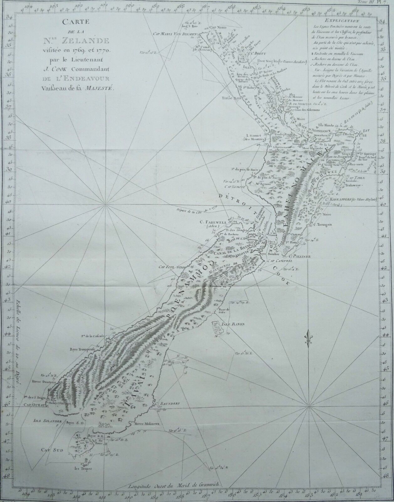
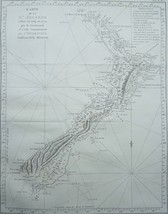
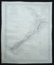
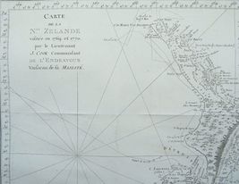
1774, Carte de la N.le Zelande
Cartographer / Cartografo
Cook/Benard
Title / Título
Carte
de la N.le Zelande
Year / Año
1774
Size / Tamaño
Image
48x38cm,
page 52x43cm
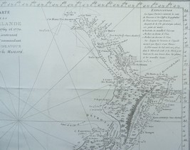
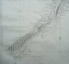
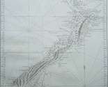
Description / Descripcion
French
edition of Cook's foundation map of New Zealand, showing the track
of the Endeavour around both islands, from October 6, 1769, to
April 1, 1770.
Endeavour
came within sight of land on April 19, well north of the area
charted by Tasman 125 years earlier. The New Holland (Australia)
coast was exasperating, however, and Cook could not find a safe
place to land until the afternoon of Saturday, April 28, when they
entered Botany Bay (part of today's Sydney Harbor), which Cook
later named for the wide variety of plant life found there. The
Aborigines that they saw there were unintelligible to Tupaia and
kept away, avoiding contact. Through May and into June, Endeavour
sailed north, arcing northwest, following the Great Barrier Reef
coastline. On the evening of June 10, when most of the men were
sleeping, the ship struck coral, stuck fast, and began leaking.
Quick thinking and decisive action by Cook and his men-pumping
furiously and jettisoning fifty tons of decayed stores, stone
ballast, and cannons-kept the ship afloat and allowed a temporary
underwater repair. A few days later, the damaged ship was safely
beached on a barren shore (near today's Cooktown, by the
EndeavourRiver), and a fury of activity began more permanent work:
the expedition had avoided a real disaster. (Henceforth, the
British Admiralty would send Cook out with two ships for safety.)
During this time, the men enjoyed more favorable interactions with
the natives, but not without miscommunications and incidents of
distrust. By August 13, the ship was ready to resume its journey.
The
labyrinth of treacherous islands and reefs was threaded slowly and
carefully, with vigilance and some luck, as the expedition sailed
northward through the Great Barrier Reef, westward around the
northernmost point of New Holland, and into what Cook called
Endeavour Strait. He stopped briefly at Possession Island (his
name) where, now knowing he was in territory explored by the
Dutch, he claimed the whole coastline he had just charted for King
George III. It was a proud moment, essentially marking the end of
Cook's first Pacific voyage's geographical discoveries.
This
map was engraved by Robert Benard for the 1774 French edition of
Hawkesworth's 1773 account of Cook's voyages.
It
follows the 1772-1773 English edition engraved by William
Whitchurch and published in 1773.
Condition / Estado
Excellent
condition. Thick and strong paper. Clear print. Folds as issued.
Remarks / Comentarios
Please
read the part about the condition of the map and study the
pictures carefully before buying. I sell original maps, often
several centuries old, and they therefore will have signs of
age and use.
Por
favor, estudie atentamente las fotos y el texto para conocer el
estado del mapa antes de adquirirlo. Se trata de un mapa original
que tiene unos siglos de antigüedad, razon por la que presenta
ciertas marcas de uso.
Payment
and shipment / Pago y envío
Payment / Pago
With
bank transfer to bank account or with PayPal (the seller prefers a
bank transfer).
Pago
por transferencia bancaria o con PayPal (el vendedor prefiere
transferencia).
Shipment / Envío
In
case you choose to have the item shipped without certified/insured
mail, the seller will not be responsible for safe arrival of the
shipment. If
needed, a proof of shipment can be provided.
En
caso de que usted no elija correo certificado, el vendedor no se
hara responsable si su paquete no llega bien. Si
lo desea, recibira un comprobante de envío.
Return policy / devolucion
In
case you do not like the map, you can return it to the seller
within 10 days after receiving it. You are responsible for the
costs for return shipment/insurance. You will receive a full
refund of the purchase amount (excl. shipping costs) after the
seller has the map.
En
caso de que al final no le guste el mapa, puede devolverlo en un
plazo de 10 días tras recibirlo. Los gastos de envío
(certificado) corren de su cargo. Cuando el vendedor reciba el
mapa, le sera devuelto el importe completo de la compra
(excluidos los gastos de envío).
SHIPMENT
CAN BE COMBINED
PUEDEN
MANDARSE VARIOS MAPAS EN UN SOLO ENVÍO
24
31 AF
Added to your wish list!
- New Zealand, large first map Benard/Cook, 1774, Carte de la N.le Zelande
- 1 in stock
- Price negotiable
- Handling time 1 day. Estimated delivery: Wed, Aug 13th
- Returns/refunds accepted
Get an item reminder
We'll email you a link to your item now and follow up with a single reminder (if you'd like one). That's it! No spam, no hassle.
Already have an account?
Log in and add this item to your wish list.