Rendered at 12:56:14 08/13/25

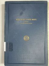


Kentucky Geological Survey State Maps Jefferson County 1915 1924 1928 W Jillson

Shipping options
Seller handling time is 1 business day Details
$4.50 to United States
Offer policy
OBO - Seller accepts offers on this item.
Details
Return policy
Full refund available within 30 days
Purchase protection
Payment options
PayPal accepted
PayPal Credit accepted
Venmo accepted
PayPal, MasterCard, Visa, Discover, and American Express accepted
Maestro accepted
Amazon Pay accepted
Nuvei accepted
Item traits
| Category: | |
|---|---|
| Quantity Available: |
Only one in stock, order soon |
| Condition: |
Unspecified by seller, may be new. |
| Type: |
Geological Map |
| Original/Reproduction: |
Antique Original |
| Year: |
1915 |
| Country/Region: |
United States of America |
| US State: |
Kentucky |
| Format: |
Folding Map |
| Cartographer/Publisher: |
U S Geological Survey |
| Date Range: |
1915-1928 |
| Seller Notes: |
Listing details
| Shipping discount: |
Free shipping on orders over $75.00 |
|---|---|
| Posted for sale: |
More than a week ago |
| Item number: |
1050590289 |
Item description
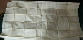
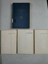
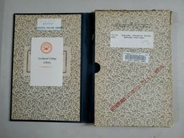
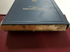
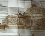
Ex-library, usual library markings, 3 maps in a slipcase, All 3 maps are folded, some tears at folds of the Jefferson County map,
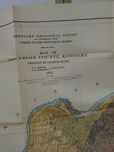
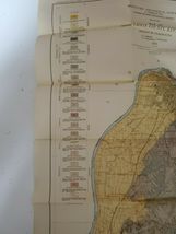
Map of Jefferson County, KY, Geology by Charles Butts, T C Brown, J J Galloway, 1915 57" x 29.5"
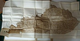
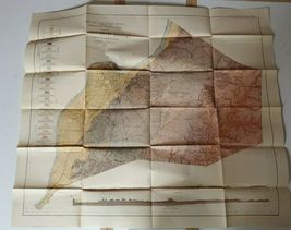
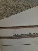
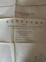
Base map of Kentucky showing physiographic features and elevations, prepared under the direction of Willard Rouse Jillson by R L Harrison and W H Gill computed and drafted from 1925-1928 34" x 29.5"
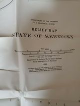
Relief map of the State of Kentucky, base from U S Geological Survey map of the State. relief shading by Jno. H
Renshawe, 1924 54" x 29.5"
Added to your wish list!
- Kentucky Geological Survey State Maps Jefferson County 1915 1924 1928 W Jillson
- 1 in stock
- Price negotiable
- Handling time 1 day.
- Returns/refunds accepted
Get an item reminder
We'll email you a link to your item now and follow up with a single reminder (if you'd like one). That's it! No spam, no hassle.
Already have an account?
Log in and add this item to your wish list.