Rendered at 04:51:51 08/07/25


Japan, large rare early map De Charlevoix, 1736, Carte de l´Empire du Japon...
$699.00
Ships from
Spain

Shipping options
Estimated to arrive by Wed, Aug 13th.
Details
$15.00 via Standard shipping (1 to 5 business days) to United States
Ships from
Spain
Offer policy
OBO - Seller accepts offers on this item.
Details
Return policy
Full refund available within 30 days
Purchase protection
Payment options
PayPal accepted
PayPal Credit accepted
Venmo accepted
PayPal, MasterCard, Visa, Discover, and American Express accepted
Maestro accepted
Amazon Pay accepted
Nuvei accepted
Item traits
| Category: | |
|---|---|
| Quantity Available: |
Only one in stock, order soon |
| Condition: |
Unspecified by seller, may be new. |
| Original/Reproduction: |
Antique Original |
| Date Range: |
1700-1799 |
| Year: |
1736 |
| Country/Region: |
Japan |
| City: |
Tokyo |
| Format: |
Atlas Map |
| Printing Technique: |
Copper Plate |
Listing details
| Seller policies: | |
|---|---|
| Shipping discount: |
No combined shipping offered |
| Posted for sale: |
More than a week ago |
| Item number: |
1756627591 |
Item description
Old
maps, Genuine antiques
No
copies
Japan,
large
rare early map
De
Charlevoix, 1736, Carte de lEmpire du Japon...
Cartographer
/ Cartografo
P.F.X.
De Charlevoix
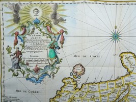
Title
/ Título
Carte
de l'empire du Japon, dressee sur les auteurs japonois, sur les
memoires des portugais et des hollandois et en particulier sur
ceux des RRPP. de la comp. de Jesus. 1735 (dated)
Year
/ Año
1736
Size
/ Tamaño
Image
41,5x54cm, page 44x56cm
Description
/ Descripcion
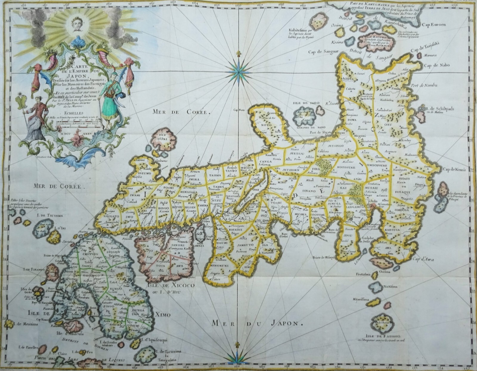
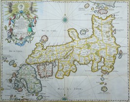
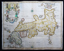
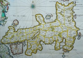
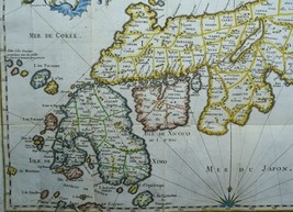
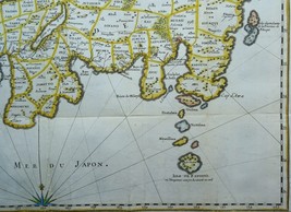
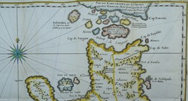
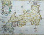
This
rare early map of Japann
is centered
on the Bay of Osaka, covering
ranges from the northern islands of Japan (Ezo) to the Ryukyu
Islands, which were vassals of Satsuma (Saxuma) Domain. Various
towns, harbors, bays, provinces, mountains, and daimyo are noted,
although many are speculative.
The
map includes several inaccuracies. Shikoku Island (here identified
as I. Xixoco) appears to be almost square with a deep inlet on its
northern side, while Kyushu (Insel Ximo) is slanted to the east.
On the island of Honshu (Insel Nippon), Aomori Prefecture is
foreshortened while the Oki Islands appear exaggerated. Shimane
prefecture and the Noto Peninsula are also distorted. The island
of Hokkaido is referred to as the 'I. de Matsumay,' after the
ruling Matsumae clan, which ruled a domain (han) in southern
Hokkaido. The Isle de Fatsisio at bottom-right is Hachij?-jima,
where political opponents of the shogun (not the emperor) and
other criminals were exiled.
Bellin
attributed this map to Jesuit and Portuguese sources, but upon
deeper analysis it is derived more closely from the work of the
German traveler and naturalist Engelbert Kaempfer (16511716).
Having spent 2 years in Japan, Kaempfer was considered one of
Europe's leading Japanologists. Charlevoix likely did not credit
Kaempfer due to his distaste for Protestants and his deep
connections to the Jesuit order.
Published
in Histoire et description generale du Japon..., P.F.X. De
Charlevoix, Paris 1736, Gandouin et al.
Condition
/ Estado
Very
good condition. Folds, as published. Clear print. Reverse side
blank. Lateral
and bottom margins short (as published) and extended with antique
paper. Otherwise perfect.
Remarks
/ Comentarios
Please
read the part about the condition of the map and study the
pictures carefully before buying. I sell original maps, often
several centuries old, and they therefore will have signs of
age and use.
Por
favor, estudie atentamente las fotos y el texto para conocer el
estado del mapa antes de adquirirlo. Se trata de un mapa original
que tiene unos siglos de antigüedad, razon por la que presenta
ciertas marcas de uso.
Payment
and shipment / Pago y envío
Payment
/ Pago
With
bank transfer to Spanish or Dutch bank account or with PayPal (the
seller prefers a bank transfer).
Pago
por transferencia bancaria a cuenta española u holandesa o con
PayPal (el vendedor prefiere transferencia).
Shipment
/ Envío
In
case you choose to have the item shipped without certified/insured
mail, the seller will not be responsible for safe arrival of the
shipment. If
needed, a proof of shipment can be provided.
En
caso de que usted no elija correo certificado, el vendedor no se
hara responsable si su paquete no llega bien. Si
lo desea, recibira un comprobante de envío.
Return
policy / devolucion
In
case you do not like the map, you can return it to the seller
within 10 days after receiving it. You are responsible for the
costs for return shipment/insurance. You will receive a full
refund of the purchase amount (excl. shipping costs) after the
seller has the map.
En
caso de que al final no le guste el mapa, puede devolverlo en un
plazo de 10 días tras recibirlo. Los gastos de envío
(certificado) corren de su cargo. Cuando el vendedor reciba el
mapa, le sera devuelto el importe completo de la compra
(excluidos los gastos de envío).
SHIPMENT
CAN BE COMBINED
PUEDEN
MANDARSE VARIOS MAPAS EN UN SOLO ENVÍO
SEE
THE OTHER MAPS I HAVE FOR SALE
MIRE
LOS DEMAS MAPAS QUE TENGO EN VENTA
Keywords:
24 23 B
Added to your wish list!
- Japan, large rare early map De Charlevoix, 1736, Carte de l´Empire du Japon...
- 1 in stock
- Price negotiable
- Handling time 1 day. Estimated delivery: Wed, Aug 13th
- Returns/refunds accepted
Get an item reminder
We'll email you a link to your item now and follow up with a single reminder (if you'd like one). That's it! No spam, no hassle.
Already have an account?
Log in and add this item to your wish list.