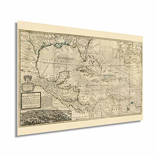
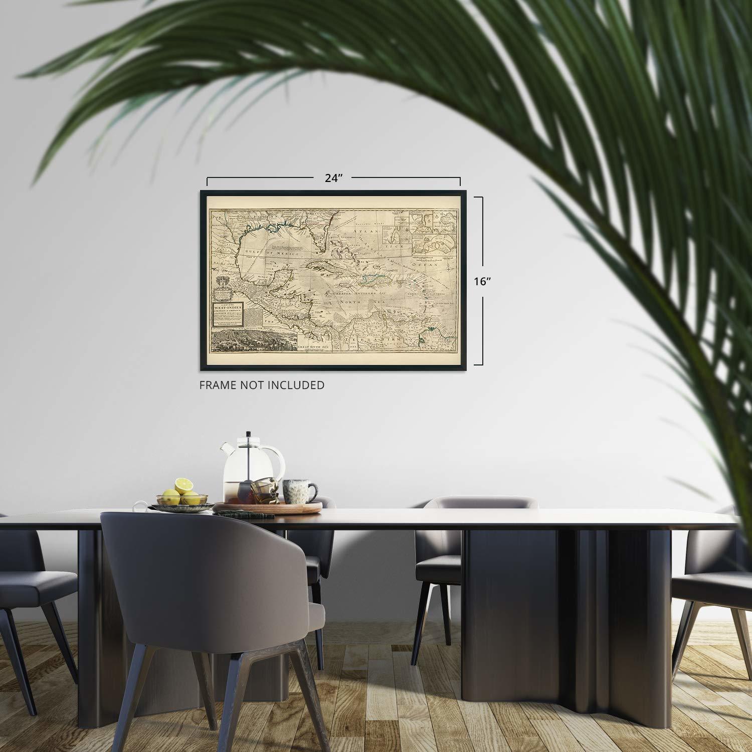
Historix Vintage 1715 Map of West Indies Islands of America - 16 x 24 Inch Vinta
Shipping options
Seller handling time is 2 business days Details
This reflects the seller's handling time and may not include time spent in transit.
If you have questions about shipping, please contact the seller.
FREE via to United States
Return policy
Full refund available for DOAs
Details
- We guarantee our products and offer full refunds or exchange for defective items or items not as-described.
- Buyer must contact us within 30 days after receipt of shipment.
- The item must be received in the same condition as shipped.
- Items must be returned with all original packaging and accessories.
- Items must not be abused, modified or damaged by accident.
- A 20% restocking fee will be charged for returns
- Buyer is responsible for all return shipping and handling fees.
- Restocking and return shipping fees do not apply when item is returned as defective or because incorrect product was delivered.
Payment options
PayPal accepted
PayPal Credit accepted
Venmo accepted
PayPal, MasterCard, Visa, Discover, and American Express accepted
Maestro accepted
Amazon Pay accepted
Nuvei accepted
Item traits
| Category: |
Laminating Machines
|
| Quantity Available: |
8 in stock
|
| Condition: |
New
|
| ASIN: |
B08665XYPV
|
| Map Type: |
Historical
|
| Bullet Point: |
View details
VINTAGE MAP REPRODUCTION: You’ll love this high quality historic reproduction of 1715 Map of West Indies Islands of America. Our museum quality maps are archival grade, which means it will look great and last without fading for over 100 years. Our...
|
| Product Description: |
View details
This restored piece or cartographical history comes alive and truly transports the viewer to another time. Pre-dating the American Revolution and harkening back to when the West Indies and Americas were simply disputed territories fought for by...
|
| Brand: |
HISTORIX
|
| Unspsc Code: |
55101500
|
| Item Type Keyword: |
wall-maps
|
| Paper Size: |
16 x 24 inches
|
| Paper Finish: |
matte
|
| Item Name: |
View details
Historix Vintage 1715 Map of West Indies Islands of America - 16 x 24 Inch Vintage Map Wall Art - Shows what belongs to Spain, England, France and Holland - Old West Indies Art - Carribean Art
|
| Product Site Launch Date: |
2020-03-20T14:43:37.445Z
|
| material: |
paper
|
Listing details
|
Seller policies:
|
View seller policies
|
|
Shipping discount:
|
Seller pays shipping for this item.
|
|
Posted for sale:
|
More than a week ago
|
|
Item number:
|
1735773874
|
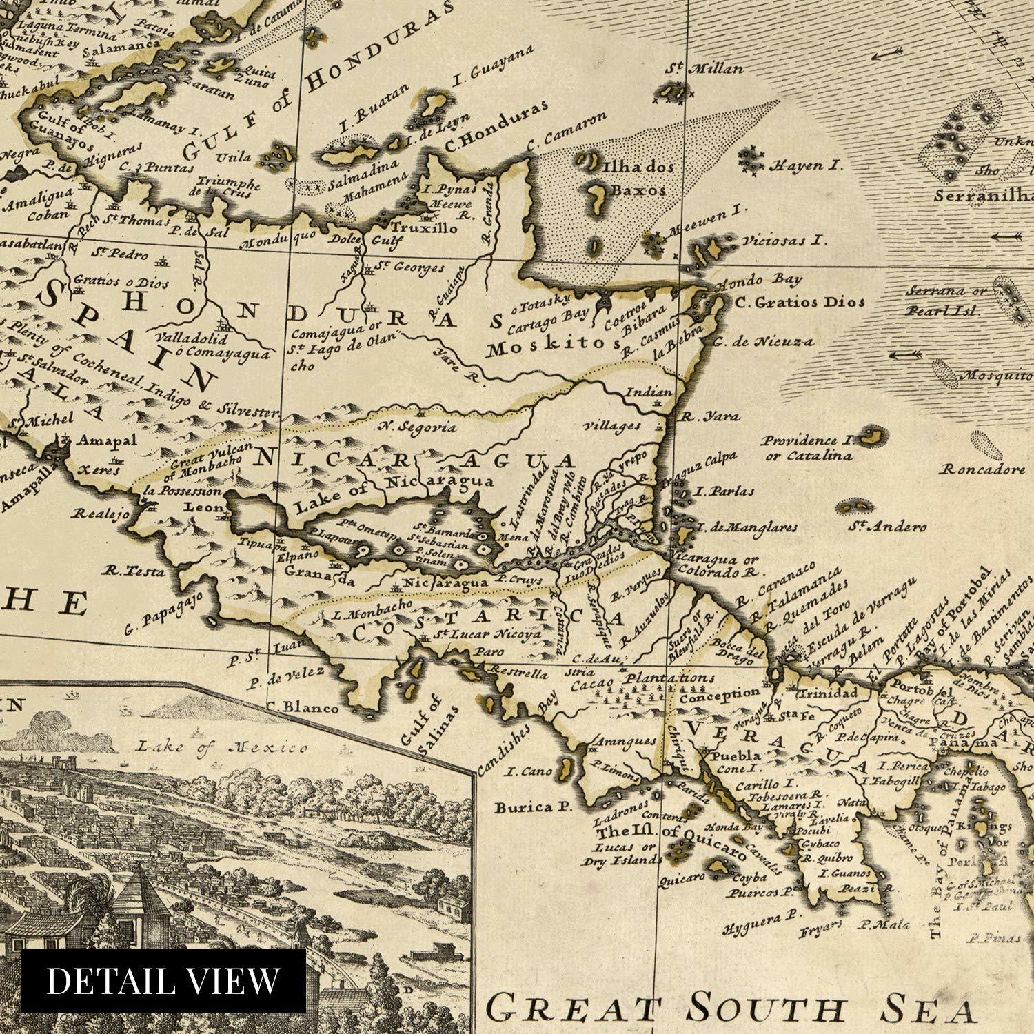
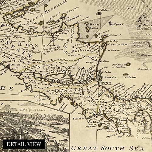
This restored piece or cartographical history comes alive and truly transports the viewer to another time. Pre-dating the American Revolution and harkening back to when the West Indies and Americas were simply disputed territories fought for by the French, Spanish, English and Dutch our restored version of this map shows in stunning clarity the impressive work of early cartographer Herman Moll. Moll was noted for his of Galleon ships and fleets to produce this intricate map that even includes trade winds.
The rich history of this region combined with what was the highest technical ability of cartography at the time, come together to depict a land in flux and evolution. The Americas had been relatively recently discovered and as such were being charted for the first time. The depictions of modern day America and Cuba, as well as Mexico and South America show how truly remarkable the endeavor to colonize these lands was. This map was originally published to distinguish each colonial powers’ claims in the new world and stands out as a testament to Moll’s dedication and expertise.
Our museum quality giclee print comes printed with archival ink on premium heavyweight matte paper. Shipped in a sturdy cardboard tube your print will arrive ready to be framed. This eye-catching vintage map reproduction print makes the perfect gift for anyone that loves history and imagery.
Additional Details
------------------------------
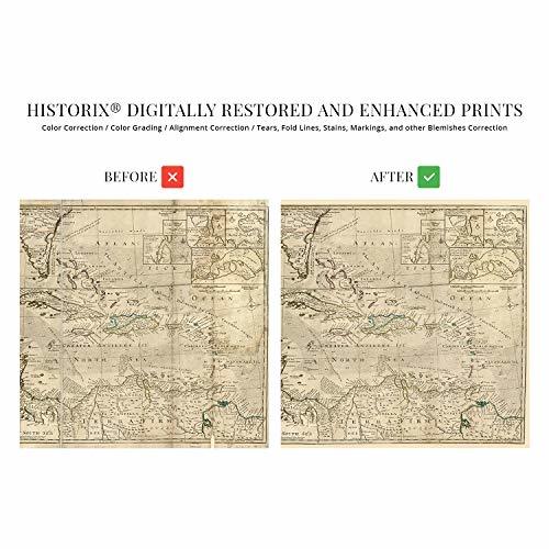
Bullet point: VINTAGE MAP REPRODUCTION: You?ll love this high quality historic reproduction of 1715 Map of West Indies Islands of America. Our museum quality maps are archival grade, which means it will look great and last without fading for over 100 years. Our print to order maps are made in the USA and each map is inspected for quality. This beautiful artwork is a perfect addition to your themed decor. Vintage maps look great in the home, study or office. They make a perfect gift as well.
Product description:
This restored piece or cartographical history comes alive and truly transports the viewer to another time. Pre-dating the American Revolution and harkening back to when the West Indies and Americas were simply disputed territories fought for by the French, Spanish, English and Dutch our restored version of this map shows in stunning clarity the impressive work of early cartographer Herman Moll. Moll was noted for his of Galleon ships and fleets to produce this intricate map that even includes trade winds.
The rich history of this region combined with what was the highest technical ability of cartography at the time, come together to depict a land in flux and evolution. The Americas had been relatively recently discovered and as such were being charted for the first time. The depictions of modern day America and Cuba, as well as Mexico and South America show how truly remarkable the endeavor to colonize these lands was. This map was originally published to distinguish each colonial powers’ claims in the new world and stands out as a testament to Moll’s dedication and expertise.
Our museum quality giclee print comes printed with archival ink on premium heavyweight matte paper. Shipped in a sturdy cardboard tube your print will arrive ready to be framed. This eye-catching vintage map reproduction print makes the perfect gift for anyone that loves history and imagery.