Rendered at 06:26:42 08/20/25

Shipping options
Estimated to arrive by Tue, Sep 9th.
Details
FREE via UPS Ground (1 to 5 business days) to United States
Return policy
Replacement product available within 30 days
Details
Purchase protection
Payment options
PayPal accepted
PayPal Credit accepted
Venmo accepted
PayPal, MasterCard, Visa, Discover, and American Express accepted
Maestro accepted
Amazon Pay accepted
Nuvei accepted
Item traits
| Category: | |
|---|---|
| Quantity Available: |
Only one in stock, order soon |
| Condition: |
New |
| Format: |
Wall Map |
| Topic: |
Maps |
| US State: |
California |
Listing details
| Seller policies: | |
|---|---|
| Posted for sale: |
More than a week ago |
| Item number: |
965831241 |
Item description
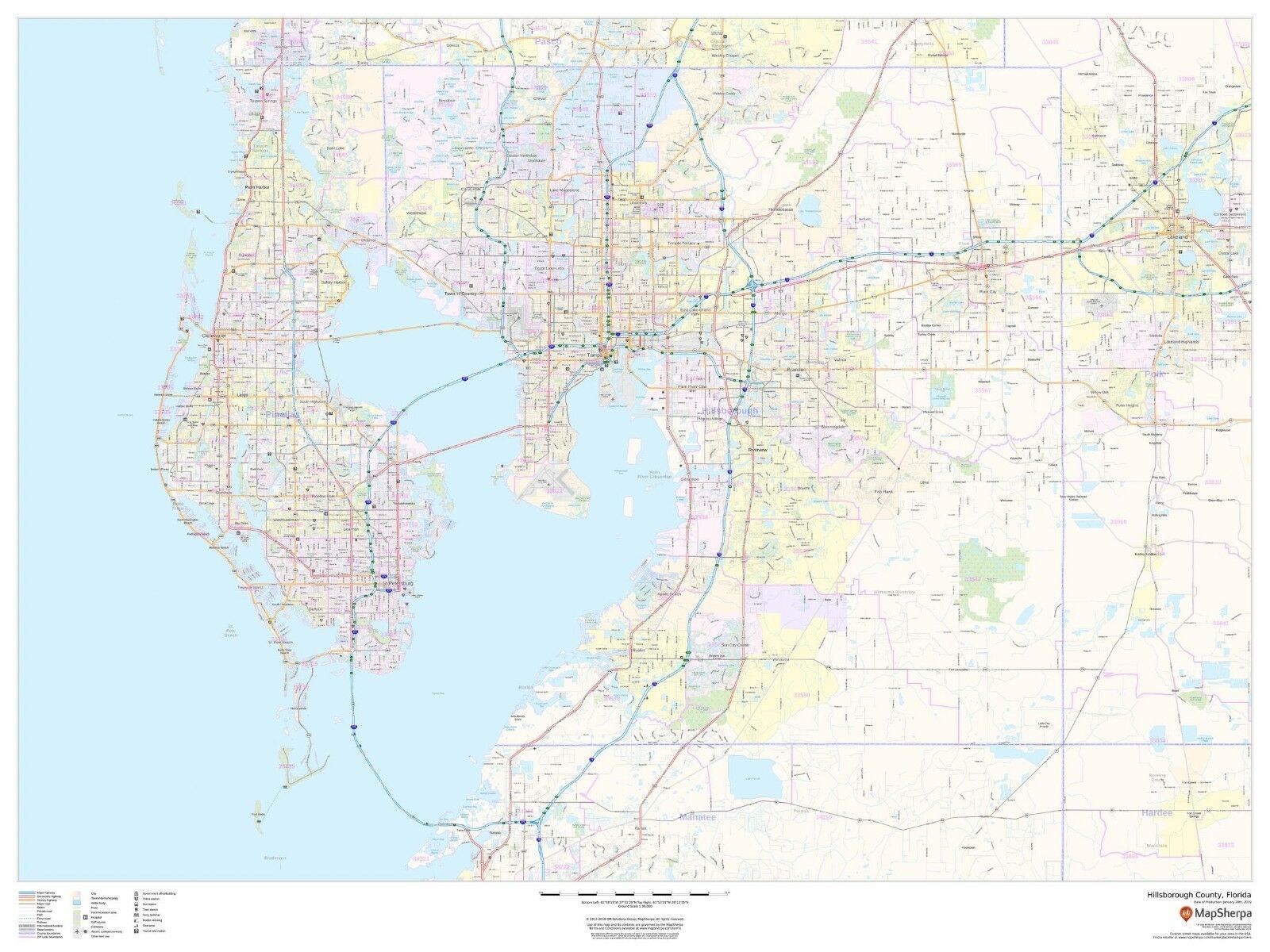
Laminated Wall Maps By Rockford Publishing
Description
This map of Hillsborough County, Florida shows regional level information. Base map features include highways and major roads with labelling; railways; high level land use such as parks and recreation areas; and a selection of points of interest including transportation hubs like airports and train stations, tourist information and police stations. ZIP code boundaries are shown as a secondary map feature.
Page Size
48 x 36 in
Published
2019
Scale
1:90,000
Added to your wish list!
- Hillsborough County, Florida Laminated Wall Map (MSH)
- 1 in stock
- Handling time 10 days. Estimated delivery: Tue, Sep 9th
- Returns/refunds accepted
Get an item reminder
We'll email you a link to your item now and follow up with a single reminder (if you'd like one). That's it! No spam, no hassle.
Already have an account?
Log in and add this item to your wish list.