HISTORIX Vintage 1963 South Africa Map Print - 18x24 Inch Vintage Map of South A
Shipping options
Seller handling time is 2 business days Details
This reflects the seller's handling time and may not include time spent in transit.
If you have questions about shipping, please contact the seller.
FREE via to United States
Return policy
Full refund available for DOAs
Details
- We guarantee our products and offer full refunds or exchange for defective items or items not as-described.
- Buyer must contact us within 30 days after receipt of shipment.
- The item must be received in the same condition as shipped.
- Items must be returned with all original packaging and accessories.
- Items must not be abused, modified or damaged by accident.
- A 20% restocking fee will be charged for returns
- Buyer is responsible for all return shipping and handling fees.
- Restocking and return shipping fees do not apply when item is returned as defective or because incorrect product was delivered.
Payment options
PayPal accepted
PayPal Credit accepted
Venmo accepted
PayPal, MasterCard, Visa, Discover, and American Express accepted
Maestro accepted
Amazon Pay accepted
Nuvei accepted
Item traits
| Category: |
Laminating Machines
|
| Quantity Available: |
8 in stock
|
| Condition: |
New
|
| MPN: |
ENMAP06751824
|
| UPC: |
705514890269
|
| EAN: |
0705514890269
|
| Paint Type: |
Watercolor
|
| color: |
Natural
|
| manufacturer: |
HISTORIX
|
| Externally Assigned Product Identifier: |
0705514890269
|
| Item Shape: |
Rectangular
|
| Age Range Description: |
Adult
|
| Bullet Point: |
View details
VINTAGE MAP REPRODUCTION: You’ll love this high quality historic reproduction of 1963 South Africa Map Print. Our museum quality prints are archival grade, which means it will look great and last without fading for over 100 years. Our print to ord...
|
| Product Description: |
View details
South Africa is a country on the southernmost point of Africa, located along the South Atlantic and the Indian Ocean. South Africa shares a unique geographical and cultural history that represents indigenous traditions as well as Dutch influenc...
|
| Brand: |
HISTORIX
|
| Unspsc Code: |
55101500
|
| Special Feature: |
Fade Resistant
|
| orientation: |
Landscape
|
| Item Name: |
View details
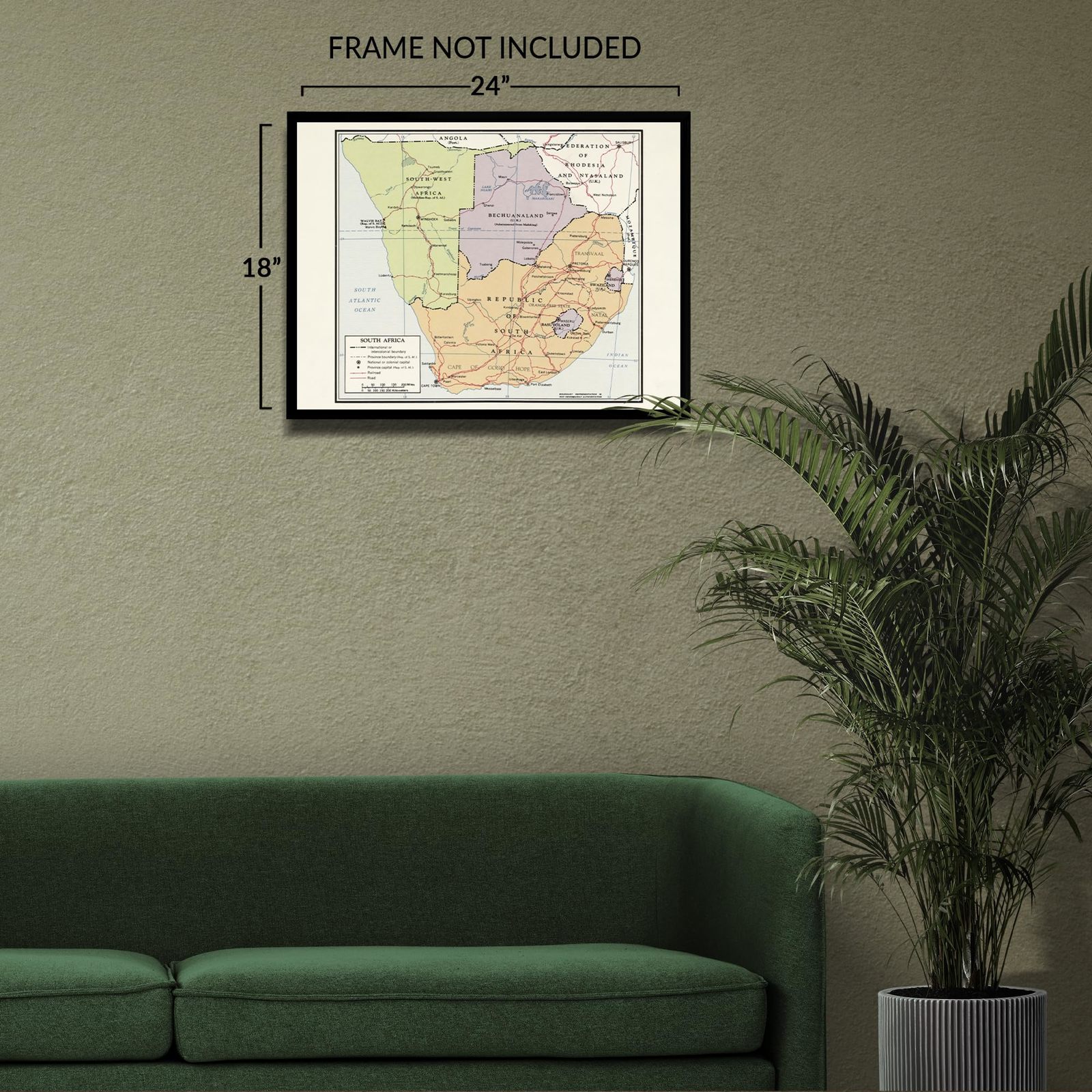
HISTORIX Vintage 1963 South Africa Map Print - 18x24 Inch Vintage Map of South Africa Wall Art - Old Map of The Republic of South Africa Poster
|
| Item Type Keyword: |
wall-maps
|
| Mounting Type: |
Wall Mount
|
| size: |
24L" x 18W"
|
| Part Number: |
ENMAP06751824
|
| style: |
Classic
|
| Wall Art Form: |
poster
|
| Target Gender: |
unisex
|
Listing details
|
Seller policies:
|
View seller policies
|
|
Shipping discount:
|
Seller pays shipping for this item.
|
|
Posted for sale:
|
More than a week ago
|
|
Item number:
|
1735775335
|
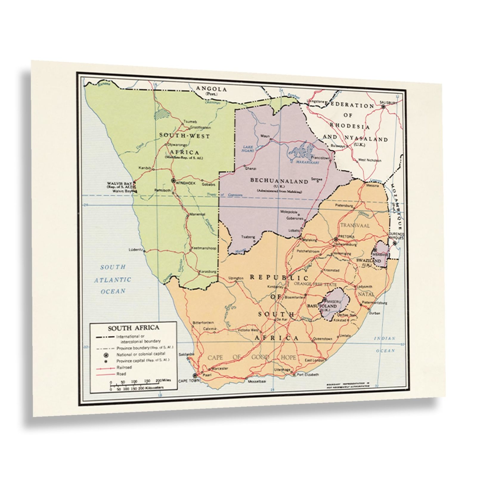
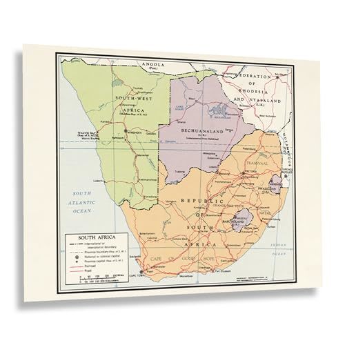
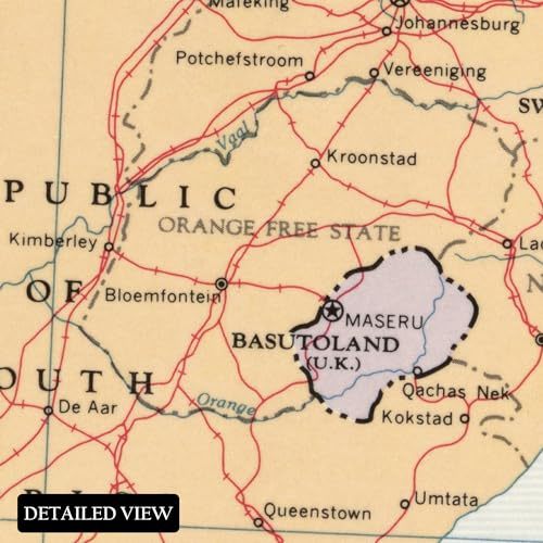
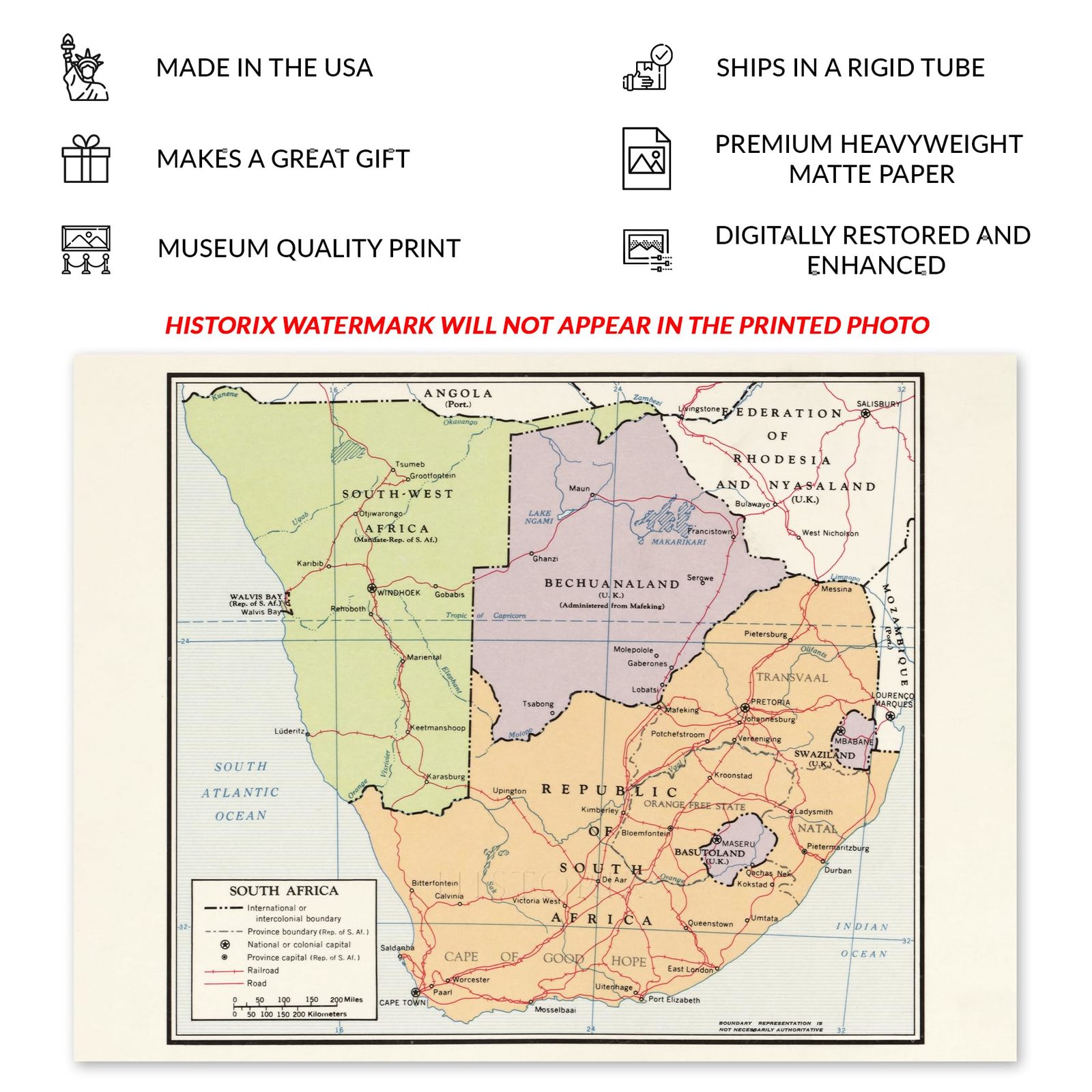
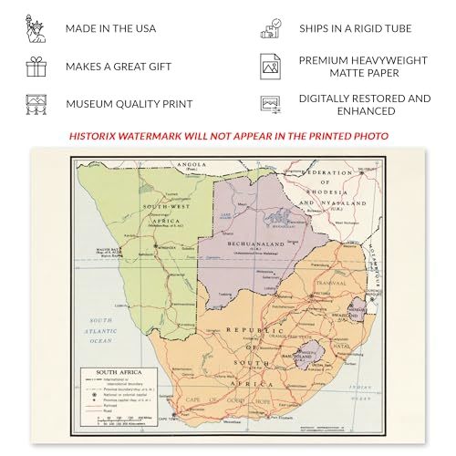
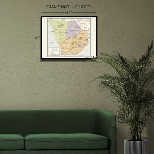
South Africa is a country on the southernmost point of Africa, located along the South Atlantic and the Indian Ocean. South Africa shares a unique geographical and cultural history that represents indigenous traditions as well as Dutch influences, which have shaped the country's larger cities like Johannesburg for centuries. South Africa is officially a multiethnic nation and recognizes twelve distinct languages, the fourth highest of any nation globally. The nation became widely recognized in the 1990s when itsracial segregationist Apartheid policies, which had been implemented in 1948, were stripped, and iconic freedom fighter Nelson Mandela was freed from a lengthy prison sentence and would become one of the most notable figures for freedom movements for the following decades.
This map was published by the Central Intelligence Agency in 1963 and informed political and military leaders about shifting geopolitical boundaries so that they could develop, implement, and maintain policy. South Africa had gained independence as a Republic only two years prior, and the political climate was evolving during this time as the nation transitioned politically and withdrew from the Commonwealth of Nations in 1961. The country drew internal and external criticism for the Apartheid policies, though they would remain in place.
CIA-produced maps bear a distinctive minimal aesthetic that is immediately recognizable and allows the viewer to gain a new perspective on how nations develop and evolve. This depiction of South Africa is a classic example of government-produced intelligence information that is truly an authentic piece of American cartographical history.
Additional Details
------------------------------
Bullet point: VINTAGE MAP REPRODUCTION: You?ll love this high quality historic reproduction of 1963 South Africa Map Print. Our museum quality prints are archival grade, which means it will look great and last without fading for over 100 years. Our print to order maps are made in the USA and each map is inspected for quality. This beautiful artwork is a perfect addition to your themed decor. Vintage maps look great in the home, study or office. They make a perfect gift as well.
Product description:
South Africa is a country on the southernmost point of Africa, located along the South Atlantic and the Indian Ocean. South Africa shares a unique geographical and cultural history that represents indigenous traditions as well as Dutch influences, which have shaped the country's larger cities like Johannesburg for centuries. South Africa is officially a multiethnic nation and recognizes twelve distinct languages, the fourth highest of any nation globally. The nation became widely recognized in the 1990s when itsracial segregationist Apartheid policies, which had been implemented in 1948, were stripped, and iconic freedom fighter Nelson Mandela was freed from a lengthy prison sentence and would become one of the most notable figures for freedom movements for the following decades.
This map was published by the Central Intelligence Agency in 1963 and informed political and military leaders about shifting geopolitical boundaries so that they could develop, implement, and maintain policy. South Africa had gained independence as a Republic only two years prior, and the political climate was evolving during this time as the nation transitioned politically and withdrew from the Commonwealth of Nations in 1961. The country drew internal and external criticism for the Apartheid policies, though they would remain in place.
CIA-produced maps bear a distinctive minimal aesthetic that is immediately recognizable and allows the viewer to gain a new perspective on how nations develop and evolve. This depiction of South Africa is a classic example of government-produced intelligence information that is truly an authentic piece of American cartographical history.