HISTORIX Vintage 1893 Mount Desert Island Maine Map - 18x24 Inch Vintage Map of
Shipping options
Seller handling time is 2 business days Details
This reflects the seller's handling time and may not include time spent in transit.
If you have questions about shipping, please contact the seller.
FREE via to United States
Return policy
Full refund available for DOAs
Details
- We guarantee our products and offer full refunds or exchange for defective items or items not as-described.
- Buyer must contact us within 30 days after receipt of shipment.
- The item must be received in the same condition as shipped.
- Items must be returned with all original packaging and accessories.
- Items must not be abused, modified or damaged by accident.
- A 20% restocking fee will be charged for returns
- Buyer is responsible for all return shipping and handling fees.
- Restocking and return shipping fees do not apply when item is returned as defective or because incorrect product was delivered.
Payment options
PayPal accepted
PayPal Credit accepted
Venmo accepted
PayPal, MasterCard, Visa, Discover, and American Express accepted
Maestro accepted
Amazon Pay accepted
Nuvei accepted
Item traits
| Category: |
Laminating Machines
|
| Quantity Available: |
8 in stock
|
| Condition: |
New
|
| MPN: |
ENMAP06691824
|
| UPC: |
705514889614
|
| EAN: |
0705514889614
|
| color: |
Natural
|
| binding: |
unbound
|
| format: |
unbound
|
| language: |
english
|
| manufacturer: |
HISTORIX
|
| Externally Assigned Product Identifier: |
0705514889614
|
| Bullet Point: |
View details
VINTAGE MAP REPRODUCTION: You’ll love this high quality historic reproduction of 1893 Mount Desert Island Maine Map. Our museum quality prints are archival grade, which means it will look great and last without fading for over 100 years. Our print...
|
| Publication Date: |
1893T
|
| Product Description: |
View details
Mount Desert Island, the largest in Maine, is also the fifty-second largest island in the United States and the second largest on the Eastern seaboard, following Long Island. The first European settlers were French traders who interacted with i...
|
| Brand: |
HISTORIX
|
| Unspsc Code: |
55101500
|
| Paper Finish: |
matte
|
| Map Scale: |
1000
|
| Item Name: |
View details
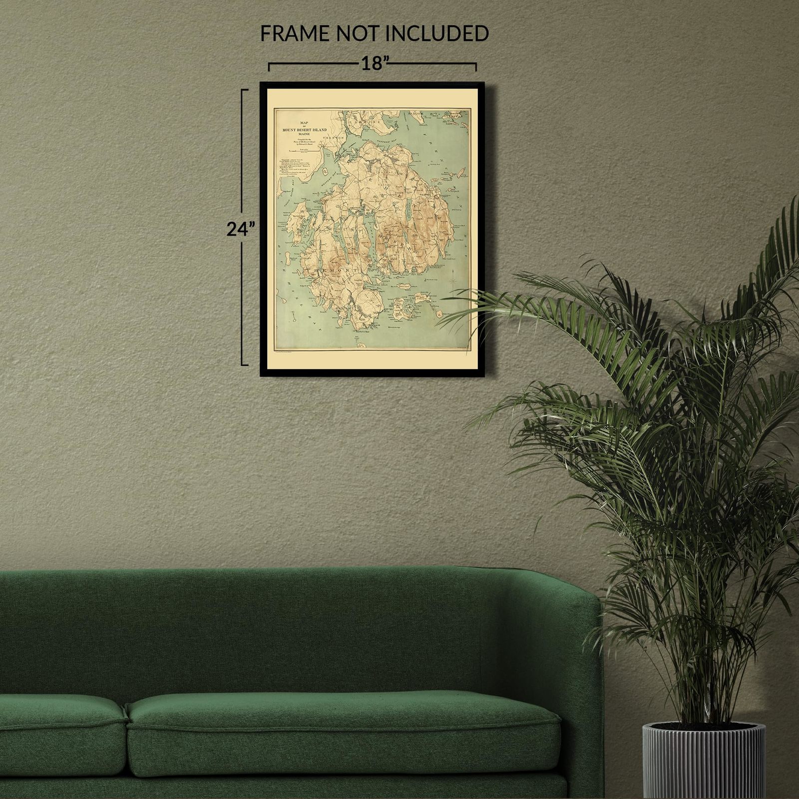
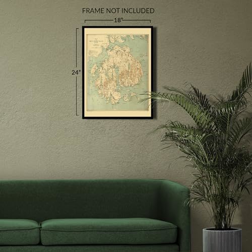
HISTORIX Vintage 1893 Mount Desert Island Maine Map - 18x24 Inch Vintage Map of Maine Poster - Old Map of Mount Desert Island Maine Wall Art Print
|
| Item Type Keyword: |
wall-maps
|
| Product Site Launch Date: |
2023-10-07T04:38:35.623Z
|
| Part Number: |
ENMAP06691824
|
Listing details
|
Seller policies:
|
View seller policies
|
|
Shipping discount:
|
Seller pays shipping for this item.
|
|
Posted for sale:
|
More than a week ago
|
|
Item number:
|
1736333387
|
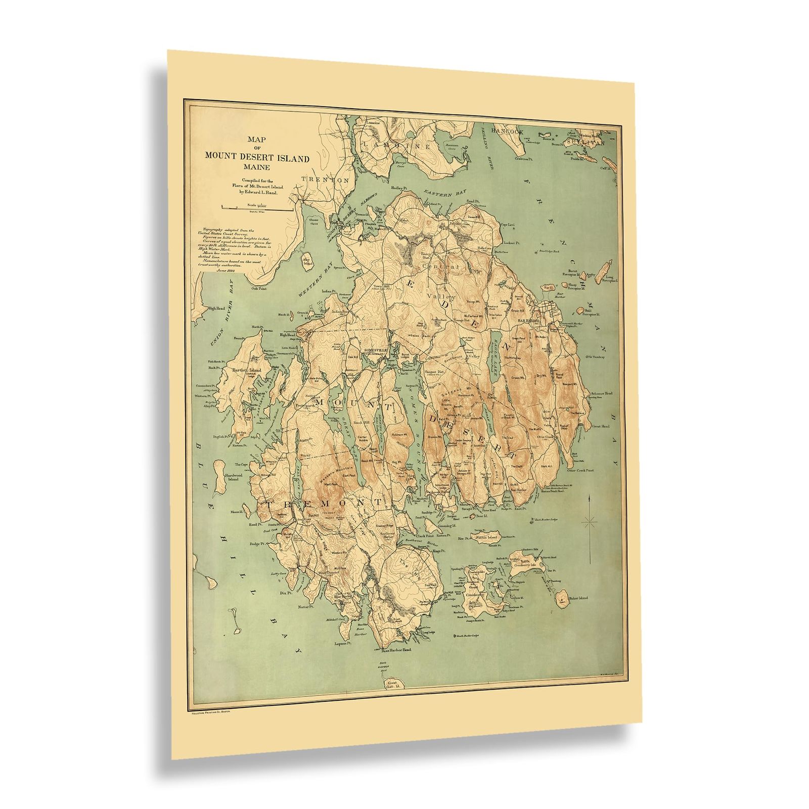
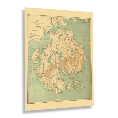
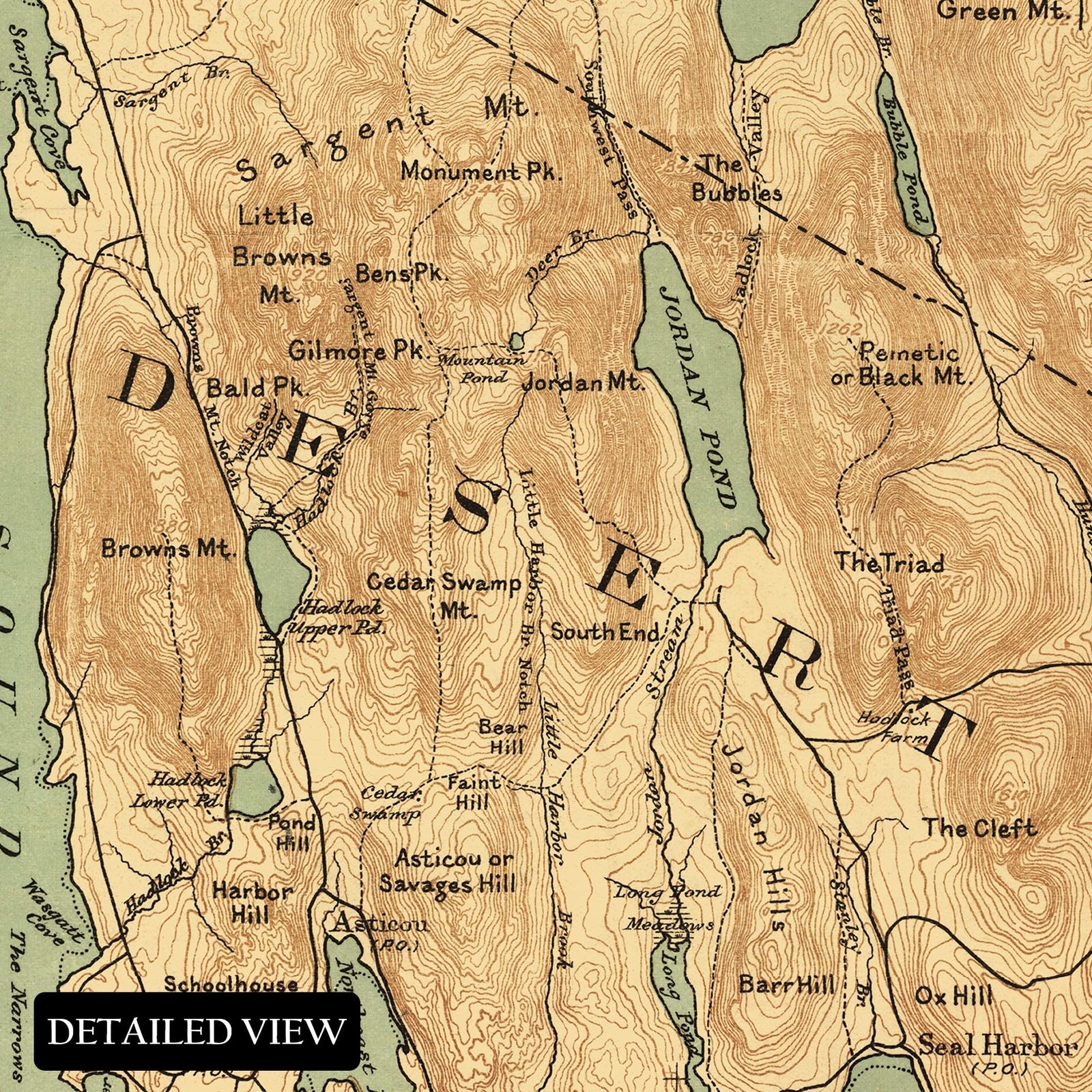
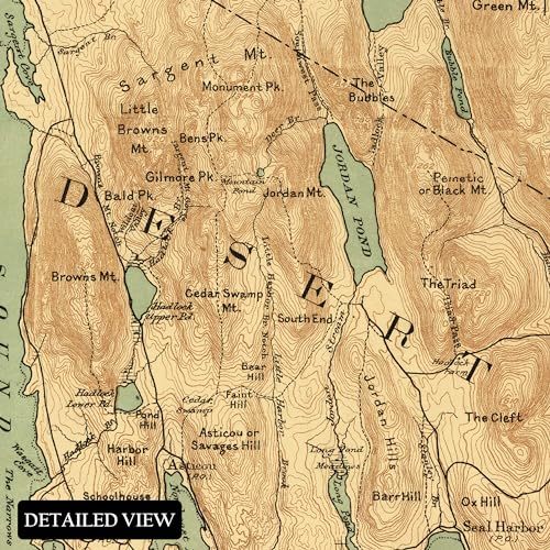
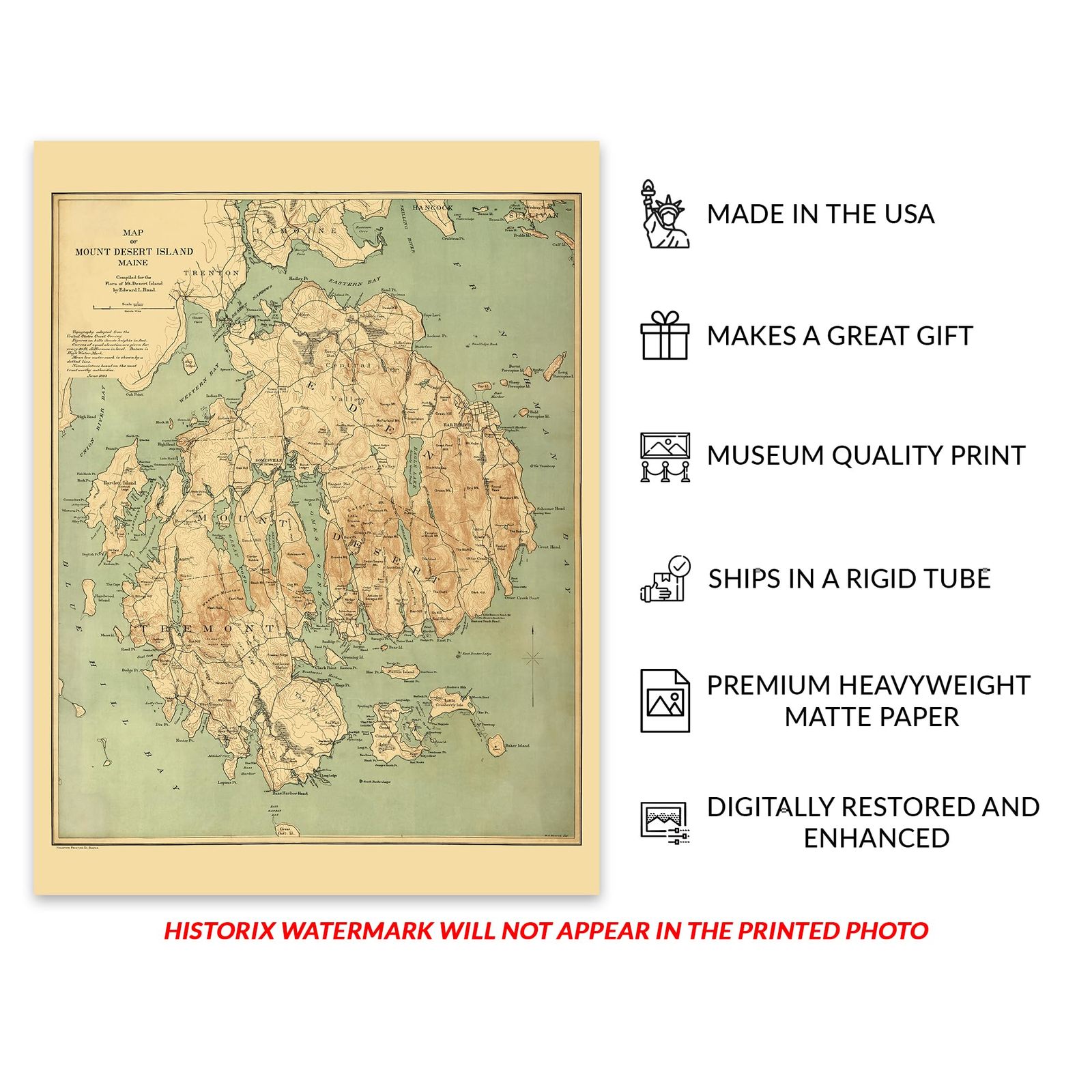
Mount Desert Island, the largest in Maine, is also the fifty-second largest island in the United States and the second largest on the Eastern seaboard, following Long Island. The first European settlers were French traders who interacted with indigenous inhabitants as early as the fifteenth century. While these early interactions have not been written and recorded, conjecture remains that it was Samuel de Champlain who made the first excursion into the area with twelve sailors and two indigenous guides who were familiar with the region and allowed him to record and map the island.
Champlain would go on to write, "Most of the summits are free of trees because they are only rocks present. I named [the island] Isle of the Desert Mountains." The first European settlement was established in 1613 by French Jesuits who built a mission and were welcomed by indigenous residents. They grew corn and built a fort, Saint Saveur Mission, which is now the name of the Saint Saveur Mountain, which overlooks the point. At the time of this map's publication, the island had become a popular summer destination for prosperous families from New York and Connecticut, and many homes were built that exist to this day.
This map's distinctive aesthetic immediately transports the viewer back in time, creating an indelible bond between the past and present. Mount Desert Island has grown considerably during the twentieth century and remains a popular tourist destination for natural attractions and cultural events like the Bar Harbor Music Festival.
Additional Details
------------------------------
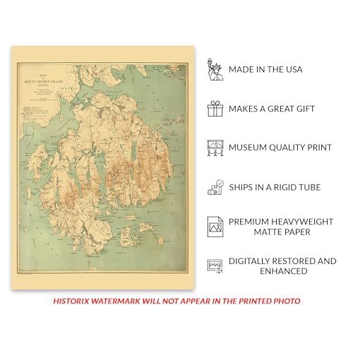
Bullet point: VINTAGE MAP REPRODUCTION: You?ll love this high quality historic reproduction of 1893 Mount Desert Island Maine Map. Our museum quality prints are archival grade, which means it will look great and last without fading for over 100 years. Our print to order maps are made in the USA and each map is inspected for quality. This beautiful artwork is a perfect addition to your themed decor. Vintage maps look great in the home, study or office. They make a perfect gift as well.
Product description:
Mount Desert Island, the largest in Maine, is also the fifty-second largest island in the United States and the second largest on the Eastern seaboard, following Long Island. The first European settlers were French traders who interacted with indigenous inhabitants as early as the fifteenth century. While these early interactions have not been written and recorded, conjecture remains that it was Samuel de Champlain who made the first excursion into the area with twelve sailors and two indigenous guides who were familiar with the region and allowed him to record and map the island.
Champlain would go on to write, "Most of the summits are free of trees because they are only rocks present. I named [the island] Isle of the Desert Mountains." The first European settlement was established in 1613 by French Jesuits who built a mission and were welcomed by indigenous residents. They grew corn and built a fort, Saint Saveur Mission, which is now the name of the Saint Saveur Mountain, which overlooks the point. At the time of this map's publication, the island had become a popular summer destination for prosperous families from New York and Connecticut, and many homes were built that exist to this day.
This map's distinctive aesthetic immediately transports the viewer back in time, creating an indelible bond between the past and present. Mount Desert Island has grown considerably during the twentieth century and remains a popular tourist destination for natural attractions and cultural events like the Bar Harbor Music Festival.
Format: wall_map