HISTORIX Vintage 1889 North Yakima Washington State Map Poster - 24x36 Inch Old
Shipping options
Seller handling time is 2 business days Details
This reflects the seller's handling time and may not include time spent in transit.
If you have questions about shipping, please contact the seller.
FREE via to United States
Return policy
Full refund available for DOAs
Details
- We guarantee our products and offer full refunds or exchange for defective items or items not as-described.
- Buyer must contact us within 30 days after receipt of shipment.
- The item must be received in the same condition as shipped.
- Items must be returned with all original packaging and accessories.
- Items must not be abused, modified or damaged by accident.
- A 20% restocking fee will be charged for returns
- Buyer is responsible for all return shipping and handling fees.
- Restocking and return shipping fees do not apply when item is returned as defective or because incorrect product was delivered.
Payment options
PayPal accepted
PayPal Credit accepted
Venmo accepted
PayPal, MasterCard, Visa, Discover, and American Express accepted
Maestro accepted
Amazon Pay accepted
Nuvei accepted
Item traits
| Category: |
Kitchen Scales
|
| Quantity Available: |
8 in stock
|
| Condition: |
New
|
| UPC: |
705514886149
|
| MPN: |
ENMAP0617_1824
|
| Style: |
Vintage/Retro
|
| ASIN: |
B0C4BYR4JP
|
| EAN: |
0705514886149
|
| Paint Type: |
Watercolor
|
| Color: |
Natural
|
| manufacturer: |
historix
|
| Externally Assigned Product Identifier: |
0705514886149
|
| Item Shape: |
Rectangular
|
| Product Description: |
View details
Located in Central Washington some sixty miles southeast of Mount Rainier, Yakima was established in the fertile valley and remains a prominent agricultural producer of wine, apples, and hops, which attracted immigrants from across Western Euro...
|
| Brand: |
HISTORIX
|
| Unspsc Code: |
55101500
|
| orientation: |
Landscape
|
| Item Name: |
View details
HISTORIX Vintage 1889 North Yakima Washington State Map Poster - 24x36 Inch Old View of the City of North Yakima Washington Map Print Wall Art
|
| Item Type Keyword: |
prints
|
| Mounting Type: |
Wall Mount
|
| Paper Size: |
24 x 36
|
| Part Number: |
ENMAP0617_1824
|
| Wall Art Form: |
poster
|
| Target Gender: |
unisex
|
Listing details
|
Seller policies:
|
View seller policies
|
|
Shipping discount:
|
Seller pays shipping for this item.
|
|
Posted for sale:
|
More than a week ago
|
|
Item number:
|
1735818295
|
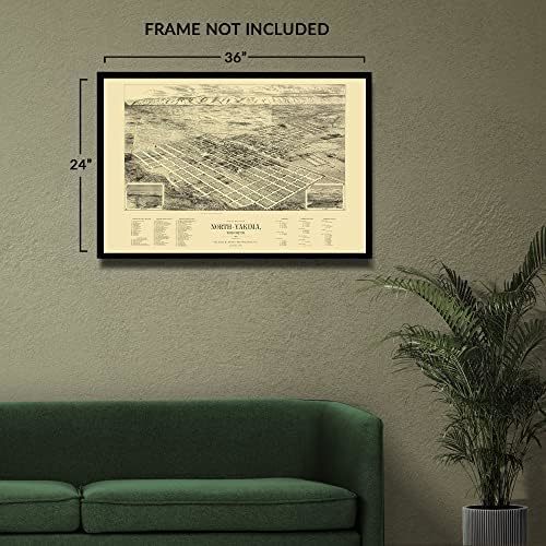
Located in Central Washington some sixty miles southeast of Mount Rainier, Yakima was established in the fertile valley and remains a prominent agricultural producer of wine, apples, and hops, which attracted immigrants from across Western Europe and other parts of the United States as the country neared the turn of the century. Railway expansion during the latter portions of the twentieth century had increased access and allowed Yakima to enjoy a period of significant growth and development. The Yakima Valley is responsible for producing more than three-quarters of all hops grown in the United States annually, which are critical for breweries across the nation.
Mount Rainier is the highest point in the Cascade Mountain Range and is surrounded by valleys, home to old-growth forests and more than twenty-five glaciers. It remains one of the most iconic Mountain Ranges of the American Northwest. The range is home to Mount Saint Helens, which erupted in 1980, blanketing the region with ash, causing significant issues with visibility, and forcing many residents to flee the area. This bird's eye perspective illustrates the city in a period of significant prosperity, which the rest of the nation also enjoyed during the so-called Gilded Age.
Panoramic maps were used to entice residents and merchants alike and featured prominent civic features, economic opportunities, and natural attractions. Bird's eye perspectives were not used for navigation, so they often include numerous artistic flourishes and bear a distinctive aesthetic and unique style that immediately transports the viewer back in time.
Additional Details
------------------------------
Product description:
Located in Central Washington some sixty miles southeast of Mount Rainier, Yakima was established in the fertile valley and remains a prominent agricultural producer of wine, apples, and hops, which attracted immigrants from across Western Europe and other parts of the United States as the country neared the turn of the century. Railway expansion during the latter portions of the twentieth century had increased access and allowed Yakima to enjoy a period of significant growth and development. The Yakima Valley is responsible for producing more than three-quarters of all hops grown in the United States annually, which are critical for breweries across the nation.
Mount Rainier is the highest point in the Cascade Mountain Range and is surrounded by valleys, home to old-growth forests and more than twenty-five glaciers. It remains one of the most iconic Mountain Ranges of the American Northwest. The range is home to Mount Saint Helens, which erupted in 1980, blanketing the region with ash, causing significant issues with visibility, and forcing many residents to flee the area. This bird's eye perspective illustrates the city in a period of significant prosperity, which the rest of the nation also enjoyed during the so-called Gilded Age.
Panoramic maps were used to entice residents and merchants alike and featured prominent civic features, economic opportunities, and natural attractions. Bird's eye perspectives were not used for navigation, so they often include numerous artistic flourishes and bear a distinctive aesthetic and unique style that immediately transports the viewer back in time.
Style: Vintage