HISTORIX Vintage 1889 Kearney Nebraska Map Print - 18x24 Inch Old Perspective Ma
Shipping options
Seller handling time is 2 business days Details
This reflects the seller's handling time and may not include time spent in transit.
If you have questions about shipping, please contact the seller.
FREE via to United States
Return policy
Full refund available for DOAs
Details
- We guarantee our products and offer full refunds or exchange for defective items or items not as-described.
- Buyer must contact us within 30 days after receipt of shipment.
- The item must be received in the same condition as shipped.
- Items must be returned with all original packaging and accessories.
- Items must not be abused, modified or damaged by accident.
- A 20% restocking fee will be charged for returns
- Buyer is responsible for all return shipping and handling fees.
- Restocking and return shipping fees do not apply when item is returned as defective or because incorrect product was delivered.
Payment options
PayPal accepted
PayPal Credit accepted
Venmo accepted
PayPal, MasterCard, Visa, Discover, and American Express accepted
Maestro accepted
Amazon Pay accepted
Nuvei accepted
Item traits
| Category: |
Kitchen Scales
|
| Quantity Available: |
8 in stock
|
| Condition: |
New
|
| UPC: |
705514886187
|
| MPN: |
ENMAP0619_1824
|
| Style: |
Modern
|
| ASIN: |
B0C4C4MRHD
|
| EAN: |
0705514886187
|
| Age Range Description: |
Adult
|
| Bullet Point: |
View details
VINTAGE MAP REPRODUCTION: You’ll love this high quality historic reproduction of 1889 Kearney Nebraska Map Print. Our museum quality prints are archival grade, which means it will look great and last without fading for over 100 years. Our print to...
|
| Product Description: |
View details
As the United States expanded to the West, many travelers were faced with an arduous journey, and numerous outposts and forts were established to aid with this expansion and settlement of the vast territory. In 1848 the US Army installed a fort ne...
|
| Brand: |
HISTORIX
|
| Unspsc Code: |
55101500
|
| Externally Assigned Product Identifier: |
705514886187
|
| Item Type Keyword: |
artwork
|
| Paper Size: |
18 x 24
|
| Part Number: |
ENMAP0619_1824
|
| Wall Art Form: |
poster
|
| Target Gender: |
unisex
|
| Paint Type: |
Watercolor
|
| Color: |
Natural
|
| Pattern: |
Printed
|
| manufacturer: |
Historix
|
| Item Shape: |
Rectangular
|
| theme: |
Map
|
| orientation: |
Landscape
|
| Paper Finish: |
matte
|
| Item Name: |
View details
HISTORIX Vintage 1889 Kearney Nebraska Map Print - 18x24 Inch Old Perspective Map of Kearney City Buffalo County Nebraska State Map Wall Art Poster
|
| Mounting Type: |
Wall Mount
|
Listing details
|
Seller policies:
|
View seller policies
|
|
Shipping discount:
|
Seller pays shipping for this item.
|
|
Posted for sale:
|
More than a week ago
|
|
Item number:
|
1735818768
|
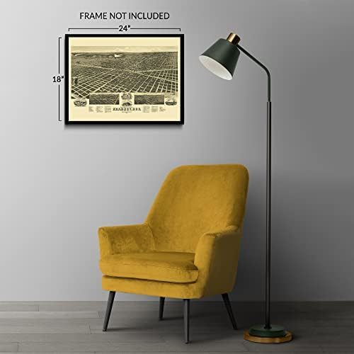
As the United States expanded to the West, many travelers were faced with an arduous journey, and numerous outposts and forts were established to aid with this expansion and settlement of the vast territory. In 1848 the US Army installed a fort near modern-day Kearney to help provide safety to westward migrants that were traveling through the region. The Union Pacific Railroad became a central hub for the region, and Kearney experienced a significant population boom in the years following its completion in 1866. The area was experiencing significant prosperity in the decades following the conclusion of the American Civil War along with the rest of the nation during the so-called Gilded Age as the industrial revolution expanded economic opportunities and significant railroad expansion connected communities across the country. This bird's eye perspective was produced and published by Henry Wellge, who was one of the most prolific cartographers of his time and is among five producers who are responsible for more than half of all panoramic maps found in the Library of Congress. Panoramic maps were produced as marketing materials to entice residents and merchants alike and featured prominent civic features, economic opportunities, and natural attractions. As America approached the turn of the century, the nation was experiencing a period of significant transformation as technological advances were changing the landscape and ushering in a period of modernity. This map's distinctive aesthetic and unique style immediately transport the viewer back in time, creating an indelible bond between the past and the present.
Additional Details
------------------------------
Bullet point: VINTAGE MAP REPRODUCTION: You?ll love this high quality historic reproduction of 1889 Kearney Nebraska Map Print. Our museum quality prints are archival grade, which means it will look great and last without fading for over 100 years. Our print to order maps are made in the USA and each map is inspected for quality. This beautiful artwork is a perfect addition to your themed decor. Vintage maps look great in the home, study or office. They make a perfect gift as well.
Product description: As the United States expanded to the West, many travelers were faced with an arduous journey, and numerous outposts and forts were established to aid with this expansion and settlement of the vast territory. In 1848 the US Army installed a fort near modern-day Kearney to help provide safety to westward migrants that were traveling through the region. The Union Pacific Railroad became a central hub for the region, and Kearney experienced a significant population boom in the years following its completion in 1866. The area was experiencing significant prosperity in the decades following the conclusion of the American Civil War along with the rest of the nation during the so-called Gilded Age as the industrial revolution expanded economic opportunities and significant railroad expansion connected communities across the country. This bird's eye perspective was produced and published by Henry Wellge, who was one of the most prolific cartographers of his time and is among five producers who are responsible for more than half of all panoramic maps found in the Library of Congress. Panoramic maps were produced as marketing materials to entice residents and merchants alike and featured prominent civic features, economic opportunities, and natural attractions. As America approached the turn of the century, the nation was experiencing a period of significant transformation as technological advances were changing the landscape and ushering in a period of modernity. This map's distinctive aesthetic and unique style immediately transport the viewer back in time, creating an indelible bond between the past and the present.