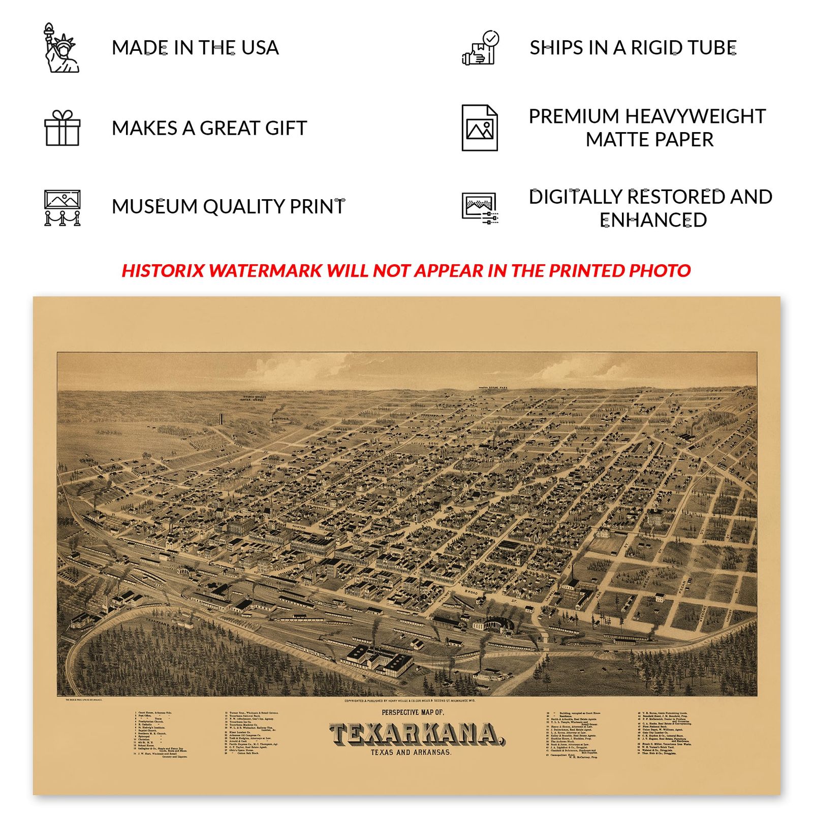
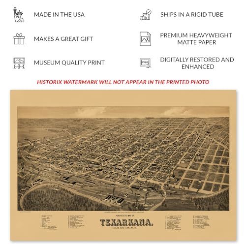
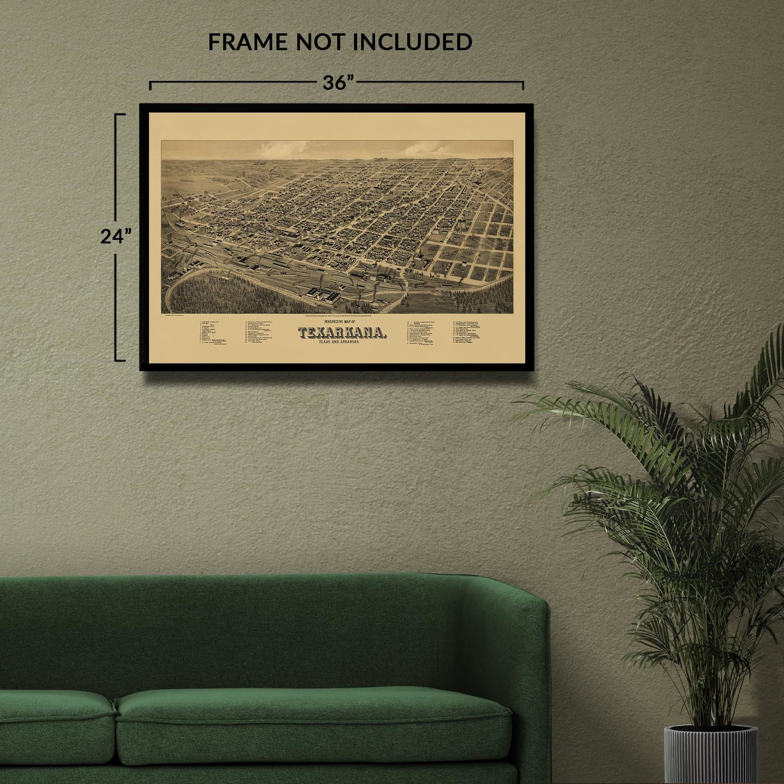
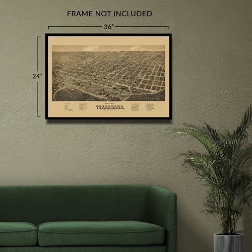
HISTORIX Vintage 1888 Texarkana Texas & Arkansas Map Print - 24x36 Inch Vintage
Shipping options
Seller handling time is 2 business days Details
This reflects the seller's handling time and may not include time spent in transit.
If you have questions about shipping, please contact the seller.
FREE via to United States
Return policy
Full refund available for DOAs
Details
- We guarantee our products and offer full refunds or exchange for defective items or items not as-described.
- Buyer must contact us within 30 days after receipt of shipment.
- The item must be received in the same condition as shipped.
- Items must be returned with all original packaging and accessories.
- Items must not be abused, modified or damaged by accident.
- A 20% restocking fee will be charged for returns
- Buyer is responsible for all return shipping and handling fees.
- Restocking and return shipping fees do not apply when item is returned as defective or because incorrect product was delivered.
Payment options
PayPal accepted
PayPal Credit accepted
Venmo accepted
PayPal, MasterCard, Visa, Discover, and American Express accepted
Maestro accepted
Amazon Pay accepted
Nuvei accepted
Item traits
| Category: |
Laminating Machines
|
| Quantity Available: |
8 in stock
|
| Condition: |
New
|
| MPN: |
ENMAP07032436
|
| UPC: |
705514892874
|
| EAN: |
0705514892874
|
| Paint Type: |
Watercolor
|
| color: |
Natural
|
| manufacturer: |
HISTORIX
|
| Externally Assigned Product Identifier: |
0705514892874
|
| Item Shape: |
Rectangular
|
| Bullet Point: |
View details
VINTAGE MAP REPRODUCTION: You’ll love this high quality historic reproduction of 1888 Texarkana Texas & Arkansas Map Print. Our museum quality prints are archival grade, which means it will look great and last without fading for over 100 years. Ou...
|
| Product Description: |
View details
Produced and published by one of the most prolific American cartographers of the Eighteenth and nineteenth centuries, this' Eye bird's-eye perspective of Texarkana, a city which spans the border of Texas and Arkansas, showcases its regional imp...
|
| Brand: |
HISTORIX
|
| Unspsc Code: |
55101500
|
| orientation: |
Landscape
|
| Item Name: |
View details
HISTORIX Vintage 1888 Texarkana Texas & Arkansas Map Print - 24x36 Inch Vintage Map of Texas & Arkansas - Perspective Map of Texas & Arkansas Poster
|
| Item Type Keyword: |
wall-maps
|
| Mounting Type: |
Wall Mount
|
| Part Number: |
ENMAP07032436
|
| Wall Art Form: |
poster
|
| Target Gender: |
unisex
|
Listing details
|
Seller policies:
|
View seller policies
|
|
Shipping discount:
|
Seller pays shipping for this item.
|
|
Posted for sale:
|
More than a week ago
|
|
Item number:
|
1735848254
|
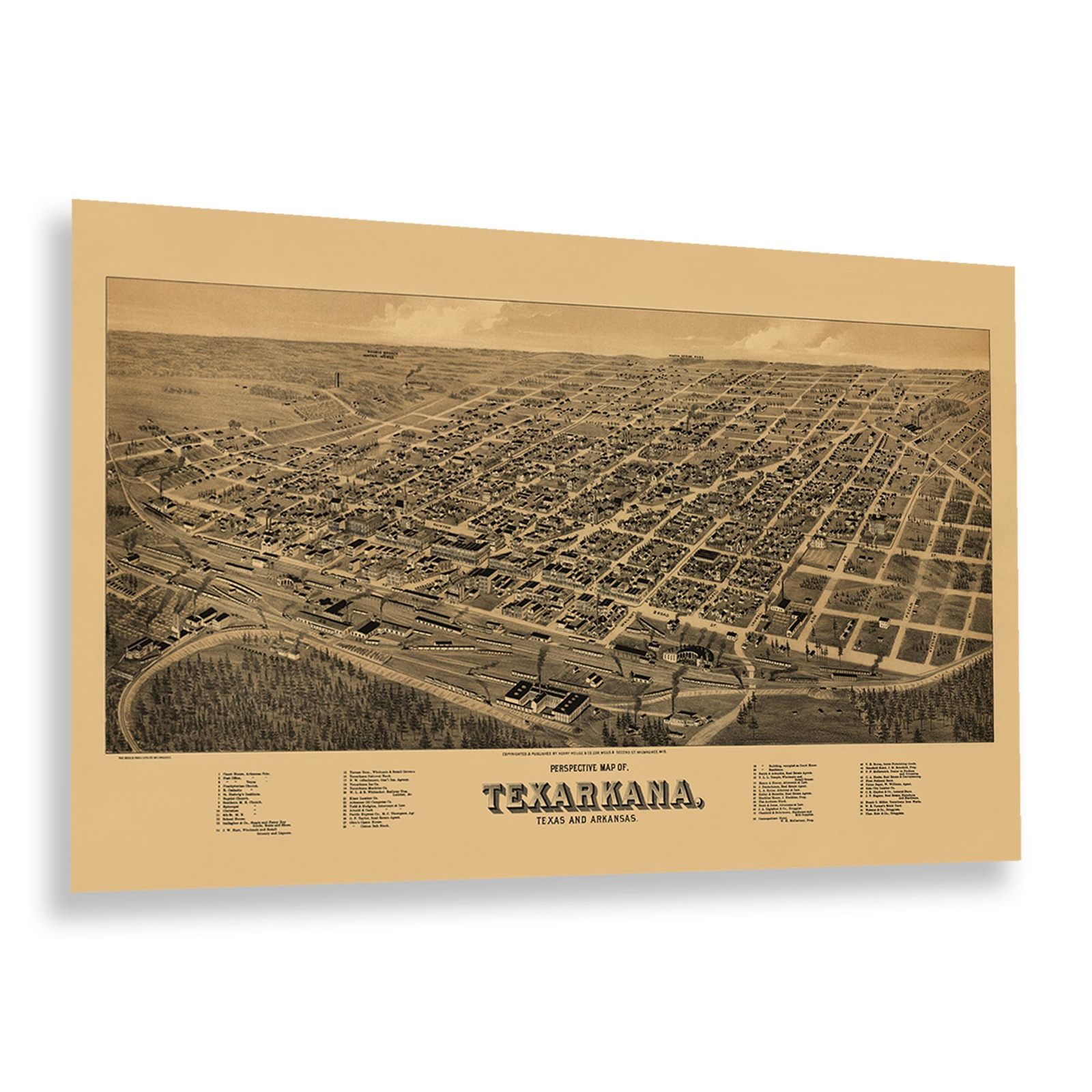
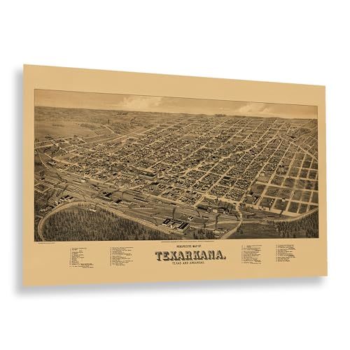
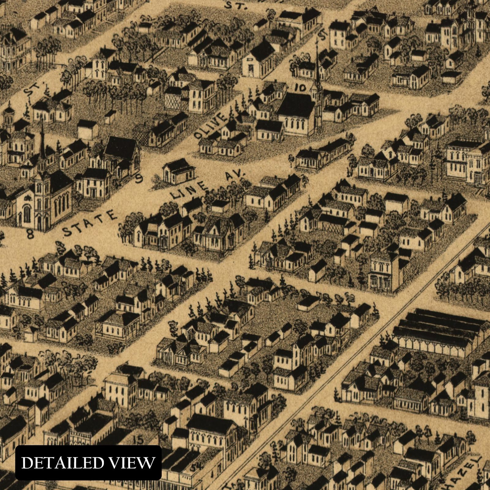
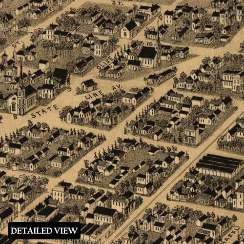
Produced and published by one of the most prolific American cartographers of the Eighteenth and nineteenth centuries, this' Eye bird's-eye perspective of Texarkana, a city which spans the border of Texas and Arkansas, showcases its regional importance as a hub for commerce, shipping, and transportation. Panoramic Maps, popular during the latter portion of the eighteenth century, were not produced for navigational directions but rather served as marketing materials. They highlighted economic opportunities and local institutions, including Churches and Schools, to attract residents from across the United States and Western Europe, underscoring the city's economic significance.
The distinctive aesthetic and recognizable style of Birds' Eye Perspective immediately transports the viewer back in time, creating an indelible bond between the past and present and offering a glimpse into how cities like Texarkana have grown and evolved over the past centuries. Due to its unique location Texarkana was one of the central hubs for rail lines connecting towns and cities across the American South and farmers looking to export their goods to markets both locally and abroad.
This led to a rapid development in the region. By the time of this map's publication, the city had grown significantly as the Texas and Pacific Rail Lines were completed. One of the most revered mapmakers of the time produced this piece of American cartographical history.
Additional Details
------------------------------
Bullet point: VINTAGE MAP REPRODUCTION: You?ll love this high quality historic reproduction of 1888 Texarkana Texas Arkansas Map Print. Our museum quality prints are archival grade, which means it will look great and last without fading for over 100 years. Our print to order maps are made in the USA and each map is inspected for quality. This beautiful artwork is a perfect addition to your themed decor. Vintage maps look great in the home, study or office. They make a perfect gift as well.
Product description:
Produced and published by one of the most prolific American cartographers of the Eighteenth and nineteenth centuries, this' Eye bird's-eye perspective of Texarkana, a city which spans the border of Texas and Arkansas, showcases its regional importance as a hub for commerce, shipping, and transportation. Panoramic Maps, popular during the latter portion of the eighteenth century, were not produced for navigational directions but rather served as marketing materials. They highlighted economic opportunities and local institutions, including Churches and Schools, to attract residents from across the United States and Western Europe, underscoring the city's economic significance.
The distinctive aesthetic and recognizable style of Birds' Eye Perspective immediately transports the viewer back in time, creating an indelible bond between the past and present and offering a glimpse into how cities like Texarkana have grown and evolved over the past centuries. Due to its unique location Texarkana was one of the central hubs for rail lines connecting towns and cities across the American South and farmers looking to export their goods to markets both locally and abroad.
This led to a rapid development in the region. By the time of this map's publication, the city had grown significantly as the Texas and Pacific Rail Lines were completed. One of the most revered mapmakers of the time produced this piece of American cartographical history.