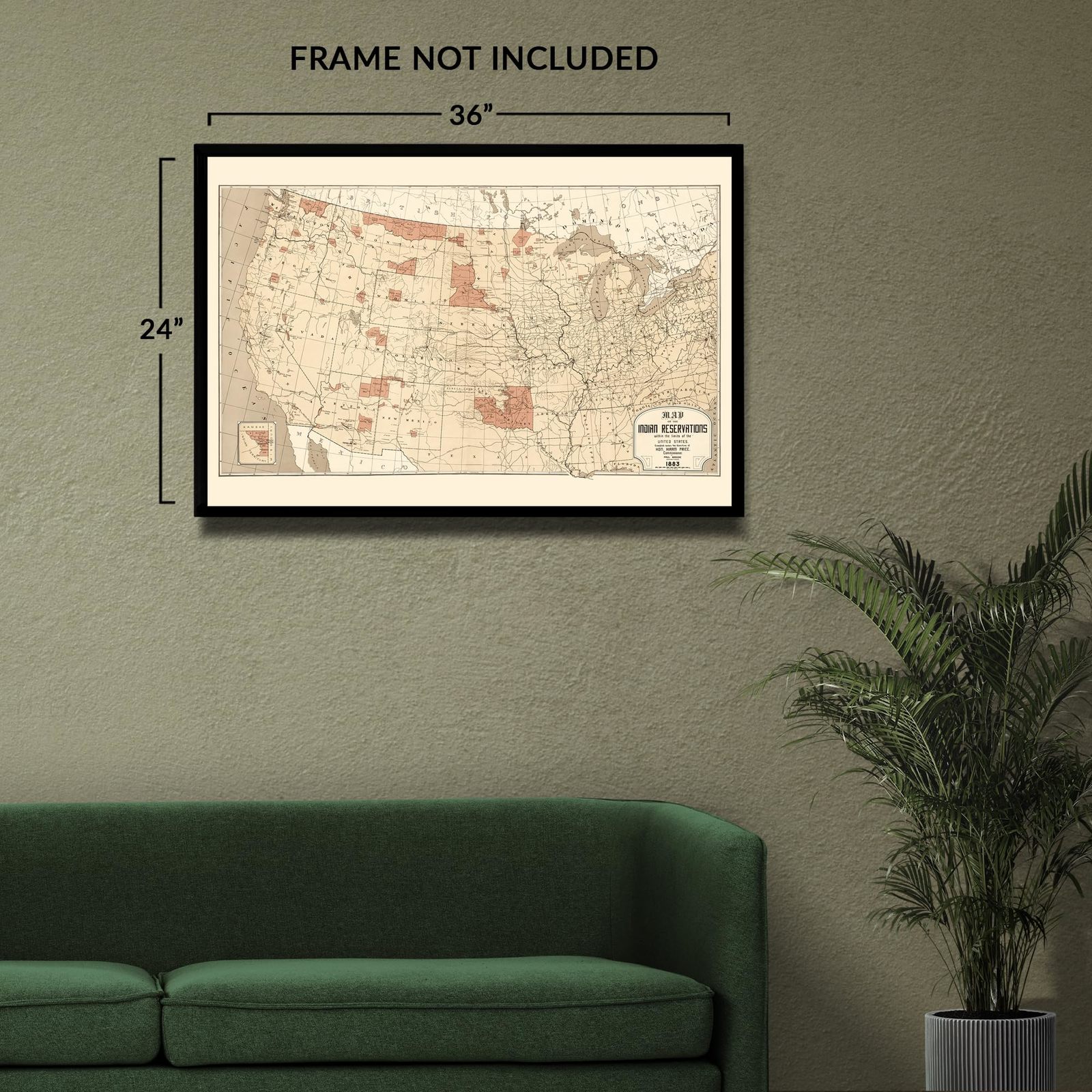
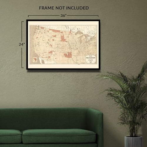
HISTORIX Vintage 1883 Indian Reservations Map Print - 24x36 Inch Vintage Map of
Shipping options
Seller handling time is 2 business days Details
This reflects the seller's handling time and may not include time spent in transit.
If you have questions about shipping, please contact the seller.
FREE via to United States
Return policy
Full refund available for DOAs
Details
- We guarantee our products and offer full refunds or exchange for defective items or items not as-described.
- Buyer must contact us within 30 days after receipt of shipment.
- The item must be received in the same condition as shipped.
- Items must be returned with all original packaging and accessories.
- Items must not be abused, modified or damaged by accident.
- A 20% restocking fee will be charged for returns
- Buyer is responsible for all return shipping and handling fees.
- Restocking and return shipping fees do not apply when item is returned as defective or because incorrect product was delivered.
Payment options
PayPal accepted
PayPal Credit accepted
Venmo accepted
PayPal, MasterCard, Visa, Discover, and American Express accepted
Maestro accepted
Amazon Pay accepted
Nuvei accepted
Item traits
| Category: |
Kitchen Scales
|
| Quantity Available: |
8 in stock
|
| Condition: |
New
|
| UPC: |
705514890313
|
| MPN: |
ENMAP06772436
|
| EAN: |
0705514890313
|
| Color: |
Natural
|
| binding: |
unbound
|
| format: |
unbound
|
| language: |
english
|
| manufacturer: |
HISTORIX
|
| Externally Assigned Product Identifier: |
0705514890313
|
| Bullet Point: |
View details
VINTAGE MAP REPRODUCTION: You’ll love this high quality historic reproduction of 1883 Indian Reservations Map Print. Our museum quality prints are archival grade, which means it will look great and last without fading for over 100 years. Our print...
|
| Publication Date: |
1883T
|
| Product Description: |
View details
Produced during a period of significant transformation across the United States, this map of Indian Reservations illustrates the evolution and redevelopment of lands that were traditionally inhabited by indigenous peoples for centuries prior to...
|
| Brand: |
HISTORIX
|
| Unspsc Code: |
55101500
|
| Paper Finish: |
matte
|
| Map Scale: |
1000
|
| Item Name: |
View details
HISTORIX Vintage 1883 Indian Reservations Map Print - 24x36 Inch Vintage Map of The Indian Reservations With the Limits of The United States Poster
|
| Item Type Keyword: |
prints
|
| Product Site Launch Date: |
2023-11-04T08:25:16.543Z
|
| Part Number: |
ENMAP06772436
|
Listing details
|
Seller policies:
|
View seller policies
|
|
Shipping discount:
|
Seller pays shipping for this item.
|
|
Posted for sale:
|
More than a week ago
|
|
Item number:
|
1735780106
|
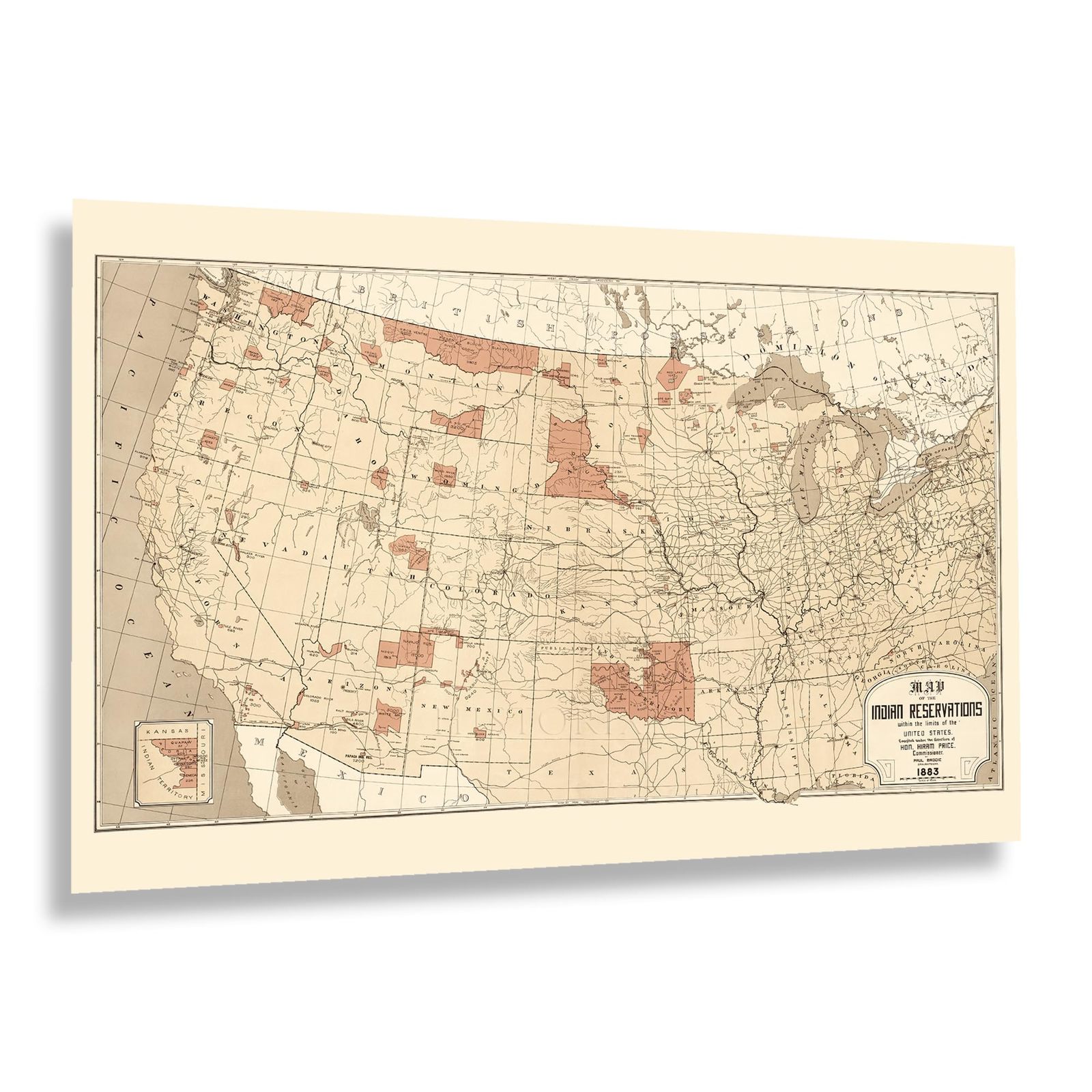
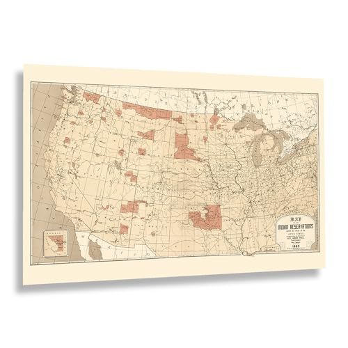
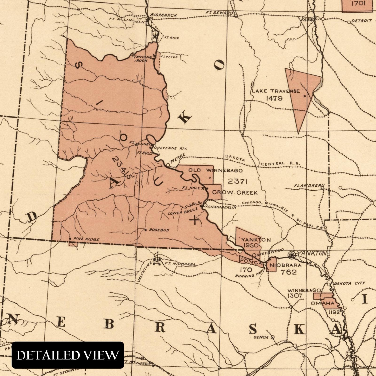
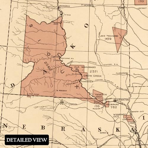
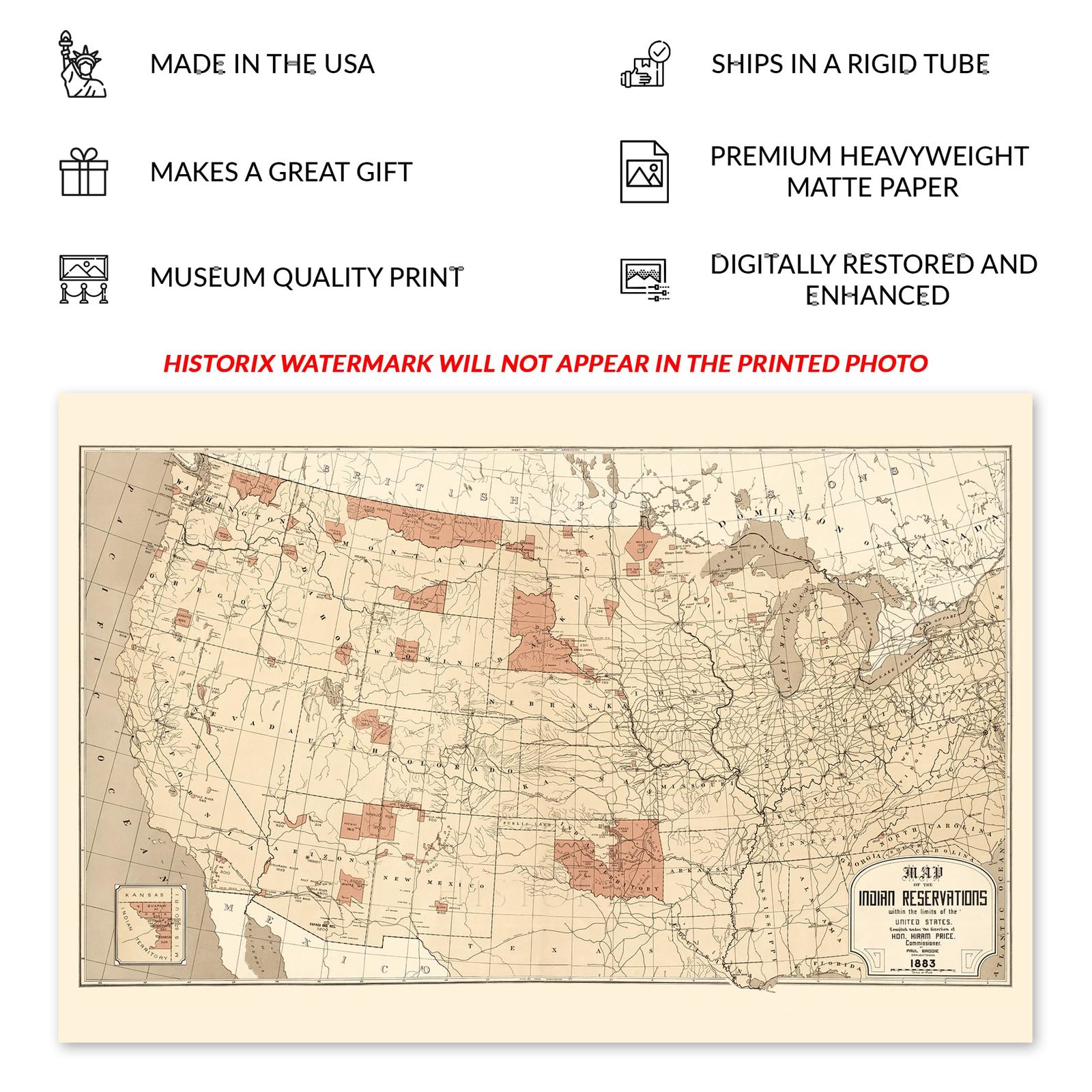
Produced during a period of significant transformation across the United States, this map of Indian Reservations illustrates the evolution and redevelopment of lands that were traditionally inhabited by indigenous peoples for centuries prior to the arrival of European settlers. Following the conclusion of the American Civil War, expansion across the American West was accelerated by the construction of a vast network of rail lines that offered access to new towns and communities that were being established as Americans sought economic opportunities. This map was produced by Hiram Price, a five-term US Congressman from Iowa who also served as the Commissioner of Indian Affairs in the nineteenth century.
The first Indian Reservation was established in New Jersey in 1758. By the time of this map’s production, most reservations were located in the American West. They did not reflect traditional ancestral boundaries or tribal regions, which led to political controversy within the United States. However, these policies were upheld, and many indigenous people were assimilated onto these lands. In 1934, the Indian New Deal was proposed by John Collier, which laid out new guidelines and regulations for reservations and their right to sovereignty, as well as slowing the assignment of indigenous people's land to non-members and other individuals.
This map bears a distinctive aesthetic and unique style that immediately transports the viewer back in time, creating a link between the past and present. This is an authentic piece of American cartographical history that illustrates a period of significant transformation.
Additional Details
------------------------------
Bullet point: VINTAGE MAP REPRODUCTION: You?ll love this high quality historic reproduction of 1883 Indian Reservations Map Print. Our museum quality prints are archival grade, which means it will look great and last without fading for over 100 years. Our print to order maps are made in the USA and each map is inspected for quality. This beautiful artwork is a perfect addition to your themed decor. Vintage maps look great in the home, study or office. They make a perfect gift as well.
Product description:
Produced during a period of significant transformation across the United States, this map of Indian Reservations illustrates the evolution and redevelopment of lands that were traditionally inhabited by indigenous peoples for centuries prior to the arrival of European settlers. Following the conclusion of the American Civil War, expansion across the American West was accelerated by the construction of a vast network of rail lines that offered access to new towns and communities that were being established as Americans sought economic opportunities. This map was produced by Hiram Price, a five-term US Congressman from Iowa who also served as the Commissioner of Indian Affairs in the nineteenth century.
The first Indian Reservation was established in New Jersey in 1758. By the time of this map’s production, most reservations were located in the American West. They did not reflect traditional ancestral boundaries or tribal regions, which led to political controversy within the United States. However, these policies were upheld, and many indigenous people were assimilated onto these lands. In 1934, the Indian New Deal was proposed by John Collier, which laid out new guidelines and regulations for reservations and their right to sovereignty, as well as slowing the assignment of indigenous people's land to non-members and other individuals.
This map bears a distinctive aesthetic and unique style that immediately transports the viewer back in time, creating a link between the past and present. This is an authentic piece of American cartographical history that illustrates a period of significant transformation.
Format: wall_map