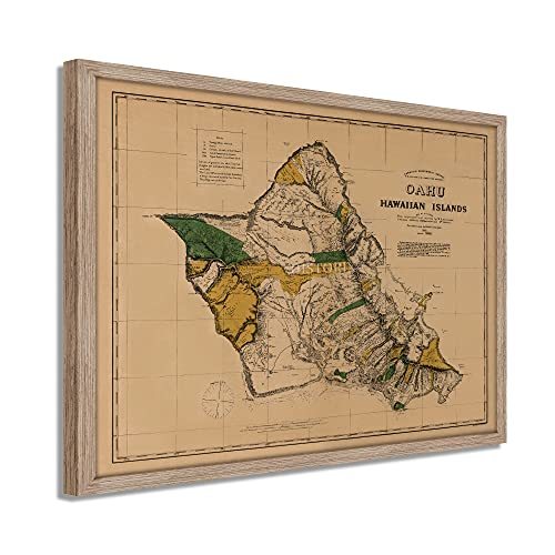
HISTORIX Vintage 1881 Oahu Hawaiian Islands Map - 19x25 Inch Light Walnut Framed
Shipping options
Seller handling time is 2 business days Details
This reflects the seller's handling time and may not include time spent in transit.
If you have questions about shipping, please contact the seller.
FREE via to United States
Return policy
Full refund available for DOAs
Details
- We guarantee our products and offer full refunds or exchange for defective items or items not as-described.
- Buyer must contact us within 30 days after receipt of shipment.
- The item must be received in the same condition as shipped.
- Items must be returned with all original packaging and accessories.
- Items must not be abused, modified or damaged by accident.
- A 20% restocking fee will be charged for returns
- Buyer is responsible for all return shipping and handling fees.
- Restocking and return shipping fees do not apply when item is returned as defective or because incorrect product was delivered.
Payment options
PayPal accepted
PayPal Credit accepted
Venmo accepted
PayPal, MasterCard, Visa, Discover, and American Express accepted
Maestro accepted
Amazon Pay accepted
Nuvei accepted
Item traits
| Category: |
Books & Magazines
|
| Quantity Available: |
8 in stock
|
| Condition: |
New
|
| ASIN: |
B09BYZY3RK
|
| EAN: |
0693634002153
|
| UPC: |
693634002153
|
| color: |
Light Walnut Frame
|
| Externally Assigned Product Identifier: |
0693634002153
|
| Item Shape: |
Rectangular
|
| Bullet Point: |
View details
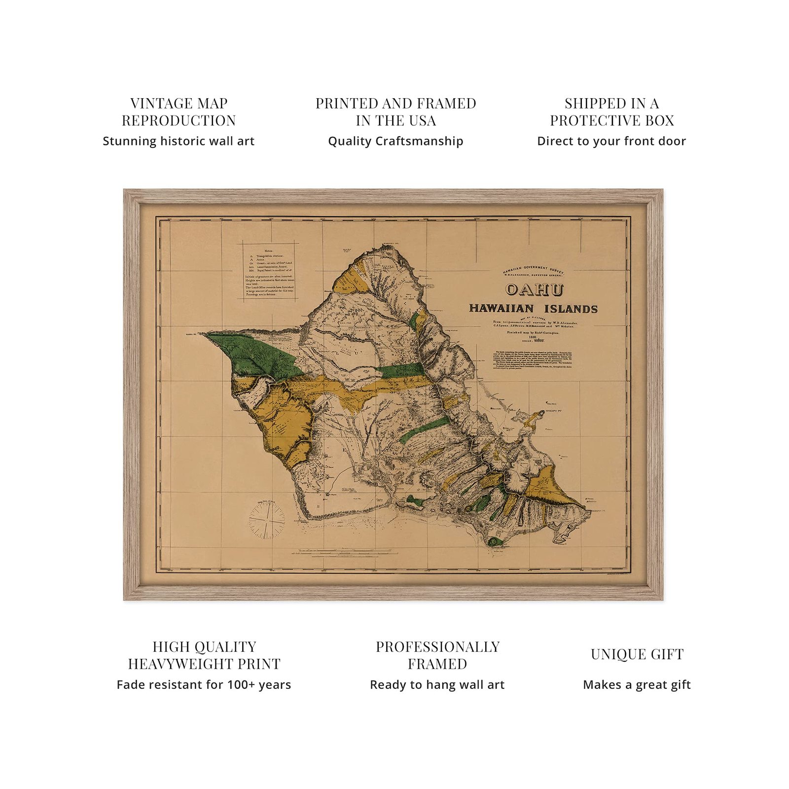
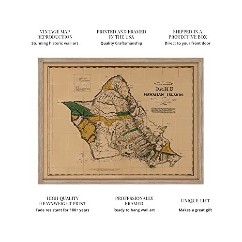
VINTAGE MAP FRAMED: You’ll love this high-quality light walnut framed historic reproduction of 1881 Oahu Hawaiian Islands Map. Our ready-to-hang maps are printed and framed in the USA by professional art framers using the highest quality materials...
|
| Product Description: |
View details
Illustrated by prominent American cartographer Richard Covington, this depiction of Hawaii shows the delineation of Royal and Government lands with Crown lands shown in yellow. Hawaii was still a kingdom in 1881 and would not be annexed as a Un...
|
| brand: |
HISTORIX
|
| Unspsc Code: |
55101500
|
| Item Name: |
View details
HISTORIX Vintage 1881 Oahu Hawaiian Islands Map - 19x25 Inch Light Walnut Framed Vintage Oahu Wall Art - Old Hawaiian Map Poster - Restored Map of Oahu Poster - Historic Oahu Hawaii Map
|
| Item Type Keyword: |
artwork
|
| Product Site Launch Date: |
2021-08-05T03:04:35.159Z
|
| material: |
Paper
|
| size: |
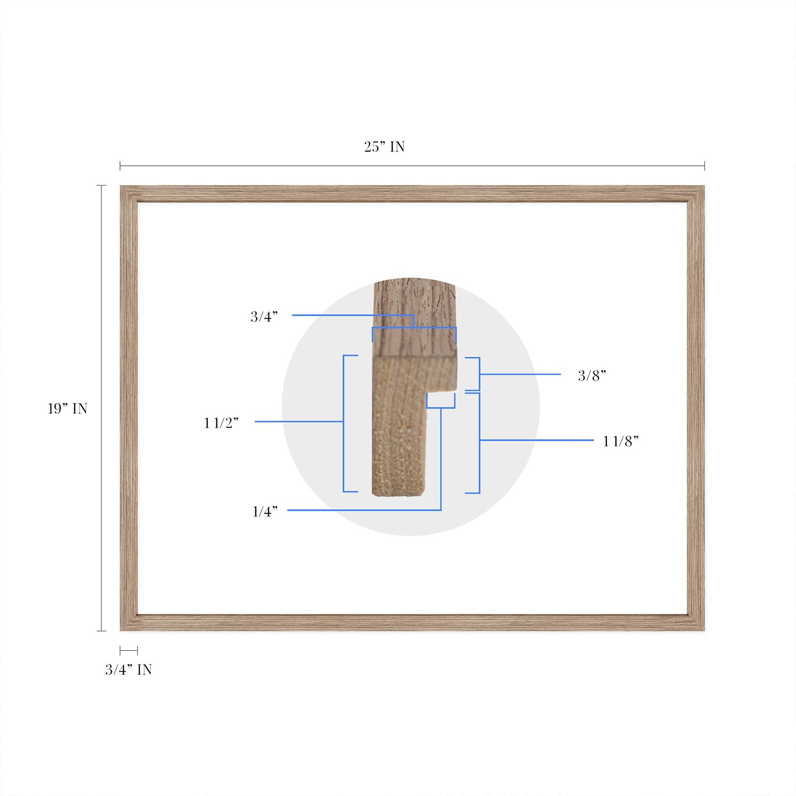
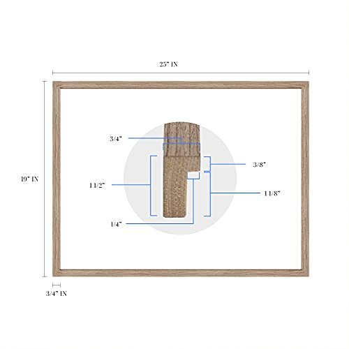
19x25 Inch
|
| style: |
Industrial
|
Listing details
|
Seller policies:
|
View seller policies
|
|
Shipping discount:
|
Seller pays shipping for this item.
|
|
Posted for sale:
|
More than a week ago
|
|
Item number:
|
1735823627
|
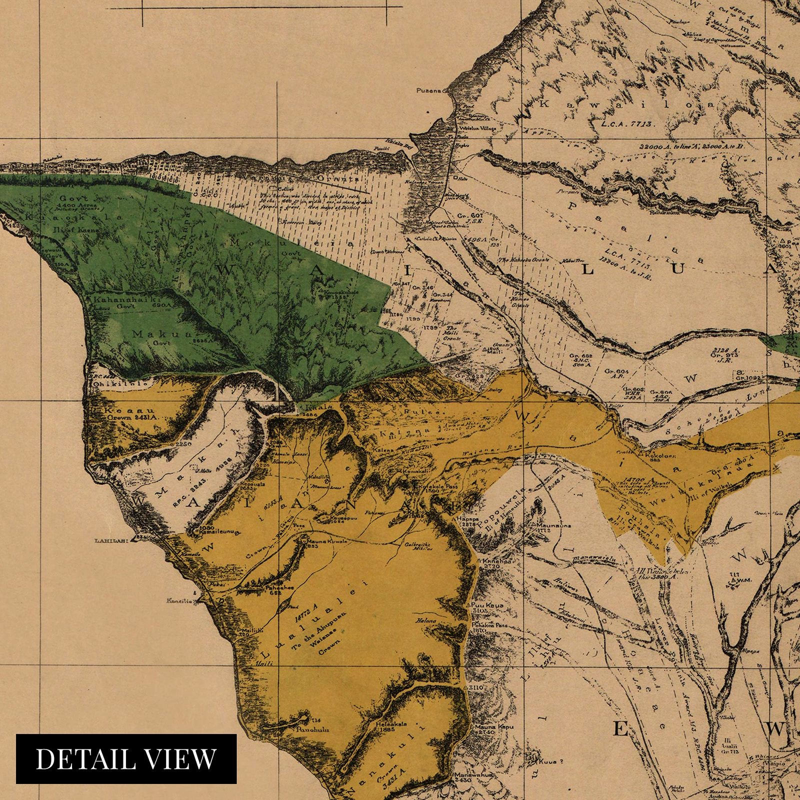
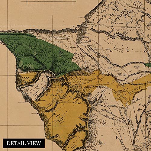
Illustrated by prominent American cartographer Richard Covington, this depiction of Hawaii shows the delineation of Royal and Government lands with Crown lands shown in yellow. Hawaii was still a kingdom in 1881 and would not be annexed as a United States territory until 1898. Covington’s unique aesthetic and technical skill show the island of Oahu in a time before significant periods of immigration and industrial farming would transform the culture and identity of the island.
This era in Hawaii’s rich history saw a transition from a primarily subsistence farming local community to agricultural stakes from Europe and the United States establishing large farms. These farms would produce much of the world’s sugar cane, and pineapples also became a huge economic driver for the islands.
This map was published only a century after the archipelago had been discovered by Captain James Cook, and set off the influx of explorers and traders who used the island as an outpost in the vastness of the Pacific Ocean. Sailing vessels from around the globe started arriving, and the islands became a diverse waypoint between North America and Southeast Asia as well as Japan.
The 1880s were also a period of revolution on the islands with the Rebellion of 1887 sparking a slew of tumultuous clashes until the final Rebellion of 1895 and the ultimate annexation by the United States at the close of the century. This unique piece of cartographical history exemplifies the remoteness of Hawaii and the iconic images that have come to be so familiar.
Our ready-to-hang wall art are printed and framed in the USA using the highest quality materials with professional craftsmanship. This beautiful artwork is a perfect addition to your themed decor. Historic prints look great in the home, study or office. They also make an unforgettable gift.
Additional Details
------------------------------
Bullet point: VINTAGE MAP FRAMED: You?ll love this high-quality light walnut framed historic reproduction of 1881 Oahu Hawaiian Islands Map. Our ready-to-hang maps are printed and framed in the USA by professional art framers using the highest quality materials. Each order is inspected for quality. This beautiful artwork is a perfect addition to your themed decor. Vintage maps look great in the home, study or office. They also make an unforgettable gift.
Product description:
Illustrated by prominent American cartographer Richard Covington, this depiction of Hawaii shows the delineation of Royal and Government lands with Crown lands shown in yellow. Hawaii was still a kingdom in 1881 and would not be annexed as a United States territory until 1898. Covington’s unique aesthetic and technical skill show the island of Oahu in a time before significant periods of immigration and industrial farming would transform the culture and identity of the island.
This era in Hawaii’s rich history saw a transition from a primarily subsistence farming local community to agricultural stakes from Europe and the United States establishing large farms. These farms would produce much of the world’s sugar cane, and pineapples also became a huge economic driver for the islands.
This map was published only a century after the archipelago had been discovered by Captain James Cook, and set off the influx of explorers and traders who used the island as an outpost in the vastness of the Pacific Ocean. Sailing vessels from around the globe started arriving, and the islands became a diverse waypoint between North America and Southeast Asia as well as Japan.
The 1880s were also a period of revolution on the islands with the Rebellion of 1887 sparking a slew of tumultuous clashes until the final Rebellion of 1895 and the ultimate annexation by the United States at the close of the century. This unique piece of cartographical history exemplifies the remoteness of Hawaii and the iconic images that have come to be so familiar.
Our ready-to-hang wall art are printed and framed in the USA using the highest quality materials with professional craftsmanship. This beautiful artwork is a perfect addition to your themed decor. Historic prints look great in the home, study or office. They also make an unforgettable gift.