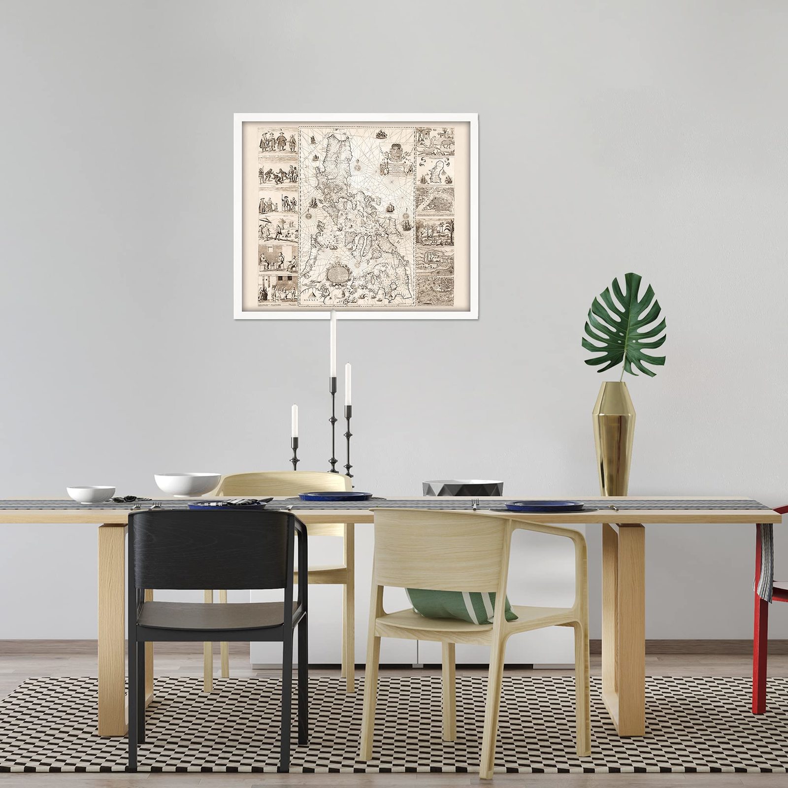
HISTORIX Vintage 1734 Philippines Map Poster - 21x25 Inch White Framed Vintage P
Shipping options
Seller handling time is 2 business days Details
This reflects the seller's handling time and may not include time spent in transit.
If you have questions about shipping, please contact the seller.
FREE via to United States
Return policy
Full refund available for DOAs
Details
- We guarantee our products and offer full refunds or exchange for defective items or items not as-described.
- Buyer must contact us within 30 days after receipt of shipment.
- The item must be received in the same condition as shipped.
- Items must be returned with all original packaging and accessories.
- Items must not be abused, modified or damaged by accident.
- A 20% restocking fee will be charged for returns
- Buyer is responsible for all return shipping and handling fees.
- Restocking and return shipping fees do not apply when item is returned as defective or because incorrect product was delivered.
Payment options
PayPal accepted
PayPal Credit accepted
Venmo accepted
PayPal, MasterCard, Visa, Discover, and American Express accepted
Maestro accepted
Amazon Pay accepted
Nuvei accepted
Item traits
| Category: |
Books
|
| Quantity Available: |
8 in stock
|
| Condition: |
Brand New
|
| ASIN: |
B09DXYWQ26
|
| EAN: |
0693634005543
|
| UPC: |
693634005543
|
| color: |
White Frame
|
| Map Type: |
Historical
|
| Externally Assigned Product Identifier: |
0693634005543
|
| Bullet Point: |
View details
VINTAGE MAP FRAMED: You’ll love this high-quality white framed historic reproduction of 1734 Philippines Map Poster. Our ready-to-hang maps are printed and framed in the USA by professional art framers using the highest quality materials. Each ord...
|
| Product Description: |
View details
One of the most historically significant maps ever published of the Philippines, this depiction of the islands while under Spanish Colonial rule, is referred to as the "Mother of all Philippine Maps." The map was the result of a collaboration b...
|
| brand: |
HISTORIX
|
| Unspsc Code: |
55101500
|
| Paper Finish: |
matte
|
| Item Name: |
View details
HISTORIX Vintage 1734 Philippines Map Poster - 21x25 Inch White Framed Vintage Philippines Wall Art - Old Philippines Map Art - Restored Historic Map of Philippines Poster Print
|
| Item Type Keyword: |
prints
|
| Product Site Launch Date: |
2021-08-30T02:23:05.358Z
|
| size: |
21x25 Inch
|
Listing details
|
Seller policies:
|
View seller policies
|
|
Shipping discount:
|
Seller pays shipping for this item.
|
|
Posted for sale:
|
More than a week ago
|
|
Item number:
|
1735822939
|
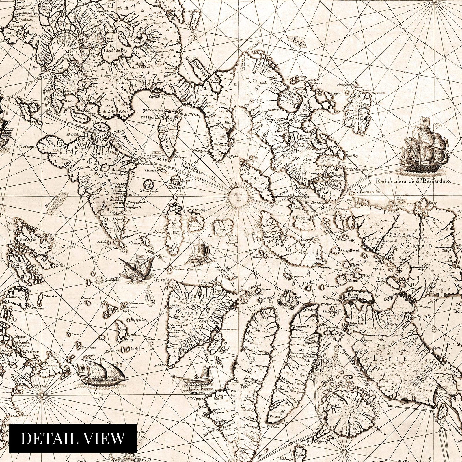
One of the most historically significant maps ever published of the Philippines, this depiction of the islands while under Spanish Colonial rule, is referred to as the "Mother of all Philippine Maps." The map was the result of a collaboration between Spanish Jesuit cartographer and missionary Pedro Murillo Velarde and two native Filipinos, engraver Nicolas de la Cruz Bagay and artist Francisco Suarez. These culturally significant engravings were seized by the British during their occupation of Manila from 1762 to 1764. The engravings were sent back to Britain, where multiple printings of the map were produced before their eventual destruction. The map was created after a direct order from Spanish King Philip V.
This depiction illustrated maritime routes from Manila to Spain and modern-day Latin America. This production was widely reprinted and was the first and most crucial scientific map of the Philippines. The Islands had been discovered two centuries prior by Portuguese explorer Ferdinand Magellan who claimed the archipelago for Spain. Under Spanish rule, the islands were unified under one government, and Catholic missionaries established churches and colonies throughout the region. These missionaries also founded schools, hospitals, and even a university. Spain would maintain colonial rule of the region until 1898.
The Philippines harbored a diverse range of indigenous people, and the map illustrates eight ethnic groups that inhabited the islands with four depictions of significant cities and islands. The distinctive aesthetic and historical significance make this map an authentic piece of cartographical history and immediately transport the viewer back in time.
Our ready-to-hang wall art are printed and framed in the USA using the highest quality materials with professional craftsmanship. This beautiful artwork is a perfect addition to your themed decor. Historic prints look great in the home, study or office.
Additional Details
------------------------------
Bullet point: VINTAGE MAP FRAMED: You?ll love this high-quality white framed historic reproduction of 1734 Philippines Map Poster. Our ready-to-hang maps are printed and framed in the USA by professional art framers using the highest quality materials. Each order is inspected for quality. This beautiful artwork is a perfect addition to your themed decor. Vintage maps look great in the home, study or office. They also make an unforgettable gift.
Product description:
One of the most historically significant maps ever published of the Philippines, this depiction of the islands while under Spanish Colonial rule, is referred to as the "Mother of all Philippine Maps." The map was the result of a collaboration between Spanish Jesuit cartographer and missionary Pedro Murillo Velarde and two native Filipinos, engraver Nicolas de la Cruz Bagay and artist Francisco Suarez. These culturally significant engravings were seized by the British during their occupation of Manila from 1762 to 1764. The engravings were sent back to Britain, where multiple printings of the map were produced before their eventual destruction. The map was created after a direct order from Spanish King Philip V.
This depiction illustrated maritime routes from Manila to Spain and modern-day Latin America. This production was widely reprinted and was the first and most crucial scientific map of the Philippines. The Islands had been discovered two centuries prior by Portuguese explorer Ferdinand Magellan who claimed the archipelago for Spain. Under Spanish rule, the islands were unified under one government, and Catholic missionaries established churches and colonies throughout the region. These missionaries also founded schools, hospitals, and even a university. Spain would maintain colonial rule of the region until 1898.
The Philippines harbored a diverse range of indigenous people, and the map illustrates eight ethnic groups that inhabited the islands with four depictions of significant cities and islands. The distinctive aesthetic and historical significance make this map an authentic piece of cartographical history and immediately transport the viewer back in time.
Our ready-to-hang wall art are printed and framed in the USA using the highest quality materials with professional craftsmanship. This beautiful artwork is a perfect addition to your themed decor. Historic prints look great in the home, study or office.