HISTORIX 2012 USDA Plant Hardiness Zone Map - 18x24 Inch United States Vegetatio
Shipping options
Seller handling time is 2 business days Details
This reflects the seller's handling time and may not include time spent in transit.
If you have questions about shipping, please contact the seller.
FREE via to United States
Return policy
Full refund available for DOAs
Details
- We guarantee our products and offer full refunds or exchange for defective items or items not as-described.
- Buyer must contact us within 30 days after receipt of shipment.
- The item must be received in the same condition as shipped.
- Items must be returned with all original packaging and accessories.
- Items must not be abused, modified or damaged by accident.
- A 20% restocking fee will be charged for returns
- Buyer is responsible for all return shipping and handling fees.
- Restocking and return shipping fees do not apply when item is returned as defective or because incorrect product was delivered.
Payment options
PayPal accepted
PayPal Credit accepted
Venmo accepted
PayPal, MasterCard, Visa, Discover, and American Express accepted
Maestro accepted
Amazon Pay accepted
Nuvei accepted
Item traits
| Category: |
Laminating Machines
|
| Quantity Available: |
16 in stock
|
| Condition: |
New
|
| ASIN: |
B09QD45RR6
|
| Item Name: |
2012 USDA plant hardiness zone map Poster Print
|
| Item Type Keyword: |
prints
|
| Unspsc Code: |
60121013
|
| sizes: |
View details
24L" x 18W" (8 in stock)
36L" x 24W" (8 in stock)
|
Listing details
|
Seller policies:
|
View seller policies
|
|
Shipping discount:
|
Seller pays shipping for this item.
|
|
Posted for sale:
|
July 8
|
|
Item number:
|
1758350227
|
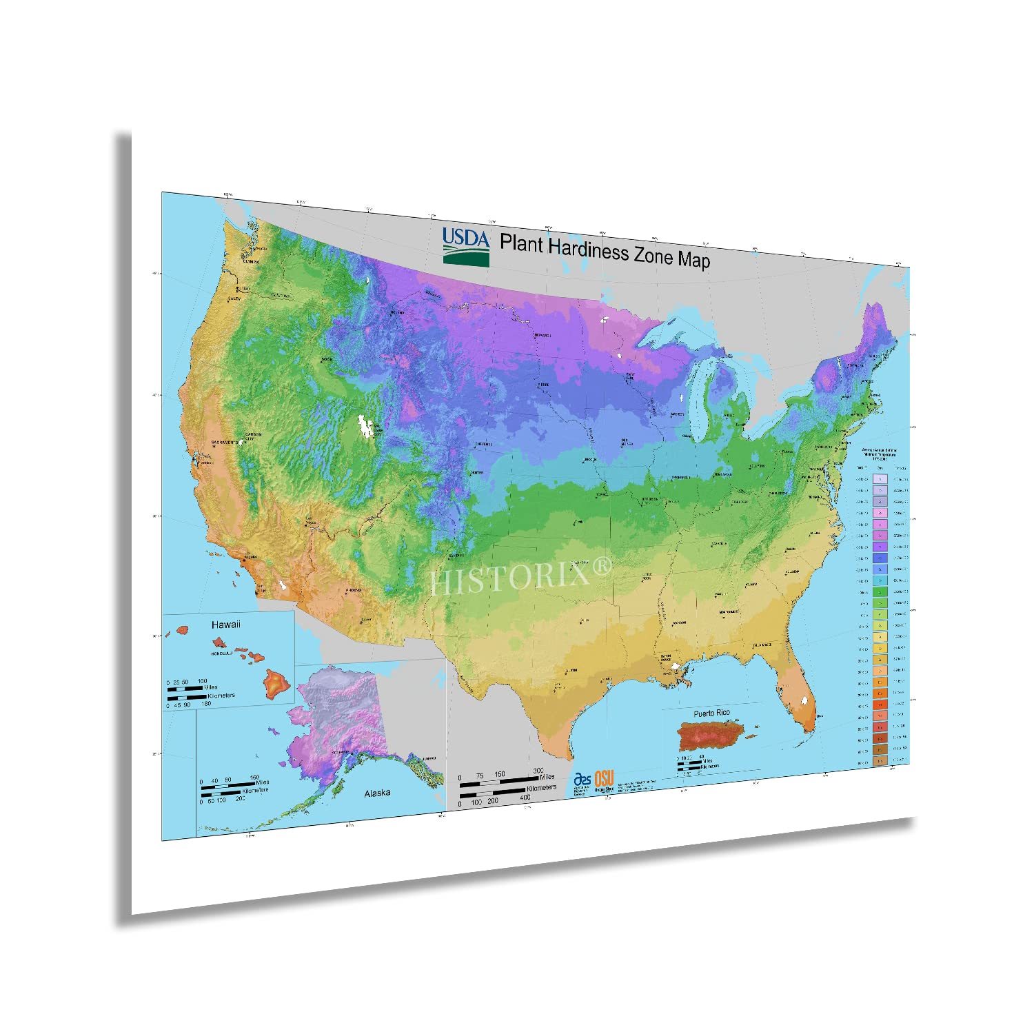
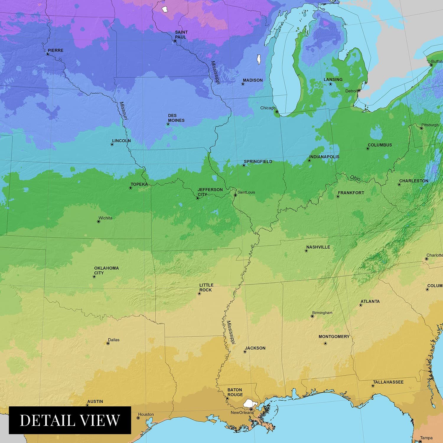
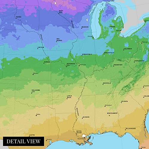
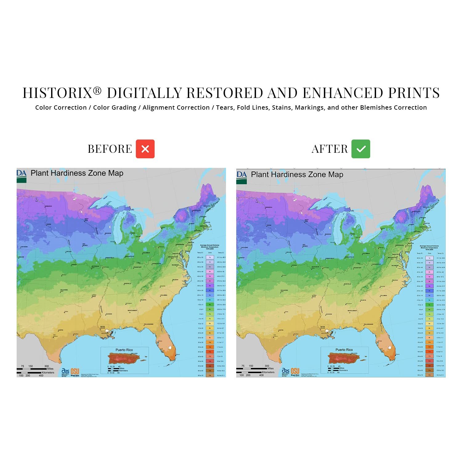
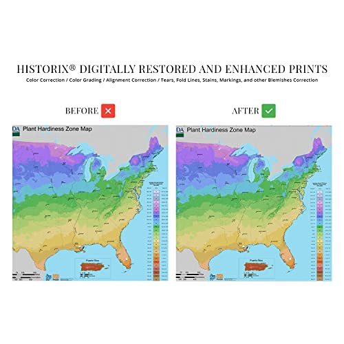
The rich details and technical analytics present in this unique depiction differentiate to from other styles of cartographical pieces. The distinctive style is immediately recognizable and informs the viewer with historical data such as average rainfall as well as high and low-temperature records. These maps define thirteen zones and are widely used for gardening, landscaping, and agricultural purposes. The United States Department of Agriculture produces these maps annually, and the first official publication was completed in 1960. Though, attempts at creating a map of these zones have been attempted since 1927.
Advances in meteorological technology along with other significant developments like computers, accurate digital thermometers, and satellite imagery would cause considerable gains in the development of these pieces, which were completely revamped in 1990. This depiction was completed after another overhaul by the Arbor Day Foundation in 2006 further altered the aesthetic and performed revisions based on current data. This map was also the first update since 2006 that increased the zones by two to reflect better definitions for tropical and semitropical plants and include Hawaii and Puerto Rico. Zone boundaries were also shifted in the 2012 publication to reflect changes to regional climates and seasonality.
This publication is also interesting as the zones reflected higher temperatures; a half zone warmer than the 1990 map. These unique pieces of cartographical history are among some of the lesser-known works, though they offer an interesting perspective on changing weather patterns. They are also an invaluable tool for arborists and horticulturalists.
Our museum quality giclee print comes printed with archival ink on premium heavyweight matte paper. Shipped in a cardboard tube your print will arrive ready to be framed. This eye-catching vintage map reproduction print makes the perfect gift for anyone that loves history.