Shopping for Collectibles? You’ve come to the right place.
With nearly 3 million items in our catalog, Bonanza is your destination for Art & Collectibles. Discover rare, unique, and vintage goods you won’t find anywhere else.

| Category: | |
|---|---|
| Quantity Available: |
8 in stock |
| Condition: |
New |
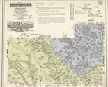
| Subject: |
Maps |
| Style: |
Vintage |
| Size: |
Medium (up to 36in.) |
| Type: |
Wall Art |
| Features: |
Museum Quality |
| Theme: |
Vintage |
| Artist: |
Various |
| Region of Origin: |
Made in the USA |
| Brand: |
HISTORIX |
| Seller policies: | |
|---|---|
| Shipping discount: |
Seller pays shipping for this item. |
| Posted for sale: |
April 13 |
| Item number: |
1738792307 |
We'll email you a link to your item now and follow up with a single reminder (if you'd like one). That's it! No spam, no hassle.
