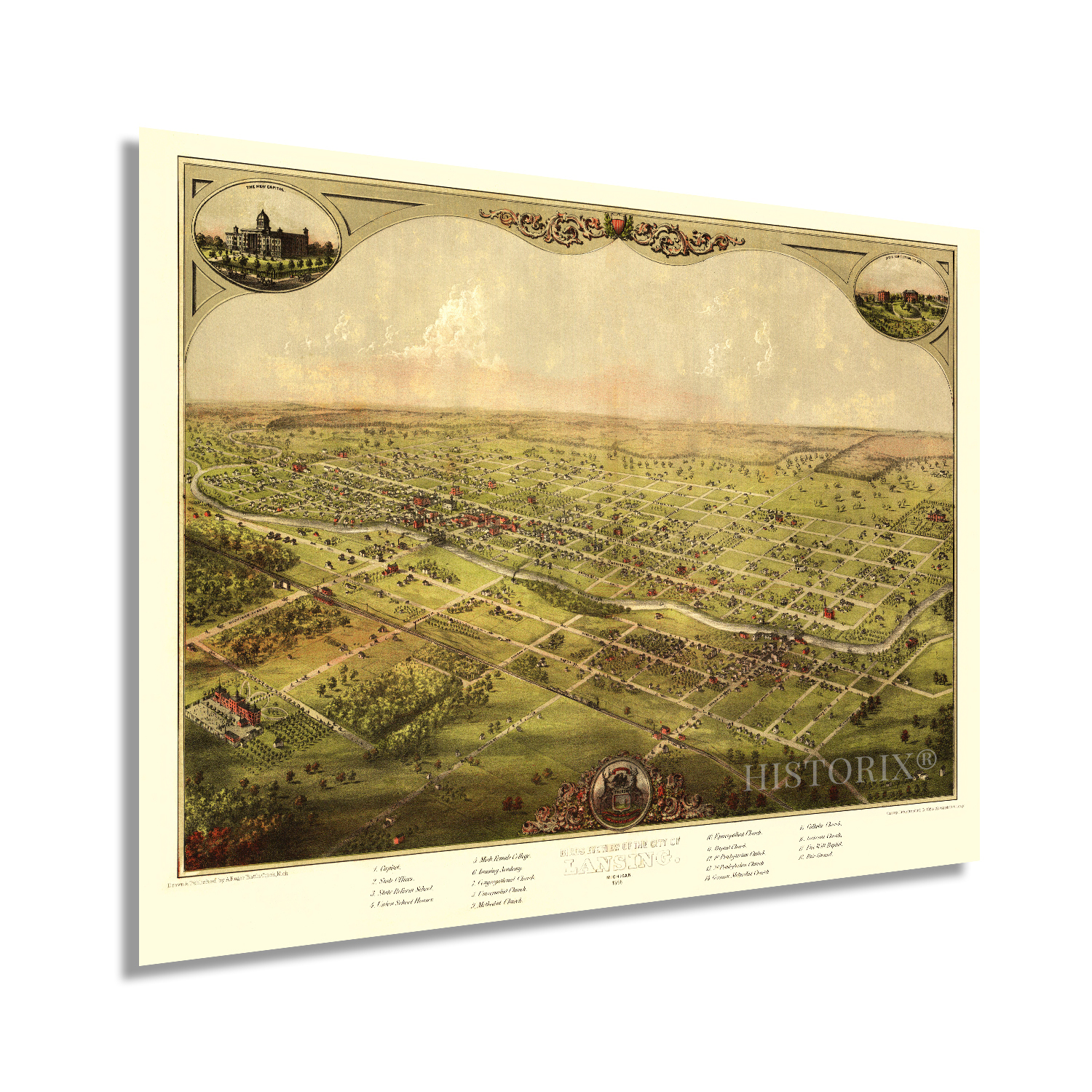
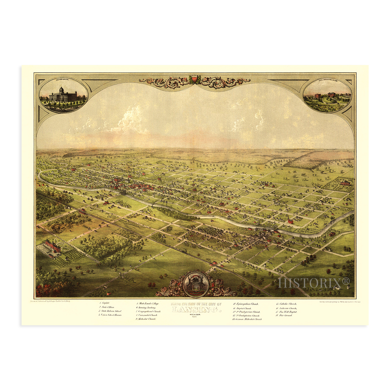
1886 Lansing Michigan Bird's Eye View Map Poster - Lansing MI Vintage Wall Art
Shipping options
Seller handling time is 2 business days Details
This reflects the seller's handling time and may not include time spent in transit.
If you have questions about shipping, please contact the seller.
FREE in United States
Return policy
Full refund available for DOAs
Details
- We guarantee our products and offer full refunds or exchange for defective items or items not as-described.
- Buyer must contact us within 30 days after receipt of shipment.
- The item must be received in the same condition as shipped.
- Items must be returned with all original packaging and accessories.
- Items must not be abused, modified or damaged by accident.
- A 20% restocking fee will be charged for returns
- Buyer is responsible for all return shipping and handling fees.
- Restocking and return shipping fees do not apply when item is returned as defective or because incorrect product was delivered.
Payment options
PayPal accepted
PayPal Credit accepted
Venmo accepted
PayPal, MasterCard, Visa, Discover, and American Express accepted
Maestro accepted
Amazon Pay accepted
Nuvei accepted
Item traits
| Category: |
Art Prints
|
| Quantity Available: |
16 in stock
|
| Condition: |
New
|
| Subject: |
Maps
|
| Style: |
Vintage
|
| Type: |
Wall Art
|
| Features: |
Museum Quality
|
| Theme: |
Vintage
|
| Artist: |
Various
|
| Region of Origin: |
Made in the USA
|
| Brand: |
HISTORIX
|
| Sizes: |
View details
18x24 Inch (8 in stock)
24x36 Inch (8 in stock)
|
Listing details
|
Seller policies:
|
View seller policies
|
|
Shipping discount:
|
Seller pays shipping for this item.
|
|
Posted for sale:
|
More than a week ago
|
|
Item number:
|
1738798321
|
HISTORIX Vintage 1886 Lansing Michigan Map Poster - Lansing Michigan Vintage Map - Bird's Eye View of The City of Lansing Michigan Wall Art - Old Lansing Michigan Map
Features
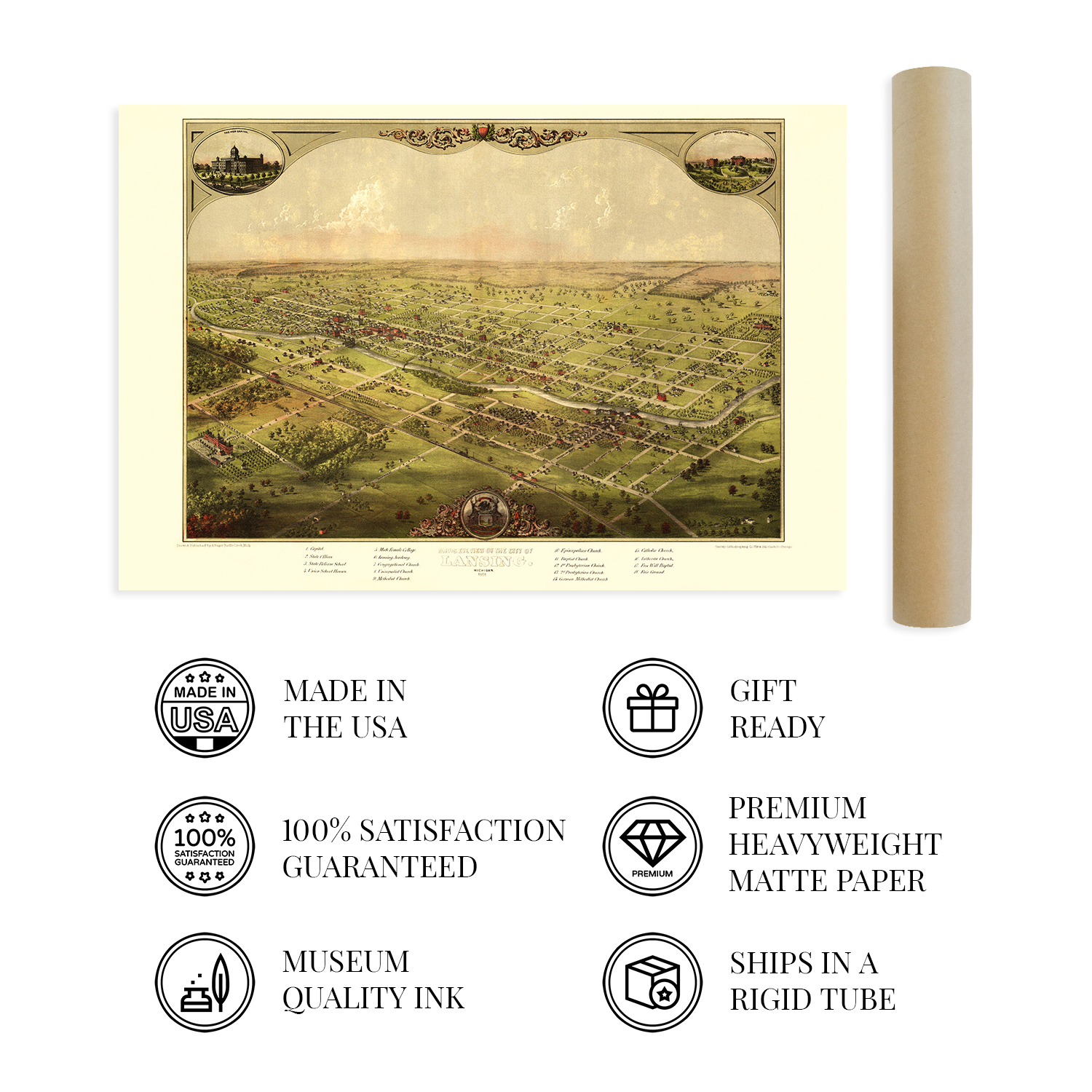
VINTAGE MAP REPRODUCTION: You'll love this high quality historic reproduction of 1886 Lansing Michigan Map Poster. Our museum quality maps are archival grade, which means it will look great and last without fading for over 100 years. Our print to order maps are made in the USA and each map is inspected for quality. This beautiful artwork is a perfect addition to your themed decor. Vintage maps look great in the home, study or office. They make a perfect gift as well.
MUSEUM QUALITY: This high quality map print will be a great addition to your vintage-themed wall. Don't waste money on cheap-looking, thin paper posters. We use thick, fine art print quality matte paper. Our professional's choice matte paper displays artwork in high detail without glare. The color is vibrant and the text is easy to read. When framed, this map looks absolutely stunning.
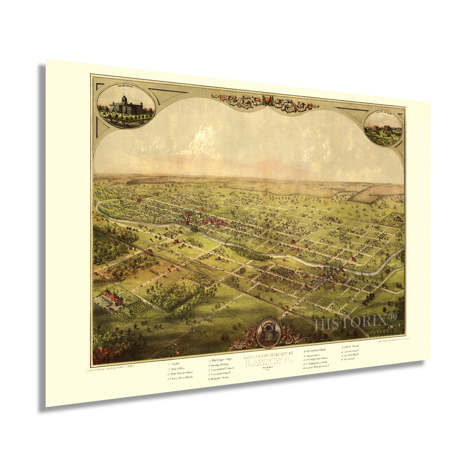
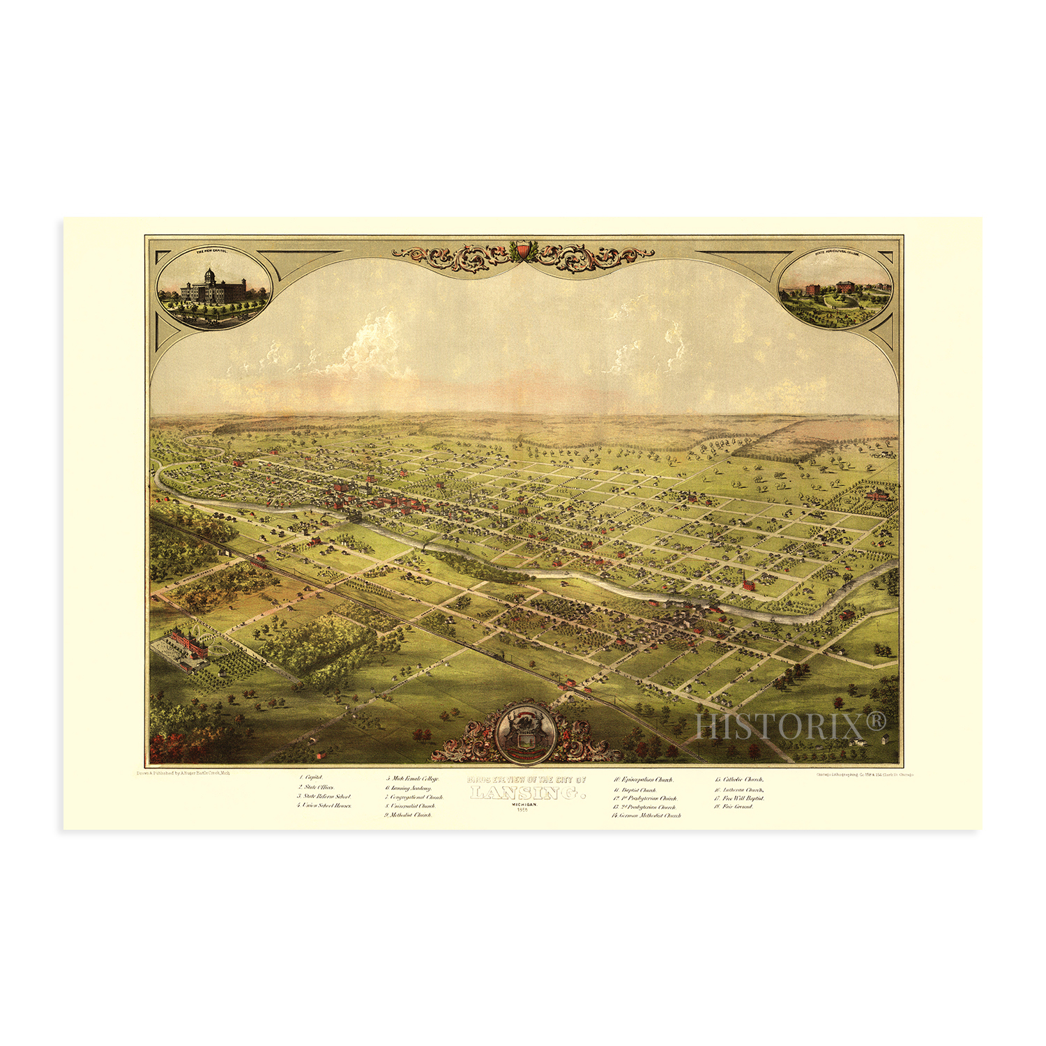
A LOOK BACK AT HISTORY: This is an impressive, historic reproduction of 1886 Old Lansing Michigan Map. This print is from an original found in the maps and geography division of the US Library of Congress. A true piece of history. See our product description section for more fascinating information about this historic map and its significance.
READY TO FRAME: This print includes a 0.2 inch border for a perfect frame fit and look. Our maps are designed to fit easy-to-find standard frame sizes, saving you money from having to pay for a custom frame. Each map is inspected for quality and shipped in a rigid tube.
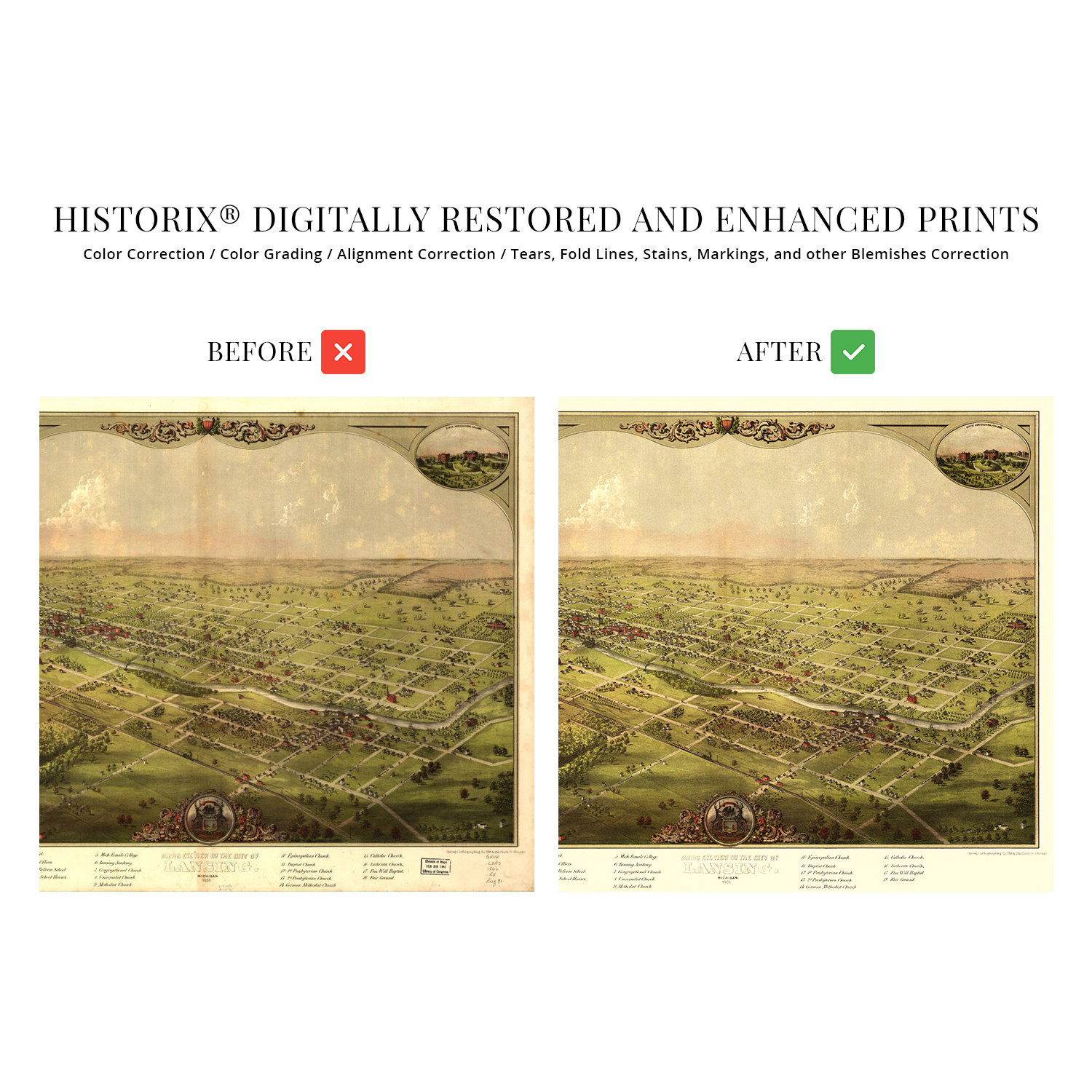
HISTORIX: We love history and art. Sometimes old maps have tears, folds, separations and other blemishes. We digitally restore and enhance maps while keeping its historical character. All our maps are proudly made in the USA. Customers all over the world love our vintage maps and we know you will too.
Additional Information
Published just one year following the conclusion of the American Civil War, this distinctive depiction of Michigan's State capital Lansing shows the iconic American City in a period of significant growth and transformation. Though Michigan did not experience any battles during the conflict, its contributions to the Union efforts were significant in providing agricultural goods, troops, munitions, and noted Generals, including George A. Custer. At the outbreak of the war, the Union requested no more than one regiment, but Governor Austin Blair wound up sending seven, a testament to the State's commitment to the Union Forces.
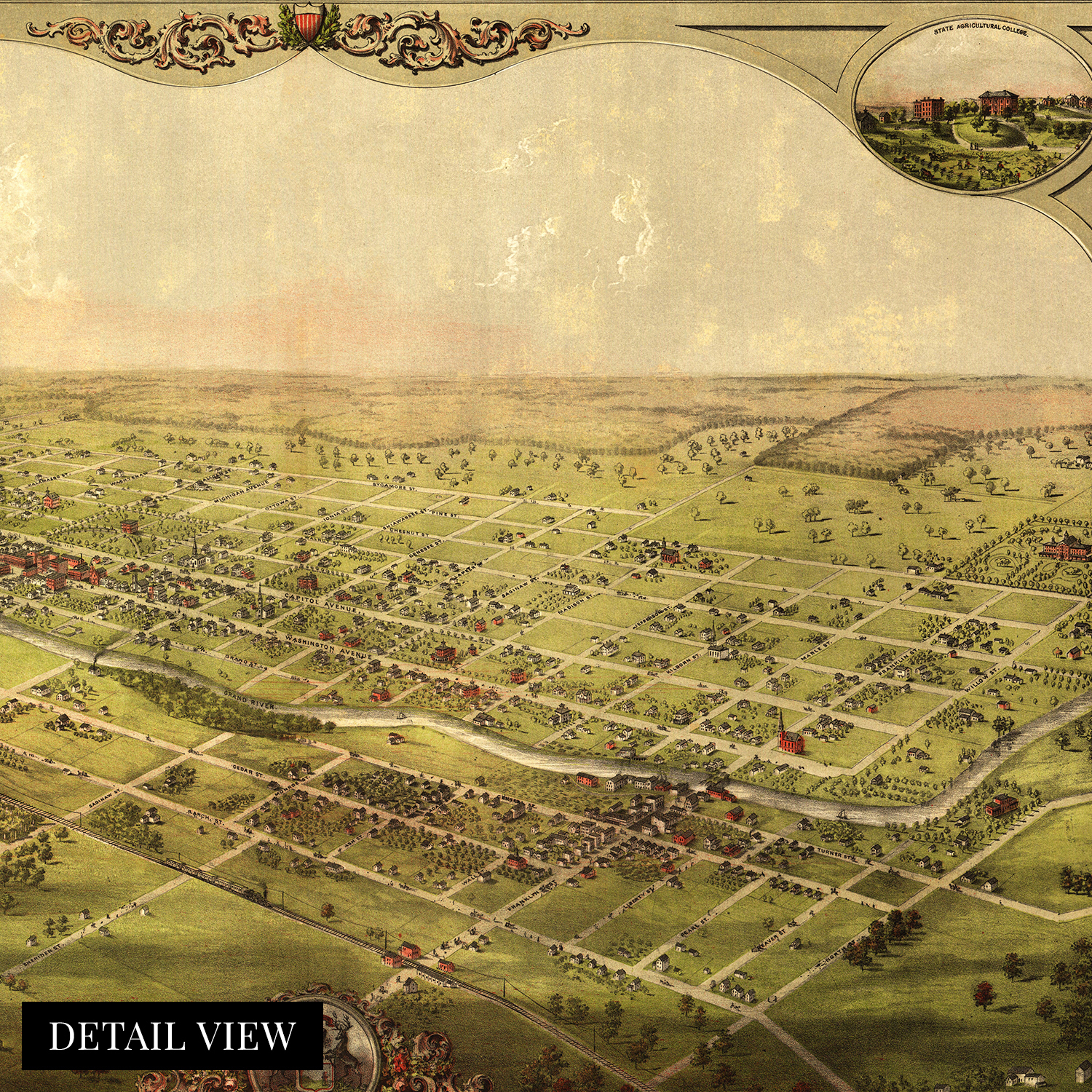
Lansing became the state capital in 1847 after being relocated from Detroit due to fears of a British Invasion from Canada. By 1859 the city had grown substantially to over three thousand residents and became a political and cultural hub for the upper Midwest and great lakes region. The city would expand throughout the later portions of the nineteenth century as rail lines increased access and motor vehicle production, and a robust manufacturing economy would spur prosperity.
Produced by prolific American illustrator, cartographer, and publisher Albert Ruger this bird's eye perspective is a unique glimpse back in time. It creates an indelible link for the viewer between the past and present. Bird's eye perspectives were among the most popular illustrations during the late nineteenth century and were used for marketing notable civic features to attract industrialists and workers alike. With an immediately recognizable aesthetic, this is truly an authentic piece of American cartographical history.
Our museum quality giclee print comes printed with archival ink on premium heavyweight matte paper. Shipped in a sturdy cardboard tube your print will arrive ready to be framed. This eye-catching vintage map reproduction print makes the perfect gift for anyone that loves history and imagery.