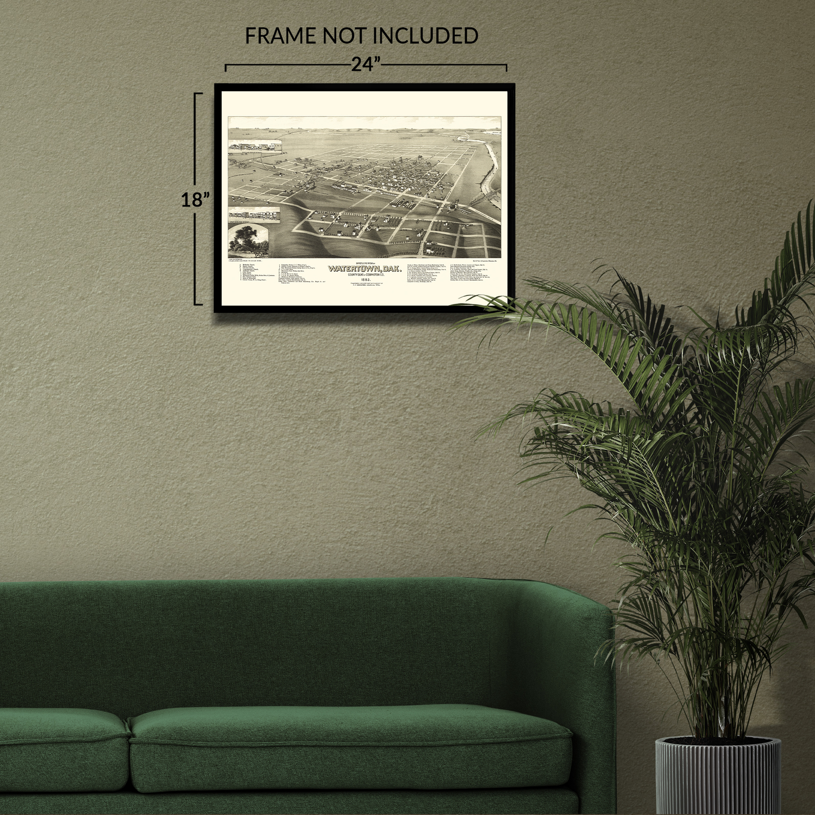
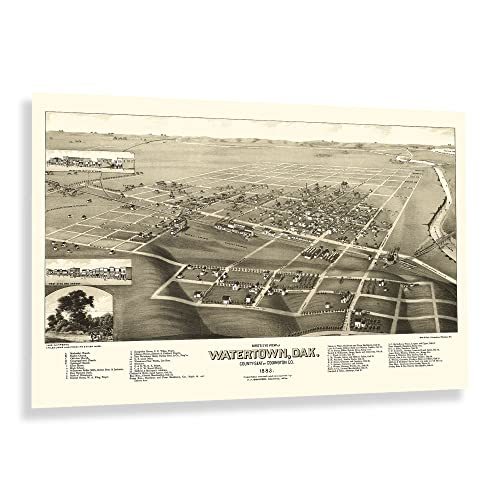
1883 Watertown Codington County South Dakota Bird's Eye View Map Poster Print
Shipping options
Seller handling time is 2 business days Details
This reflects the seller's handling time and may not include time spent in transit.
If you have questions about shipping, please contact the seller.
FREE in United States
Return policy
Full refund available for DOAs
Details
- We guarantee our products and offer full refunds or exchange for defective items or items not as-described.
- Buyer must contact us within 30 days after receipt of shipment.
- The item must be received in the same condition as shipped.
- Items must be returned with all original packaging and accessories.
- Items must not be abused, modified or damaged by accident.
- A 20% restocking fee will be charged for returns
- Buyer is responsible for all return shipping and handling fees.
- Restocking and return shipping fees do not apply when item is returned as defective or because incorrect product was delivered.
Payment options
PayPal accepted
PayPal Credit accepted
Venmo accepted
PayPal, MasterCard, Visa, Discover, and American Express accepted
Maestro accepted
Amazon Pay accepted
Nuvei accepted
Item traits
| Category: |
Art Prints
|
| Quantity Available: |
16 in stock
|
| Condition: |
New
|
| Type: |
Print
|
| Sizes: |
View details
18x24 Inch (8 in stock)
24x36 Inch (8 in stock)
|
Listing details
|
Seller policies:
|
View seller policies
|
|
Shipping discount:
|
Seller pays shipping for this item.
|
|
Posted for sale:
|
More than a week ago
|
|
Item number:
|
1738799507
|
Feature Points
VINTAGE MAP REPRODUCTION: You?ll love this high quality historic reproduction of 1883 Watertown South Dakota Map Poster. Our museum quality prints are archival grade, which means it will look great and last without fading for over 100 years. Our print to order maps are made in the USA and each map is inspected for quality. This beautiful artwork is a perfect addition to your themed decor. Vintage maps look great in the home, study or office. They make a perfect gift as well.
MUSEUM QUALITY: This high quality map print will be a great addition to your vintage-themed wall. Don't waste money on cheap-looking, thin paper posters. We use thick, fine art print quality matte paper. Our professional?s choice matte paper displays artwork in high detail without glare. The color is vibrant and text is easy to read. When framed, this map looks absolutely stunning.
A LOOK BACK AT HISTORY: This is an impressive, historic reproduction of 1883 Watertown Wall Art Map of South Dakota Poster. A true piece of history. See our product description section for more fascinating information about this historic map and its significance.
READY TO FRAME: This print includes a 0.2 inch border for a perfect frame fit and look. Our maps are designed to fit easy-to-find standard frame sizes, saving you money from having to pay for a custom frame. Each map is inspected for quality and shipped in a rigid tube.
HISTORIX: We love history and art. Sometimes old maps have tears, folds, separations and other blemishes. We digitally restore and enhance maps while keeping its historical character. All our maps are proudly made in the USA. Customers all over the world love our vintage maps and we know you will too.
Additional Information
Produced and published during a period of significant prosperity, Watertown became a transportation hub for the region as the expansion of rail lines across the American West opened access and allowed for numerous towns and communities to be established throughout the latter portion of the nineteenth century. In the years following the conclusion of the American Civil War, westward expansion was flourishing, and Watertown was considered to be named the State Capital when South Dakota achieved statehood in 1889, only six years after this map's publication. Watertown is located on the banks of the Big Sioux River, a tributary of the Mississippi River that allowed for early traders to move goods into the area from larger markets on the Mississippi.
This bird's eye perspective was produced by the prominent cartographer Joseph John Stoner in partnership with his frequent collaborators, Beck Pauli, whose lithography firm was based in Milwaukee. This trio created numerous panoramic maps of various towns and cities across the United States designed as marketing materials to entice residents and merchants alike by promoting notable civic features, natural attractions, and economic opportunities that brought immigrants from across America, Eastern, and Western Europe that established neighborhoods and communities based on cultural lines, many of which exist to this day.
In the years following the conclusion of the American Civil War, the region continued to o and expand. This is a unique piece of American cartographical history with a distinct style that transports the viewer back in time.