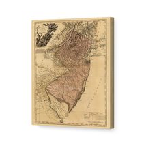
HISTORIX Vintage 1820 Mississippi Map Canvas and 50 similar items
Free Shipping
HISTORIX Vintage 1820 Mississippi Map Canvas Art - 16x24x1.5 Inch Canvas Wrap Vi
$251.99 - $280.99
View full item details »
Shipping options
Seller handling time is 1 business day Details
FREE via to United States
Return policy
Full refund available for DOAs
Details
Purchase protection
Payment options
PayPal accepted
PayPal Credit accepted
Venmo accepted
PayPal, MasterCard, Visa, Discover, and American Express accepted
Maestro accepted
Amazon Pay accepted
Nuvei accepted
Item traits
| Category: | |
|---|---|
| Quantity Available: |
16 in stock |
| Condition: |
New |
| ASIN: |
B09DXF34ZV |
| Item Name: |
1820 Map of Mississippi |
| Item Type Keyword: |
prints |
| Product Site Launch Date: |
2021-08-29T15:54:27.299Z |
| Unspsc Code: |
55101501 |
| sizes: |
Listing details
| Seller policies: | |
|---|---|
| Shipping discount: |
Seller pays shipping for this item. |
| Posted for sale: |
April 19 |
| Item number: |
1740885842 |
Item description
Published by noted Scottish mapmaker John Melish in 1820, this depiction of Mississippi shows the state just three years after it’s inclusion into the United States. Melish was one of the earliest surveyors to produce maps and created the first map of the United States that extended to the Pacific Ocean. He had settled in Philadelphia in 1811 and is considered one of the most prominent cartographers of the United States in its early years. His publication of the United Stated is deemed to have been influential in the westward expansion doctrine known as manifest destiny.
The Mississippi River played a pivotal role in the economic development of the region, and towns were typically established due to their proximity to the river. The Mississippi is one of the most iconic waterways in America and holds a unique place in the history and lore of the nation. The river allowed trade into the mid-west and became vital for the economic success of the gulf coast, including Mississippi and Louisiana. The river also allowed further exploration into the western portion of the united states, encouraging growth and settlement west of the river as well as into northern areas.
Melish’s maps were renowned for their accuracy and fulfilled the contemporary need for precise cartography. As Mississippi entered the United States, it was in a period of significant transition in the early 19th century, and the distinctive aesthetic of this illustration immediately transports the viewer back in time and is an authentic piece of cartographical history.
Our ready-to-hang canvas wall art prints are made in the USA using the highest quality materials with professional craftsmanship. This beautiful artwork is a perfect addition to your themed decor. Historic prints look great in the home, study or office. They also make an unforgettable gift.
|
Why are we showing these items?
Booth
Historic Prints |

|

-
Refine your browsing experience
We can show you more items that are exactly like the original item, or we can show you items that are similar in spirit. By default we show you a mix.
This item has been added to your cart
 HISTORIX Vintage 1820 Mississippi Map Canvas Art - 16x24x1.5 Inch Canvas Wrap Vi added to cart.
16 available in stock
View Cart or continue shopping.
 Please wait while we finish adding this item to your cart.
Get an item reminder
We'll email you a link to your item now and follow up with a single reminder (if you'd like one). That's it! No spam, no hassle.
Already have an account?
Log in and add this item to your wish list.


