1865 Puget Sound Map - Old Haro Strait Map & and 47 similar items


Free Shipping
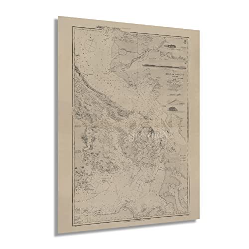
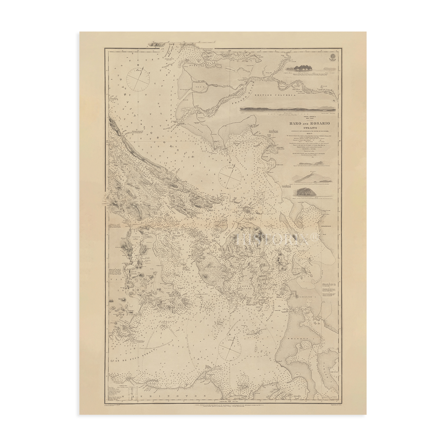
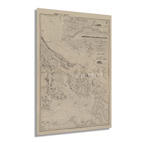
1865 Puget Sound Map - Old Haro Strait Map & Map of Rosario Strait Wall Art
$39.99 - $59.99
View full item details »

Shipping options
Seller handling time is 2 business days Details
FREE in United States
Return policy
Full refund available for DOAs
Details
Purchase protection
Payment options
PayPal accepted
PayPal Credit accepted
Venmo accepted
PayPal, MasterCard, Visa, Discover, and American Express accepted
Maestro accepted
Amazon Pay accepted
Nuvei accepted
View full item details »
Shipping options
Seller handling time is 2 business days Details
FREE in United States
Return policy
Full refund available for DOAs
Details
Purchase protection
Payment options
PayPal accepted
PayPal Credit accepted
Venmo accepted
PayPal, MasterCard, Visa, Discover, and American Express accepted
Maestro accepted
Amazon Pay accepted
Nuvei accepted
Item traits
| Category: | |
|---|---|
| Quantity Available: |
16 in stock |
| Condition: |
New |
| Subject: |
Maps |
| Style: |
Vintage |
| Type: |
Wall Art |
| Features: |
Museum Quality |
| Theme: |
Vintage |
| Artist: |
Various |
| Region of Origin: |
Made in the USA |
| Brand: |
HISTORIX |
| Sizes: |
Listing details
| Seller policies: | |
|---|---|
| Shipping discount: |
Seller pays shipping for this item. |
| Posted for sale: |
More than a week ago |
| Item number: |
1738798190 |
Item description
Feature Points
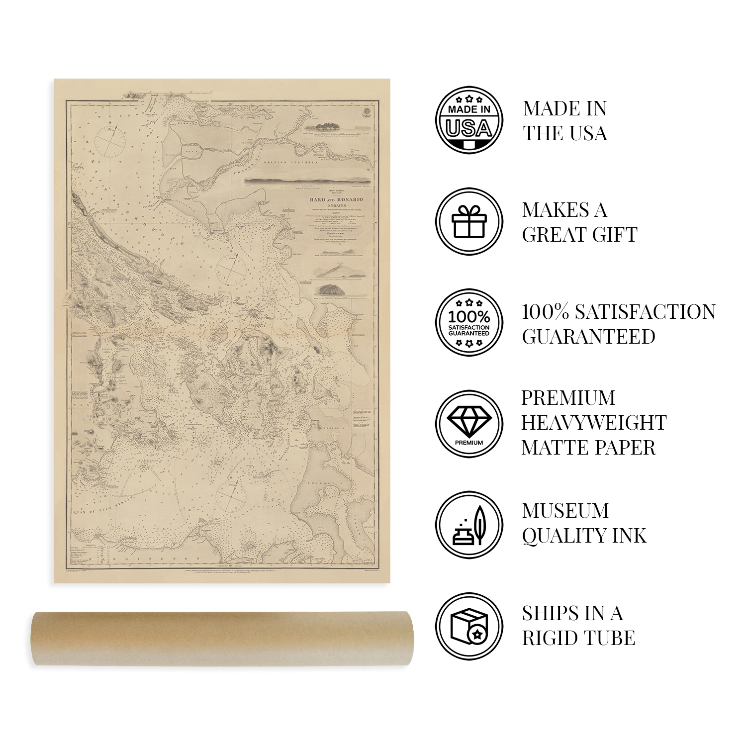
VINTAGE MAP REPRODUCTION: You?ll love this high quality historic reproduction of 1865 Puget Sound Map. Our museum quality prints are archival grade, which means it will look great and last without fading for over 100 years. Our print to order maps are made in the USA and each map is inspected for quality. This beautiful artwork is a perfect addition to your themed decor. Vintage maps look great in the home, study or office. They make a perfect gift as well.
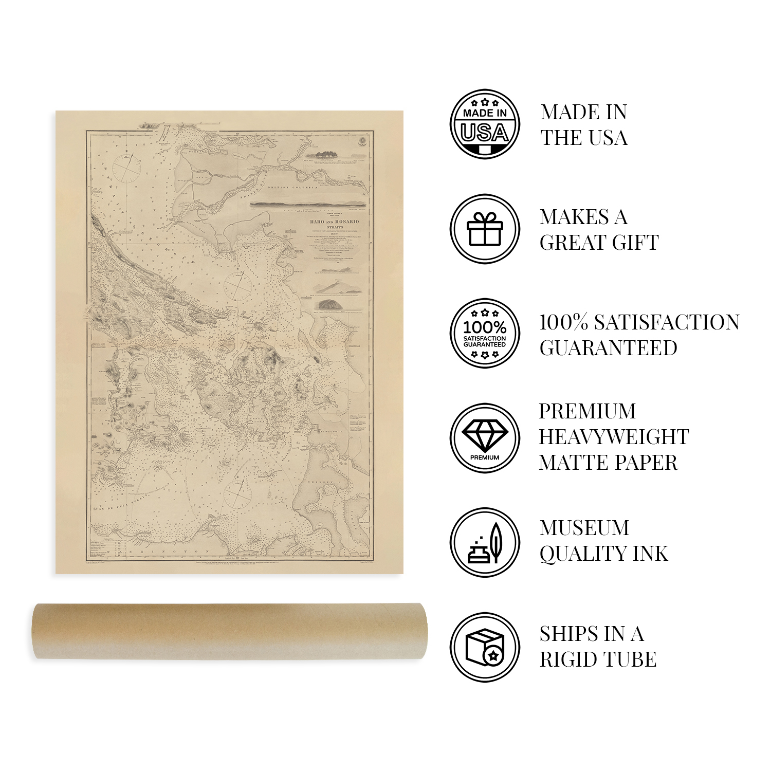
MUSEUM QUALITY: This high quality map print will be a great addition to your vintage-themed wall. Don't waste money on cheap-looking, thin paper posters. We use thick, fine art print quality matte paper. Our professional?s choice matte paper displays artwork in high detail without glare. The color is vibrant and text is easy to read. When framed, this map looks absolutely stunning.
A LOOK BACK AT HISTORY: This is an impressive, historic reproduction of 1865 Map of Puget Sound Wall Art. A true piece of history. See our product description section for more fascinating information about this historic map and its significance.
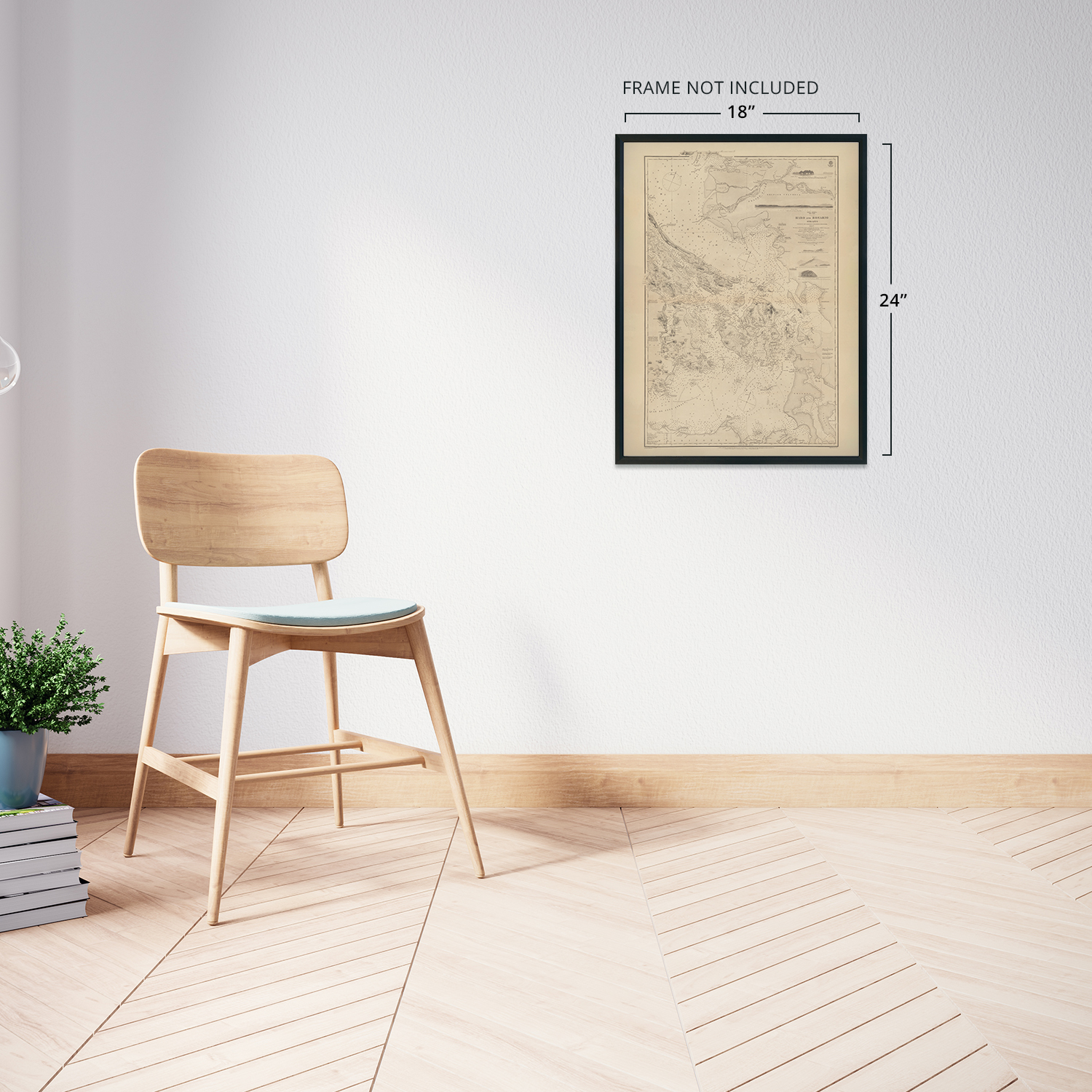
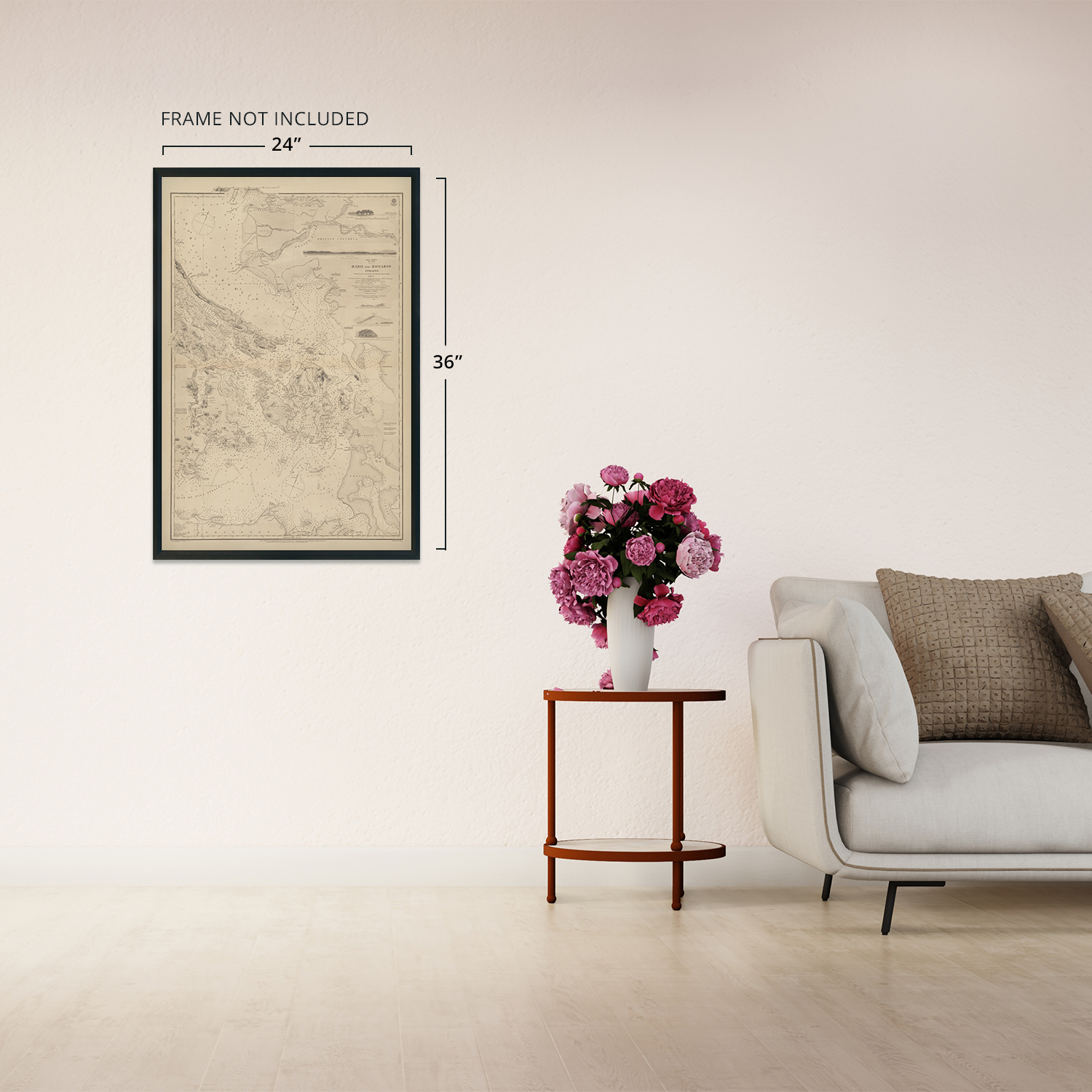
READY TO FRAME: This print includes a 0.2 inch border for a perfect frame fit and look. Our maps are designed to fit easy-to-find standard frame sizes, saving you money from having to pay for a custom frame. Each map is inspected for quality and shipped in a rigid tube.
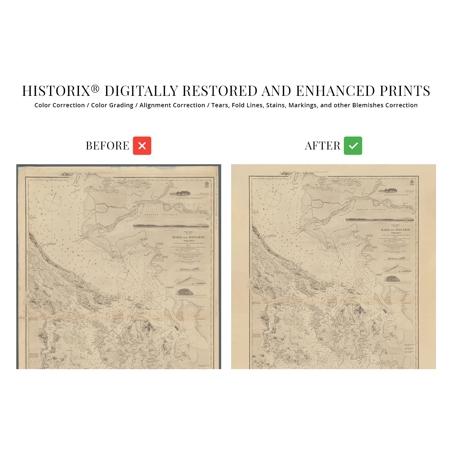
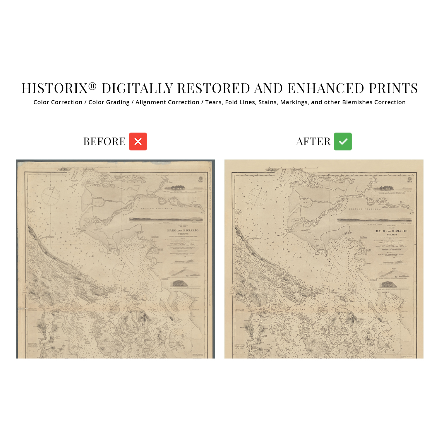
HISTORIX: We love history and art. Sometimes old maps have tears, folds, separations and other blemishes. We digitally restore and enhance maps while keeping its historical character. All our maps are proudly made in the USA. Customers all over the world love our vintage maps and we know you will too.
Additional Information
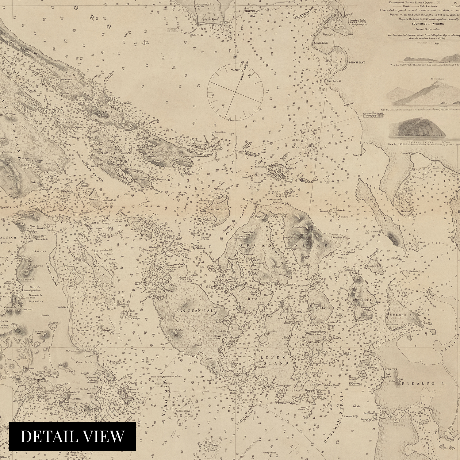
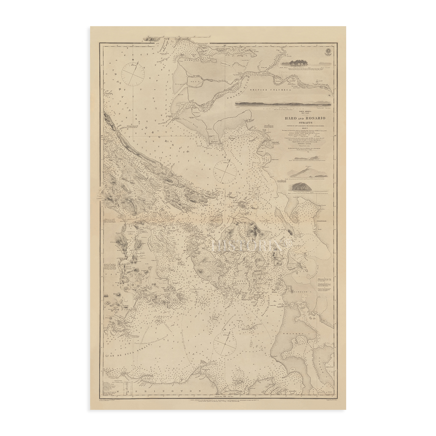
Published during a period of significant growth for the region, this depiction of Puget Sound and the Rosario Straits bears a unique aesthetic and distinctive style that immediately transports the viewer back in time. The mid-nineteenth century saw the region grow from a remote fur-trapping outpost to a thriving port with international importing and exporting driving a prosperous economy and attracting immigrants from America, Canada, Western Europe, and Asia. The completion of the Lake Superior and Puget Sound Rail lines in 1865 further increased access and expansion.
The Rosario Straits are a critical shipping lane discovered by Spanish sailors in 1790 and allowed access to the Northwest only sixteen years before the overland discovery by Lewis and Clark. President Thomas Jefferson commissioned the expedition following the completion of the Louisiana Purchase in 1803 to establish an American presence in the Northwest before European settlers could arrive.
Puget Sound extends more than one hundred miles from Deception Pass in the North to Olympia in the South. The inlet of the Pacific Ocean is part of the Salish Sea and refers to the body of water itself and the cities and towns located on its banks, including Seattle, Tacoma, and Everett. The Sound was discovered in 1792 by British Royal Navy Captain George Vancouver in an attempt to locate the fabled Northwest Passage. This is truly an authentic piece of cartographical and maritime history. As the region?s ports grew and railroads increased access, the region became one of the most iconic in the Northwest.
Our museum quality giclee print comes printed with archival ink on premium heavyweight matte paper. Shipped in a sturdy cardboard tube your print will arrive ready to be framed. This eye-catching vintage map reproduction print makes the perfect gift for anyone that loves history and imagery.
|
Why are we showing these items?
Search Results
Print, art prints"print" Category "Art Prints"
|


-
Refine your browsing experience
We can show you more items that are exactly like the original item, or we can show you items that are similar in spirit. By default we show you a mix.


This item has been added to your cart
 1865 Puget Sound Map - Old Haro Strait Map & Map of Rosario Strait Wall Art added to cart.
16 available in stock
1865 Puget Sound Map - Old Haro Strait Map & Map of Rosario Strait Wall Art added to cart.
16 available in stock
View Cart or continue shopping.
 Please wait while we finish adding this item to your cart.
Get an item reminder
We'll email you a link to your item now and follow up with a single reminder (if you'd like one). That's it! No spam, no hassle.
Already have an account?
Log in and add this item to your wish list.