HISTORIX Vintage 1867 Port Huron Michigan and similar items


Free Shipping
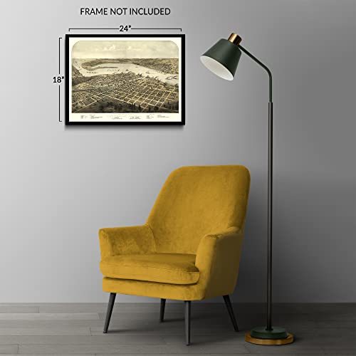
HISTORIX Vintage 1867 Port Huron Michigan Map Print - 18x24 Inch Old Gratiot & S
$39.99
View full item details »

Shipping options
Seller handling time is 2 business days Details
FREE via to United States
Return policy
Full refund available for DOAs
Details
Purchase protection
Payment options
PayPal accepted
PayPal Credit accepted
Venmo accepted
PayPal, MasterCard, Visa, Discover, and American Express accepted
Maestro accepted
Amazon Pay accepted
Nuvei accepted
View full item details »
Shipping options
Seller handling time is 2 business days Details
FREE via to United States
Return policy
Full refund available for DOAs
Details
Purchase protection
Payment options
PayPal accepted
PayPal Credit accepted
Venmo accepted
PayPal, MasterCard, Visa, Discover, and American Express accepted
Maestro accepted
Amazon Pay accepted
Nuvei accepted
Item traits
| Category: | |
|---|---|
| Quantity Available: |
8 in stock |
| Condition: |
New |
| UPC: |
737214972518 |
| Color: |
Brown |
| Style: |
Vintage/Retro |
| ASIN: |
B0BT8H683B |
| EAN: |
0737214972518 |
| Paint Type: |
Watercolor |
| Externally Assigned Product Identifier: |
0737214972518 |
| Item Shape: |
Rectangular |
| Bullet Point: | |
| Product Description: | |
| Brand: |
HISTORIX |
| Supplier Declared Dg Hz Regulation: |
not_applicable |
| Unspsc Code: |
55101500 |
| orientation: |
Landscape |
| Paper Finish: |
matte |
| Item Name: | |
| Item Type Keyword: |
prints |
| Mounting Type: |
Wall Mount |
| size: |
24L" x 36W" |
| Paper Size: |
18 x 24 |
| Target Gender: |
unisex |
Listing details
| Seller policies: | |
|---|---|
| Shipping discount: |
Seller pays shipping for this item. |
| Posted for sale: |
More than a week ago |
| Item number: |
1736375485 |
Item description
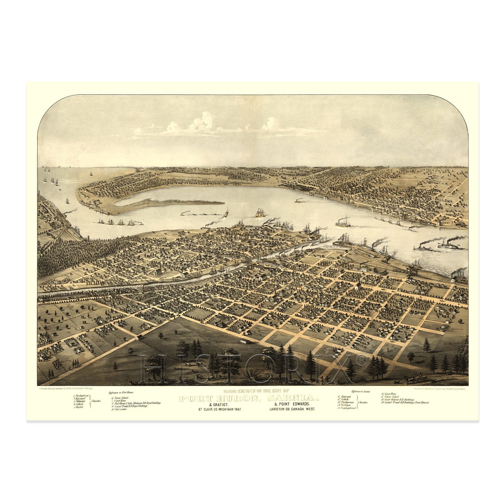
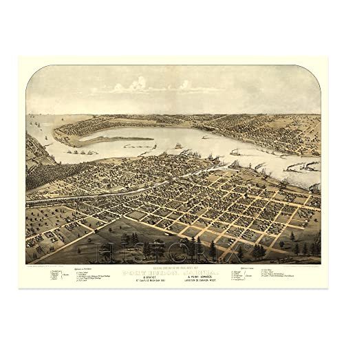
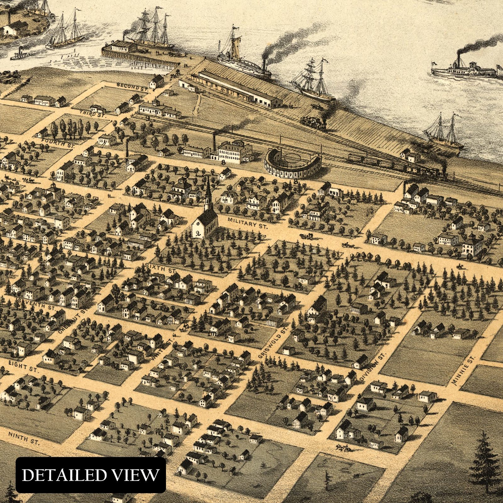
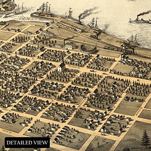
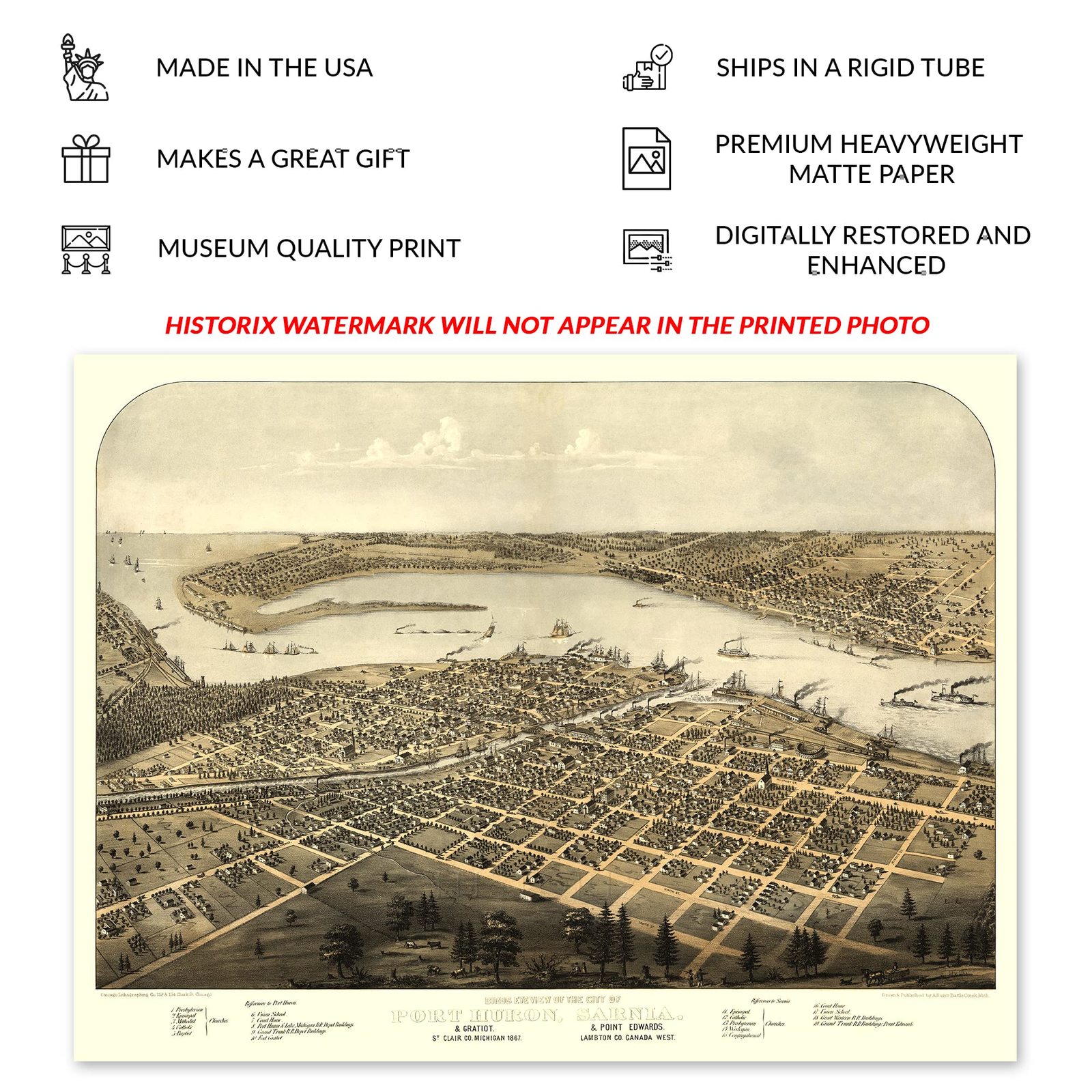
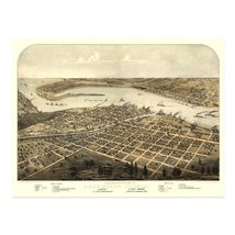
Located at the American and Canadian border, the cities of Port Huron and Sarnia remain an important crossing point for residents of both countries for both professional and personal business across the border. Port Huron lies at the southern tip of Lake Huron, and the construction of the Blue Water Bridge, which was completed in 1938, increased access throughout the region. This depiction by Albert Ru ger in the bird's eye perspective style is immediately recognizable and transports the viewer back in time with its distinctive details and bold colors. Ru ger was a pioneer of the form, which served as marketing materials to attract residents and merchants alike.
The region grew as a manufacturing hub and became an essential part of the burgeoning automotive industry during the early and middle portions of the twentieth century. In 1814 the United States established Fort Gratiot following the conclusion of the War of 1812, and the region grew around this gateway to the Midwest. Though not his hometown, Thomas Edison grew up in Port Huron and sold newspapers in the train depot where this type of map would have been displayed. The years after the conclusion of the American Civil War saw a significant increase in population as residents made roots in the town following immigration from the American South as well as Western and Northern Europe.
Panoramic maps are unique because they were not produced for navigation and are not bound by traditional rules. The form is a key link in cartographical history.
Additional Details
------------------------------
Bullet point: VINTAGE MAP REPRODUCTION: You?ll love this high quality historic reproduction of 1867 Port Huron Gratiot St Clair County Map of Michigan. Our museum quality prints are archival grade, which means it will look great and last without fading for over 100 years. Our print to order maps are made in the USA and each map is inspected for quality. This beautiful artwork is a perfect addition to your themed decor. Vintage maps look great in the home, study or office. They make a perfect gift as well.
Product description:
Located at the American and Canadian border, the cities of Port Huron and Sarnia remain an important crossing point for residents of both countries for both professional and personal business across the border. Port Huron lies at the southern tip of Lake Huron, and the construction of the Blue Water Bridge, which was completed in 1938, increased access throughout the region. This depiction by Albert Ru ger in the bird's eye perspective style is immediately recognizable and transports the viewer back in time with its distinctive details and bold colors. Ru ger was a pioneer of the form, which served as marketing materials to attract residents and merchants alike.
The region grew as a manufacturing hub and became an essential part of the burgeoning automotive industry during the early and middle portions of the twentieth century. In 1814 the United States established Fort Gratiot following the conclusion of the War of 1812, and the region grew around this gateway to the Midwest. Though not his hometown, Thomas Edison grew up in Port Huron and sold newspapers in the train depot where this type of map would have been displayed. The years after the conclusion of the American Civil War saw a significant increase in population as residents made roots in the town following immigration from the American South as well as Western and Northern Europe.
Panoramic maps are unique because they were not produced for navigation and are not bound by traditional rules. The form is a key link in cartographical history.
Style: Retro
Loading
This item has been added to your cart
 HISTORIX Vintage 1867 Port Huron Michigan Map Print - 18x24 Inch Old Gratiot & S added to cart.
8 available in stock
HISTORIX Vintage 1867 Port Huron Michigan Map Print - 18x24 Inch Old Gratiot & S added to cart.
8 available in stock
View Cart or continue shopping.
 Please wait while we finish adding this item to your cart.
Get an item reminder
We'll email you a link to your item now and follow up with a single reminder (if you'd like one). That's it! No spam, no hassle.
Already have an account?
Log in and add this item to your wish list.