HISTORIX Vintage 1869 Naperville Illinois and similar items


Free Shipping
HISTORIX Vintage 1869 Naperville Illinois Map Poster - 18x24 Inch Old Bird's Eye
$39.99
View full item details »

Shipping options
Seller handling time is 2 business days Details
FREE via to United States
Return policy
Full refund available for DOAs
Details
Purchase protection
Payment options
PayPal accepted
PayPal Credit accepted
Venmo accepted
PayPal, MasterCard, Visa, Discover, and American Express accepted
Maestro accepted
Amazon Pay accepted
Nuvei accepted
View full item details »
Shipping options
Seller handling time is 2 business days Details
FREE via to United States
Return policy
Full refund available for DOAs
Details
Purchase protection
Payment options
PayPal accepted
PayPal Credit accepted
Venmo accepted
PayPal, MasterCard, Visa, Discover, and American Express accepted
Maestro accepted
Amazon Pay accepted
Nuvei accepted
Item traits
| Category: | |
|---|---|
| Quantity Available: |
8 in stock |
| Condition: |
New |
| UPC: |
705514888914 |
| MPN: |
ENMAP06581824 |
| EAN: |
0705514888914 |
| Paint Type: |
Oil |
| Color: |
Natural |
| manufacturer: |
HISTORIX |
| Externally Assigned Product Identifier: |
0705514888914 |
| Item Shape: |
Rectangular |
| Bullet Point: | |
| Product Description: | |
| Brand: |
HISTORIX |
| Unspsc Code: |
60121000 |
| Special Feature: |
Fade Resistant |
| orientation: |
Landscape |
| Paper Finish: |
matte |
| Item Name: | |
| Item Type Keyword: |
prints |
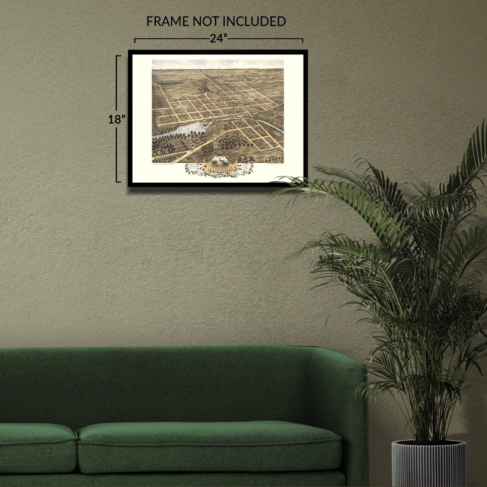
| size: |
24L" x 18W" |
| Mounting Type: |
Wall Mount |
| Part Number: |
ENMAP06581824 |
| Wall Art Form: |
poster |
| Target Gender: |
unisex |
Listing details
| Seller policies: | |
|---|---|
| Shipping discount: |
Seller pays shipping for this item. |
| Posted for sale: |
More than a week ago |
| Item number: |
1735808013 |
Item description
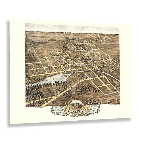
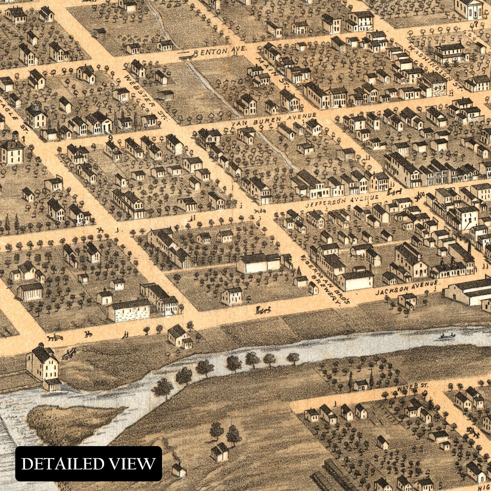
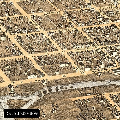
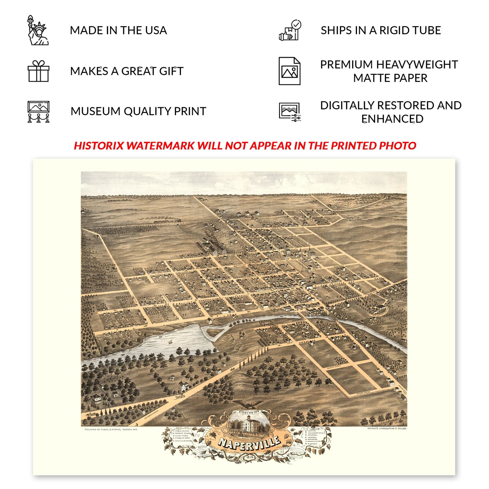
Located in the greater Chicago metropolitan area, Naperville is some 28 miles west of the city's downtown and bears a distinct heritage as one of Chicago's most prominent suburbs. The town was founded in 1831 on the banks of the DuPage River and has grown to become Illinois' fourth largest city. Joseph Naper arrived with his wife, brother, and sister and, by 1832, had been joined by another one-hundred settlers. Naper's settlement was officially incorporated in 1857, and by the time this panoramic map was produced, the city had grown significantly following the conclusion of the American Civil War and the subsequent migration of residents across the nation.
Produced by an early pioneer of the form, Albert Ruger, this bird's eye perspective bears a unique style and distinctive aesthetic that immediately transports the viewer back in time, creating an indelible bond between the past and present. Ruger's work served as marketing materials to entice residents and merchants alike by featuring prominent civic buildings, educational institutions, religious communities, and natural attractions. As Chicago continued to become the largest city in the American Midwest, residents flocked to the neighboring suburbs, including Naperville, which developed distinct cultures of their own, and numerous neighborhoods and communities were established based on cultural heritage, many of which exist to this day.
This bird's eye perspective is an authentic piece of American cartographical history. Naperville remains a vibrant community and, by the latter portion of the nineteenth century, continued to grow, expand, and prosper.
Additional Details
------------------------------
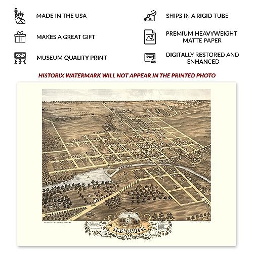
Bullet point: VINTAGE MAP REPRODUCTION: You?ll love this high quality historic reproduction of 1869 Naperville Illinois Map Poster. Our museum quality prints are archival grade, which means it will look great and last without fading for over 100 years. Our print to order maps are made in the USA and each map is inspected for quality. This beautiful artwork is a perfect addition to your themed decor. Vintage maps look great in the home, study or office. They make a perfect gift as well.
Product description:
Located in the greater Chicago metropolitan area, Naperville is some 28 miles west of the city's downtown and bears a distinct heritage as one of Chicago's most prominent suburbs. The town was founded in 1831 on the banks of the DuPage River and has grown to become Illinois' fourth largest city. Joseph Naper arrived with his wife, brother, and sister and, by 1832, had been joined by another one-hundred settlers. Naper's settlement was officially incorporated in 1857, and by the time this panoramic map was produced, the city had grown significantly following the conclusion of the American Civil War and the subsequent migration of residents across the nation.
Produced by an early pioneer of the form, Albert Ruger, this bird's eye perspective bears a unique style and distinctive aesthetic that immediately transports the viewer back in time, creating an indelible bond between the past and present. Ruger's work served as marketing materials to entice residents and merchants alike by featuring prominent civic buildings, educational institutions, religious communities, and natural attractions. As Chicago continued to become the largest city in the American Midwest, residents flocked to the neighboring suburbs, including Naperville, which developed distinct cultures of their own, and numerous neighborhoods and communities were established based on cultural heritage, many of which exist to this day.
This bird's eye perspective is an authentic piece of American cartographical history. Naperville remains a vibrant community and, by the latter portion of the nineteenth century, continued to grow, expand, and prosper.
Loading
This item has been added to your cart
 HISTORIX Vintage 1869 Naperville Illinois Map Poster - 18x24 Inch Old Bird's Eye added to cart.
8 available in stock
HISTORIX Vintage 1869 Naperville Illinois Map Poster - 18x24 Inch Old Bird's Eye added to cart.
8 available in stock
View Cart or continue shopping.
 Please wait while we finish adding this item to your cart.
Get an item reminder
We'll email you a link to your item now and follow up with a single reminder (if you'd like one). That's it! No spam, no hassle.
Already have an account?
Log in and add this item to your wish list.