HISTORIX 2005 Map of the Antarctic Region - and similar items


Free Shipping
HISTORIX 2005 Map of the Antarctic Region - 18x24 Inch Antarctic Peninsula Map -
$39.99
View full item details »

Shipping options
Seller handling time is 2 business days Details
FREE via to United States
Return policy
Full refund available for DOAs
Details
Purchase protection
Payment options
PayPal accepted
PayPal Credit accepted
Venmo accepted
PayPal, MasterCard, Visa, Discover, and American Express accepted
Maestro accepted
Amazon Pay accepted
Nuvei accepted
View full item details »
Shipping options
Seller handling time is 2 business days Details
FREE via to United States
Return policy
Full refund available for DOAs
Details
Purchase protection
Payment options
PayPal accepted
PayPal Credit accepted
Venmo accepted
PayPal, MasterCard, Visa, Discover, and American Express accepted
Maestro accepted
Amazon Pay accepted
Nuvei accepted
Item traits
| Category: | |
|---|---|
| Quantity Available: |
8 in stock |
| Condition: |
New |
| ASIN: |
B086DMXJZW |
| Age Range Description: |
Over 100 years |
| Bullet Point: | |
| Product Description: | |
| Brand: |
HISTORIX |
| Unspsc Code: |
55101500 |
| Item Type Keyword: |
prints |
| Finish Type: |
Matte |
| size: |
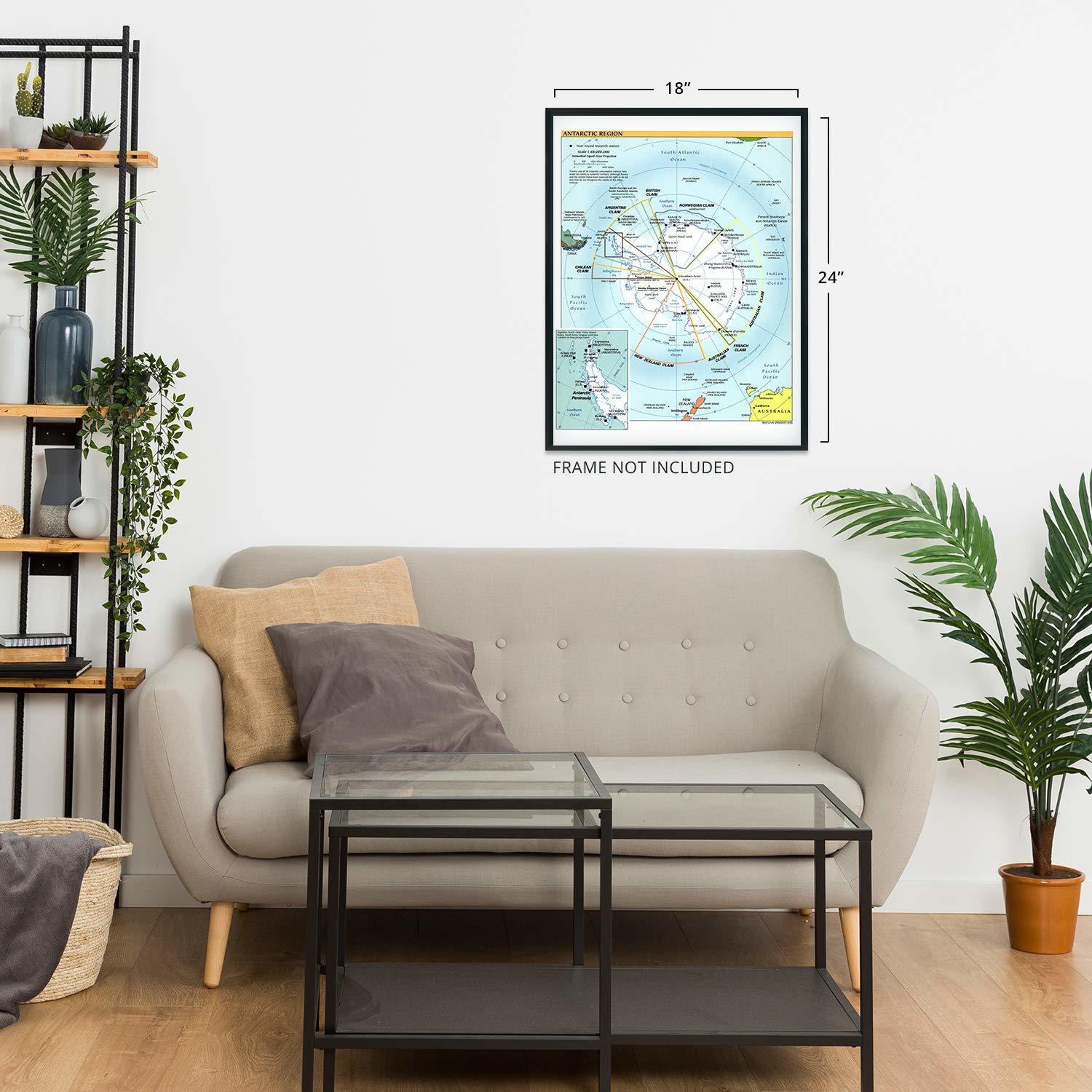
24L" x 18W" |
| Paper Size: |
18 x 24 |
| Style: |
Fine Art |
| Wall Art Form: |
poster |
| Target Gender: |
unisex |
| Paint Type: |
Watercolor |
| Color: |
colorful |
| Pattern: |
Printed |
| manufacturer: |
Historix |
| Item Shape: |
Rectangular |
| Indoor Outdoor Usage: |
indoor |
| theme: |
Historical |
| Special Feature: |
Lightweight |
| orientation: |
Portrait |
| Paper Finish: |
matte |
| Item Name: | |
| Material: |
Paper |
| Mounting Type: |
Wall Mount |
| Room Type: |
Office |
Listing details
| Seller policies: | |
|---|---|
| Shipping discount: |
Seller pays shipping for this item. |
| Posted for sale: |
More than a week ago |
| Item number: |
1735164260 |
Item description
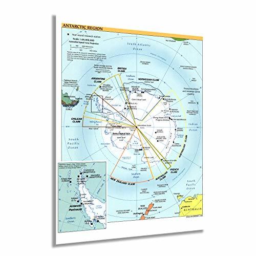
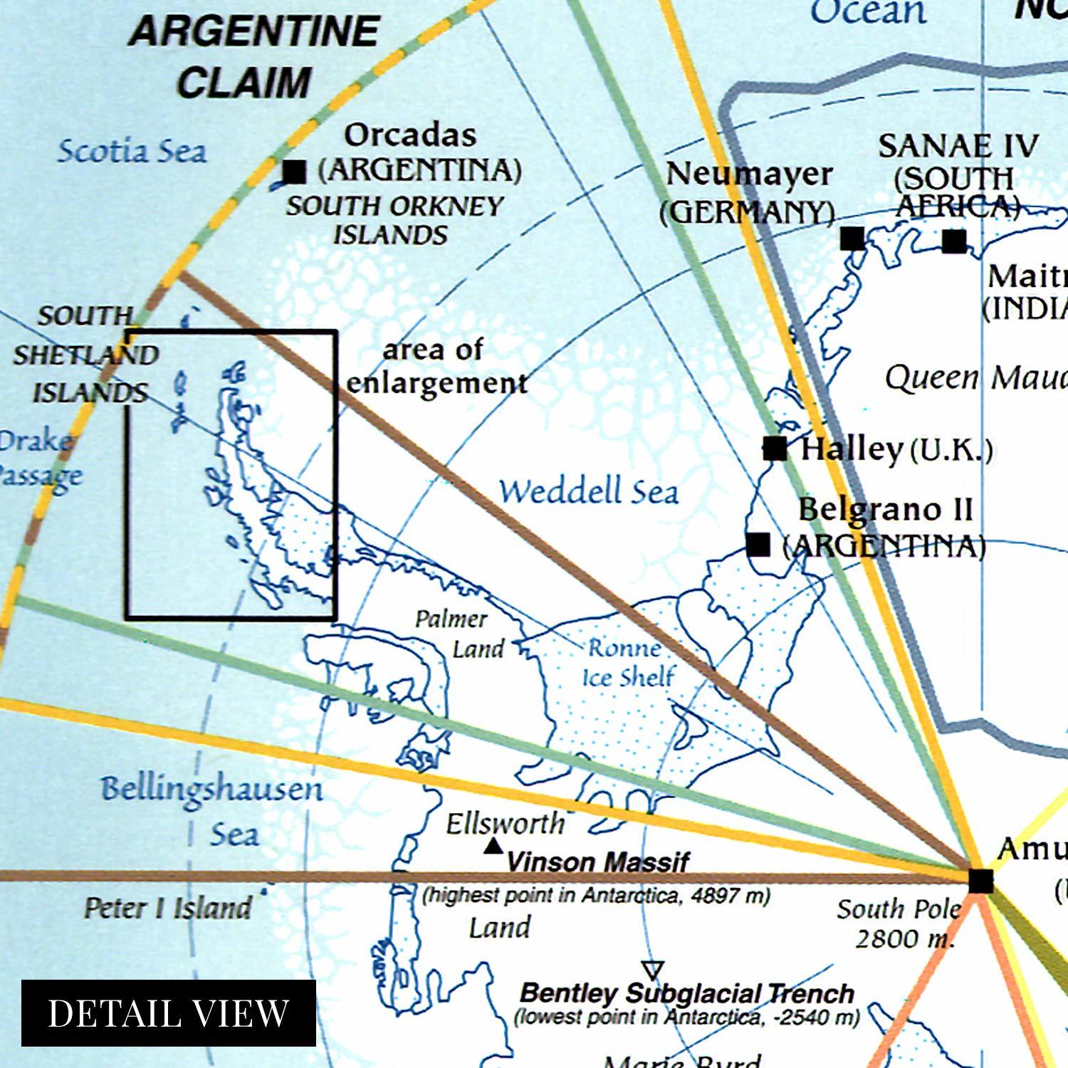
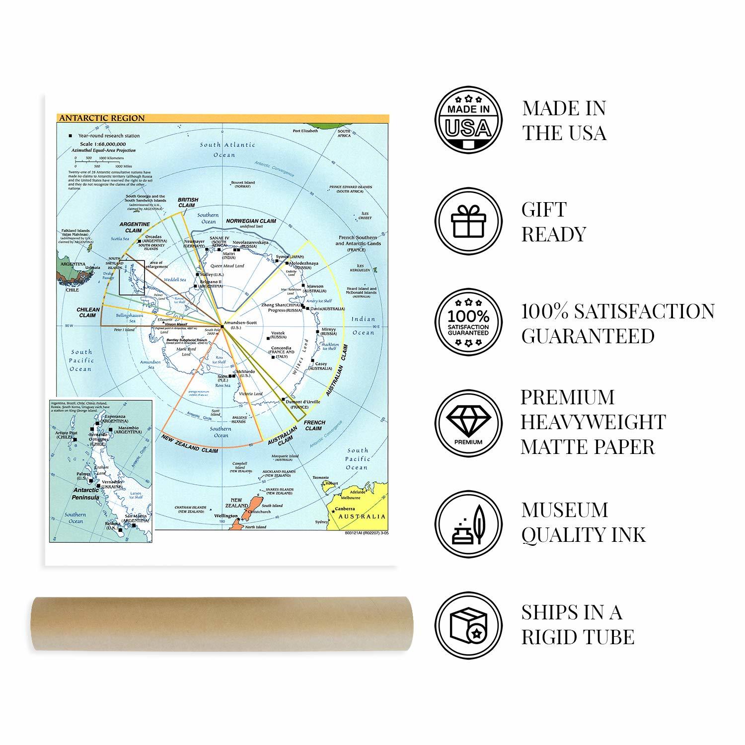
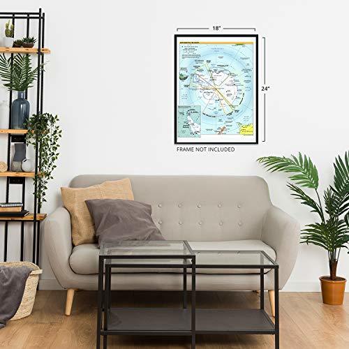
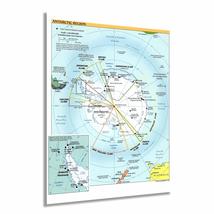
Created by the CIA in 2005, this map depicts the Antarctic region and the outlying Islands. Home to year-round research stations, the continent is the coldest, driest, and windiest on the planet. This map displays the international claims within the continent, which has no traditional boundaries as it is uninhabitable by anyone other than international researchers. Though the continent is primarily covered in ice, recent techniques have been developed to study the unique geology that lies beneath. Geologically Antarctica is similar to the southern Andes Mountains.
The original Amundsen-Scott South Pole station was built near the center of the continent and was built in 1956, making it the first permanent structure. The station is the southernmost habitation on Earth and is named after the first two explorers to reach the South Pole. Norwegian Roald Amundsen was the first to reach the South Pole in December 1911, followed one month later by the British expedition led by Robert F. Scott. The dome was abandoned in 1975 after the construction of a geodesic dome. Eventually, the dome was also left behind after the completion of the current station, which was officially dedicated in 2008.
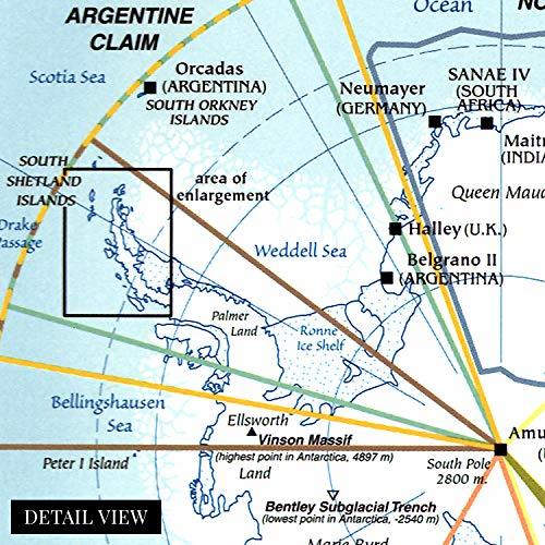
The unique climate in Antarctica makes it particularly well suited for conducting astronomical research due to the lack of light pollution or cloud cover. Scientists from around the world also study glaciers, geophysics, meteorology, and bio-medicine in the station. The insert on the map details the most densely populated portion of the continent on the Antarctic Peninsula with eight international research stations.
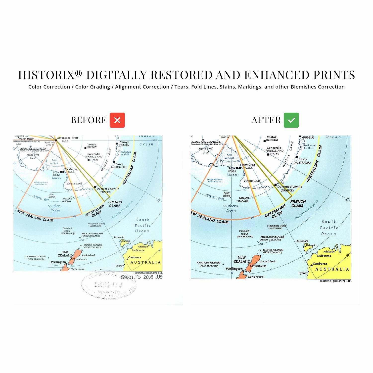
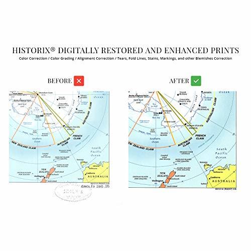
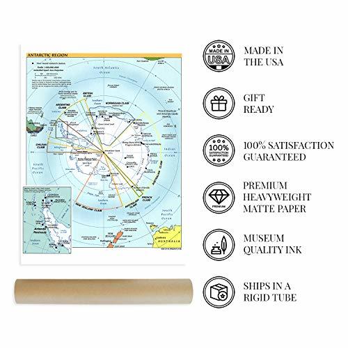
Our museum quality giclee print comes printed with archival ink on premium heavyweight matte paper. Shipped in a sturdy cardboard tube your print will arrive ready to be framed. This eye-catching print makes the perfect gift for anyone that loves history and imagery.
Additional Details
------------------------------
Bullet point: HISTORIC PRINTS: You?ll love this high quality print of 2005 Map of the Antarctic Region. Our museum quality prints are archival grade, which means it will look great and last without fading for over 100 years. Our print to order maps are made in the USA and each map is inspected for quality. Maps are great for education in the classroom. Maps also make for beautiful wall art in the home, study or office. A great gift for travelers or map enthusiasts.
Product description:
Created by the CIA in 2005, this map depicts the Antarctic region and the outlying Islands. Home to year-round research stations, the continent is the coldest, driest, and windiest on the planet. This map displays the international claims within the continent, which has no traditional boundaries as it is uninhabitable by anyone other than international researchers. Though the continent is primarily covered in ice, recent techniques have been developed to study the unique geology that lies beneath. Geologically Antarctica is similar to the southern Andes Mountains.
The original Amundsen-Scott South Pole station was built near the center of the continent and was built in 1956, making it the first permanent structure. The station is the southernmost habitation on Earth and is named after the first two explorers to reach the South Pole. Norwegian Roald Amundsen was the first to reach the South Pole in December 1911, followed one month later by the British expedition led by Robert F. Scott. The dome was abandoned in 1975 after the construction of a geodesic dome. Eventually, the dome was also left behind after the completion of the current station, which was officially dedicated in 2008.
The unique climate in Antarctica makes it particularly well suited for conducting astronomical research due to the lack of light pollution or cloud cover. Scientists from around the world also study glaciers, geophysics, meteorology, and bio-medicine in the station. The insert on the map details the most densely populated portion of the continent on the Antarctic Peninsula with eight international research stations.
Our museum quality giclee print comes printed with archival ink on premium heavyweight matte paper. Shipped in a sturdy cardboard tube your print will arrive ready to be framed. This eye-catching print makes the perfect gift for anyone that loves history and imagery.
Loading
This item has been added to your cart
 HISTORIX 2005 Map of the Antarctic Region - 18x24 Inch Antarctic Peninsula Map - added to cart.
8 available in stock
HISTORIX 2005 Map of the Antarctic Region - 18x24 Inch Antarctic Peninsula Map - added to cart.
8 available in stock
View Cart or continue shopping.
 Please wait while we finish adding this item to your cart.
Get an item reminder
We'll email you a link to your item now and follow up with a single reminder (if you'd like one). That's it! No spam, no hassle.
Already have an account?
Log in and add this item to your wish list.