Rendered at 06:20:36 07/23/25


Free Shipping
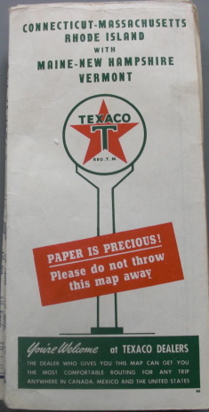
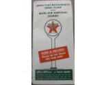
Texaco Touring Map of Connecticut-Massachusets Rhode Island with Maine-New Hamps
$19.00
Shipping options
Estimated to arrive by Thu, Jul 31st.
Details
FREE via UPS Ground (1 to 5 business days) to United States
Return policy
Purchase protection
Payment options
PayPal accepted
PayPal Credit accepted
Venmo accepted
PayPal, MasterCard, Visa, Discover, and American Express accepted
Maestro accepted
Amazon Pay accepted
Nuvei accepted
Item traits
| Category: | |
|---|---|
| Quantity Available: |
Only one in stock, order soon |
| Condition: |
Used |
| Country: |
United States |
| Country/Region of Manufacture: |
United States |
| Publication Date: |
1940 |
Listing details
| Shipping discount: |
Seller pays shipping for this item. |
|---|---|
| Price discount: |
10% off w/ $100.00 spent |
| Posted for sale: |
More than a week ago |
| Item number: |
1743435248 |
Item description
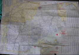
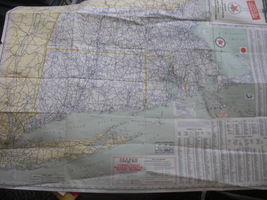
Texaco Touring Map of Connecticut-Massachusets Rhode Island with Maine-New Hampshire and Vermont. C. 1940 and printed by Rand McNally Company, Chicago, Ill.
Clean and crisp, minimal tare on one edge. Excellent condition. Lots of information on the map, populations of cities, reading road signs, etc
Added to your wish list!
Get an item reminder
We'll email you a link to your item now and follow up with a single reminder (if you'd like one). That's it! No spam, no hassle.
Already have an account?
Log in and add this item to your wish list.