Rendered at 05:47:03 07/23/25


Free Shipping
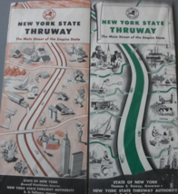
New York State Thruway Maps-The Main Street of the Empire State., printed by Sta
$12.00
Shipping options
Estimated to arrive by Thu, Jul 31st.
Details
FREE via UPS Ground (1 to 5 business days) to United States
Return policy
Purchase protection
Payment options
PayPal accepted
PayPal Credit accepted
Venmo accepted
PayPal, MasterCard, Visa, Discover, and American Express accepted
Maestro accepted
Amazon Pay accepted
Nuvei accepted
Item traits
| Category: | |
|---|---|
| Quantity Available: |
Only one in stock, order soon |
| Condition: |
Used |
| Country: |
United States |
| Country/Region of Manufacture: |
United States |
| Publication Date: |
1950 |
Listing details
| Shipping discount: |
Seller pays shipping for this item. |
|---|---|
| Price discount: |
10% off w/ $100.00 spent |
| Posted for sale: |
More than a week ago |
| Item number: |
1742789638 |
Item description
Two Vintage 1950’s Map of New York State Thruway - Main Street of The Empire State. New York State Thruway Authority, 1957. Very Good. Map of the New York State Thruway by the General Drafting Company. Rubbing, Very Good
Added to your wish list!

Get an item reminder
We'll email you a link to your item now and follow up with a single reminder (if you'd like one). That's it! No spam, no hassle.
Already have an account?
Log in and add this item to your wish list.