Rendered at 09:00:27 08/07/25


Belgium, Netherlands, Luxembourg L. C. Desnos / M. Brion, 1767, Les Pays Bas Fra
Ships from
Spain

Shipping options
Estimated to arrive by Wed, Aug 13th.
Details
$15.00 via Standard shipping (1 to 5 business days) to United States
Ships from
Spain
Offer policy
OBO - Seller accepts offers on this item.
Details
Return policy
Full refund available within 30 days
Purchase protection
Payment options
PayPal accepted
PayPal Credit accepted
Venmo accepted
PayPal, MasterCard, Visa, Discover, and American Express accepted
Maestro accepted
Amazon Pay accepted
Nuvei accepted
Item traits
| Category: | |
|---|---|
| Quantity Available: |
Only one in stock, order soon |
| Condition: |
Unspecified by seller, may be new. |
| Type: |
Topographical Map |
| Original/Reproduction: |
Antique Original |
| Date Range: |
1700-1799 |
| Year: |
1767 |
| Country/Region: |
Belgium |
| Format: |
Atlas Map |
| Printing Technique: |
Copper Plate |
| Cartographer/Publisher: |
Brion de la Tour |
Listing details
| Seller policies: | |
|---|---|
| Shipping discount: |
No combined shipping offered |
| Posted for sale: |
More than a week ago |
| Item number: |
1756263357 |
Item description
Old
maps, Genuine antiques
No
copies
Belgium,
Netherlands, Luxembourg
L.
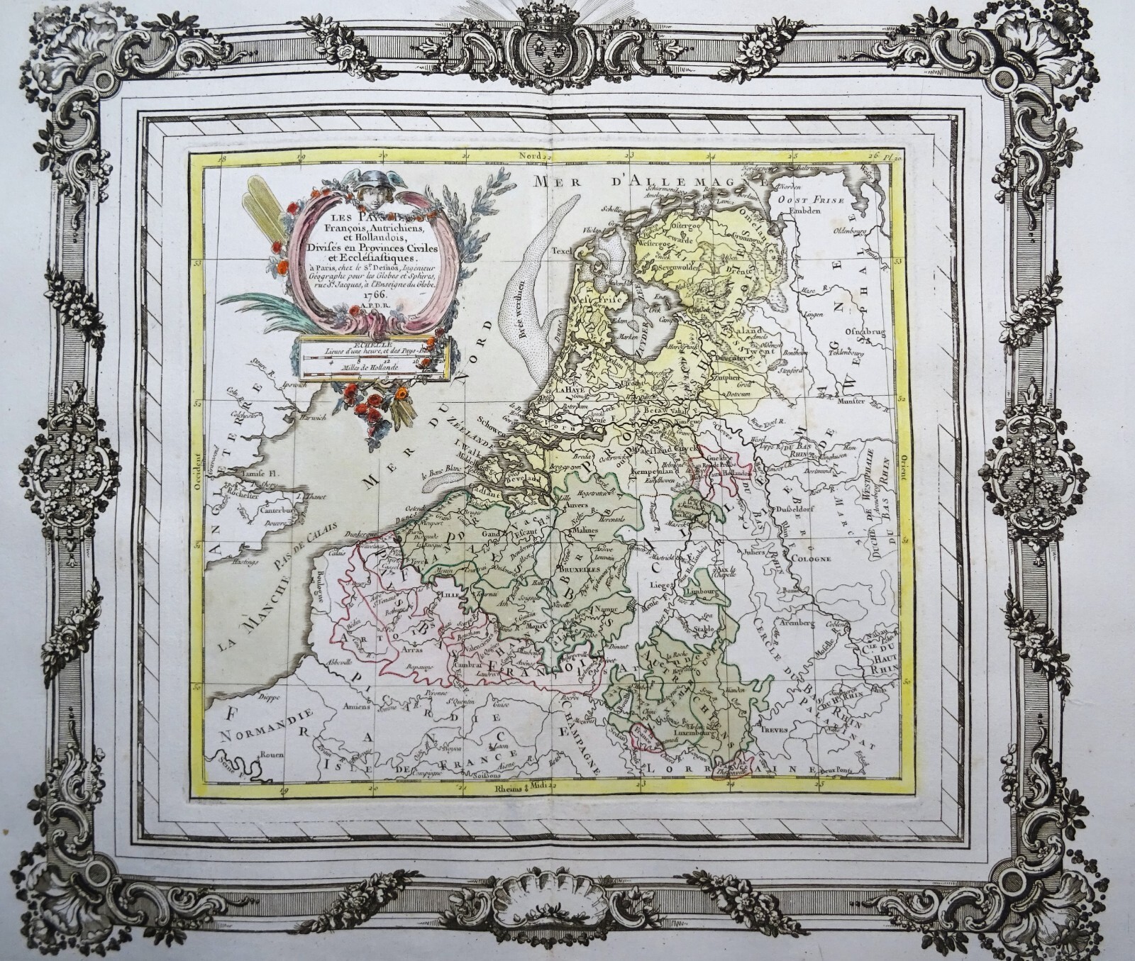
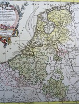
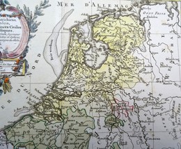
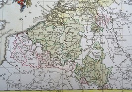
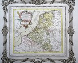
C. Desnos / M. Brion, 1767, Les Pays Bas Francois, Autrichien et
Hollandais?
Cartographer
/ Cartografo
L.
C. Desnos / M. Brion
Title
/ Título
Les
Pays Bas Francois, Autrichien et Hollandais?
Year
/ Año
1767
Size
/ Tamaño
Image
35x39cm, sheet 40x52,5
Description
/ Descripcion
Folio
size map, made by Brion de la Tour, of Belgium,
the Netherlands and Luxemburg, also showing the parts of the
original Low Countries that were in French hands.
The
map is printed in a decorative frame and in orginal coloring.
Published
in Atlas general, civil et ecclesiastique, methodique et
elementaire pour l'etude de la geographie et de l'histoire /
Chez le sieur Desnos a Paris, 1767
Louis
Brion De La Tour (fl 1756-1803)
Beyond
the fact that Brion was an engineer by profession and held the
post of Ingenieur-Geographe du Roi, little is known of his career.
He published a wide range of statistical works and a number of
atlases, published by the well known French mapmaker Louis Charles
Desnos (1725-1805).
Condition
/ Estado
Excellent
condition. Thick paper. Clear print. Original coloring. Ample
margins. Reverse side blank.
Remarks
/ Comentarios
Please
read the part about the condition of the map and study the
pictures carefully before buying. I sell original maps, often
several centuries old, and they therefore will have signs of
age and use.
Por
favor, estudie atentamente las fotos y el texto para conocer el
estado del mapa antes de adquirirlo. Se trata de un mapa original
que tiene unos siglos de antigüedad, razon por la que presenta
ciertas marcas de uso.
Payment
and shipment / Pago y envío
Payment
/ Pago
With
bank transfer to Spanish or Dutch bank account or with PayPal (the
seller prefers a bank transfer).
Pago
por transferencia bancaria a cuenta española u holandesa o con
PayPal (el vendedor prefiere transferencia).
Shipment
/ Envío
In
case you choose to have the item shipped without certified/insured
mail, the seller will not be responsible for safe arrival of the
shipment. If
needed, a proof of shipment can be provided.
En
caso de que usted no elija correo certificado, el vendedor no se
hara responsable si su paquete no llega bien. Si
lo desea, recibira un comprobante de envío.
Return
policy / devolucion
In
case you do not like the map, you can return it to the seller
within 10 days after receiving it. You are responsible for the
costs for return shipment/insurance. You will receive a full
refund of the purchase amount (excl. shipping costs) after the
seller has the map.
En
caso de que al final no le guste el mapa, puede devolverlo en un
plazo de 10 días tras recibirlo. Los gastos de envío
(certificado) corren de su cargo. Cuando el vendedor reciba el
mapa, le sera devuelto el importe completo de la compra
(excluidos los gastos de envío).
SHIPMENT
CAN BE COMBINED
PUEDEN
MANDARSE VARIOS MAPAS EN UN SOLO ENVÍO
SEE
THE OTHER MAPS I HAVE FOR SALE
MIRE
LOS DEMAS MAPAS QUE TENGO EN VENTA
Keywords:
24 26 AK
Added to your wish list!
- Belgium, Netherlands, Luxembourg L. C. Desnos / M. Brion, 1767, Les Pays Bas Fra
- 1 in stock
- Price negotiable
- Handling time 1 day. Estimated delivery: Wed, Aug 13th
- Returns/refunds accepted
Get an item reminder
We'll email you a link to your item now and follow up with a single reminder (if you'd like one). That's it! No spam, no hassle.
Already have an account?
Log in and add this item to your wish list.