HISTORIX Vintage 1968 China Nepal Boundary and similar items


Free Shipping
HISTORIX Vintage 1968 China Nepal Boundary Map - 18x24 Inch Vintage Map of China
$39.99 - $59.99
View full item details »

Shipping options
Seller handling time is 1 business day Details
FREE via to United States
Return policy
Full refund available for DOAs
Details
Purchase protection
Payment options
PayPal accepted
PayPal Credit accepted
Venmo accepted
PayPal, MasterCard, Visa, Discover, and American Express accepted
Maestro accepted
Amazon Pay accepted
Nuvei accepted
View full item details »
Shipping options
Seller handling time is 1 business day Details
FREE via to United States
Return policy
Full refund available for DOAs
Details
Purchase protection
Payment options
PayPal accepted
PayPal Credit accepted
Venmo accepted
PayPal, MasterCard, Visa, Discover, and American Express accepted
Maestro accepted
Amazon Pay accepted
Nuvei accepted
Item traits
| Category: | |
|---|---|
| Quantity Available: |
16 in stock |
| Condition: |
New |
| UPC: |
737214974857 |
| Item Name: |
1968 China-Nepal boundary Poster Print |
| Item Type Keyword: |
prints |
| Product Site Launch Date: |
2021-12-27T08:04:17.830Z |
| Unspsc Code: |
10111300 |
| sizes: |
Listing details
| Seller policies: | |
|---|---|
| Shipping discount: |
Seller pays shipping for this item. |
| Posted for sale: |
April 13 |
| Item number: |
1738905083 |
Item description
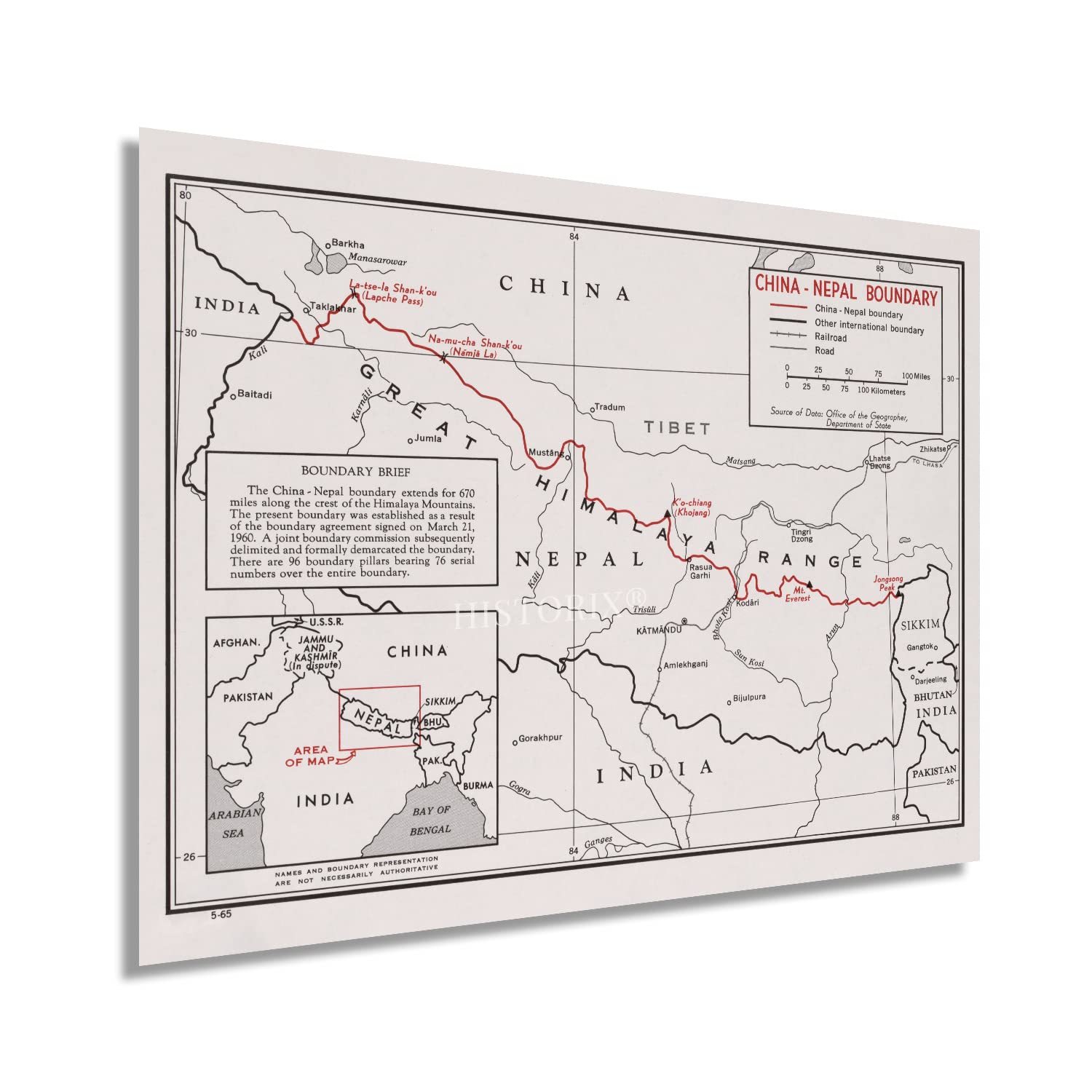
The international border between Nepal and the Autonomous Region of Tibet has a long and storied history and features perhaps the most iconic peak globally with Mount Everest. The border has long been disputed and has shifted dramatically due to disputes between the two nations for centuries. The years following the conclusion of World War II and the beginning of the Cold War put particular focus on the border, and the current geopolitical boundary was established in 1960 with the Sino-Nepalese treaty of Peace and Friendship. The border itself is nearly nine hundred miles long and traverses the Himalayan Mountain Range.
Historically this region has been an important trade route for India, Nepal, and China allowing for the flow of goods, agricultural products, and ideas for centuries. There have been numerous disputes over the border, and in 2012 an agreement was reached to open six international ports of entry to allow expanded commercial opportunities.
The Central Intelligence Agency began producing maps in 1941 and maintains a comprehensive database of productions that chronicle the most accurate geopolitical data as boundaries, governments, and international borders evolve and change. CIA maps bear a signature style characterized by minimal inclusion of unnecessary information or imagery, and this example takes that characteristic to the extreme. The immediately recognizable aesthetic makes this a remarkable piece of CIA cartographical history. The Western portion of the border remains disputed between Nepal and India, and the Nepalese Parliament objected to the establishment of a trading post in Lipulekh in 2015.
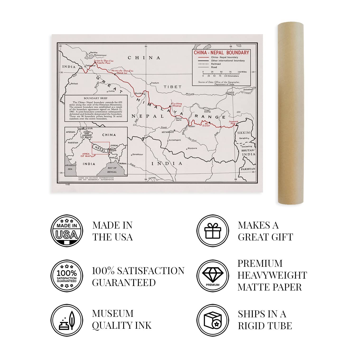
Our museum quality giclee print comes printed with archival ink on premium heavyweight matte paper. Shipped in a sturdy cardboard tube your print will arrive ready to be framed. This eye-catching vintage map reproduction print makes the perfect gift for anyone that loves history and imagery.
Loading
This item has been added to your cart
 HISTORIX Vintage 1968 China Nepal Boundary Map - 18x24 Inch Vintage Map of China added to cart.
16 available in stock
HISTORIX Vintage 1968 China Nepal Boundary Map - 18x24 Inch Vintage Map of China added to cart.
16 available in stock
View Cart or continue shopping.
 Please wait while we finish adding this item to your cart.
Get an item reminder
We'll email you a link to your item now and follow up with a single reminder (if you'd like one). That's it! No spam, no hassle.
Already have an account?
Log in and add this item to your wish list.