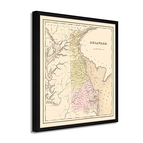
1838 Delaware State Map - Framed Vintage and 46 similar items


Free Shipping
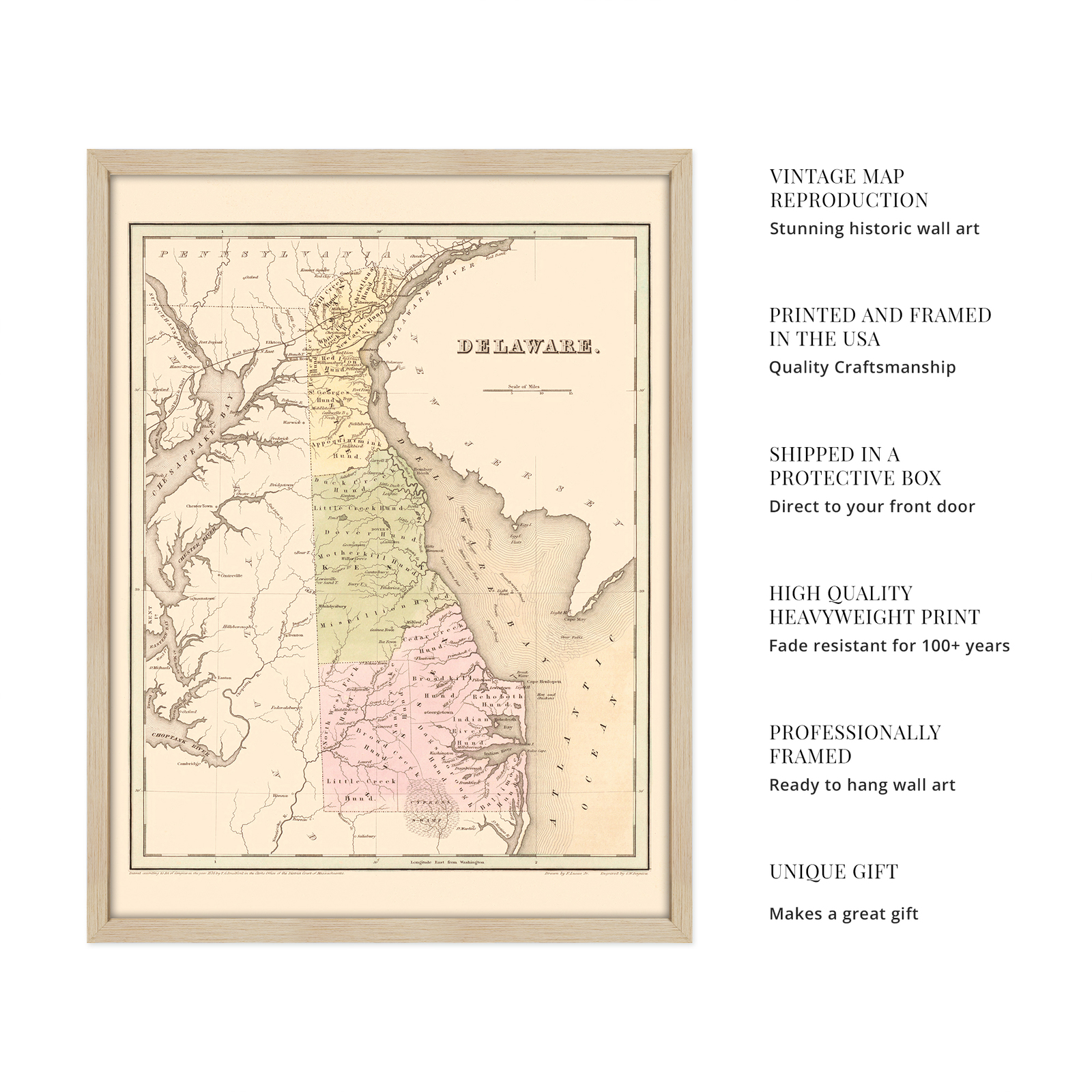
1838 Delaware State Map - Framed Vintage Delaware Wall Art Poster Print
$275.99 - $326.99
View full item details »

Shipping options
Estimated to arrive by Mon, Jun 16th.
Details
FREE via UPS Ground (1 to 5 business days) to United States
Return policy
Full refund available for DOAs
Details
Purchase protection
Payment options
PayPal accepted
PayPal Credit accepted
Venmo accepted
PayPal, MasterCard, Visa, Discover, and American Express accepted
Maestro accepted
Amazon Pay accepted
Nuvei accepted
View full item details »
Shipping options
Estimated to arrive by Mon, Jun 16th.
Details
FREE via UPS Ground (1 to 5 business days) to United States
Return policy
Full refund available for DOAs
Details
Purchase protection
Payment options
PayPal accepted
PayPal Credit accepted
Venmo accepted
PayPal, MasterCard, Visa, Discover, and American Express accepted
Maestro accepted
Amazon Pay accepted
Nuvei accepted
Item traits
| Category: | |
|---|---|
| Quantity Available: |
16 in stock |
| Condition: |
New |
| Subject: |
Maps |
| Style: |
Vintage |
| Type: |
Wall Art |
| Features: |
Museum Quality |
| Theme: |
History |
| Artist: |
Various |
| Region of Origin: |
Made in the USA |
| Framing: |
Framed |
| Brand: |
HISTORIX |
| Sizes: | |
| Colors: |
Listing details
| Seller policies: | |
|---|---|
| Shipping discount: |
Seller pays shipping for this item. |
| Posted for sale: |
More than a week ago |
| Item number: |
1738800538 |
Item description
Feature Points
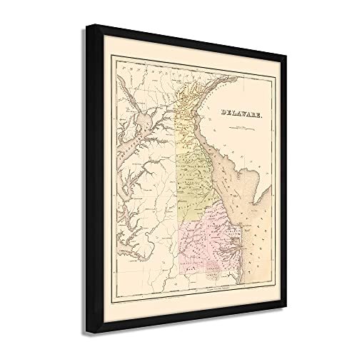
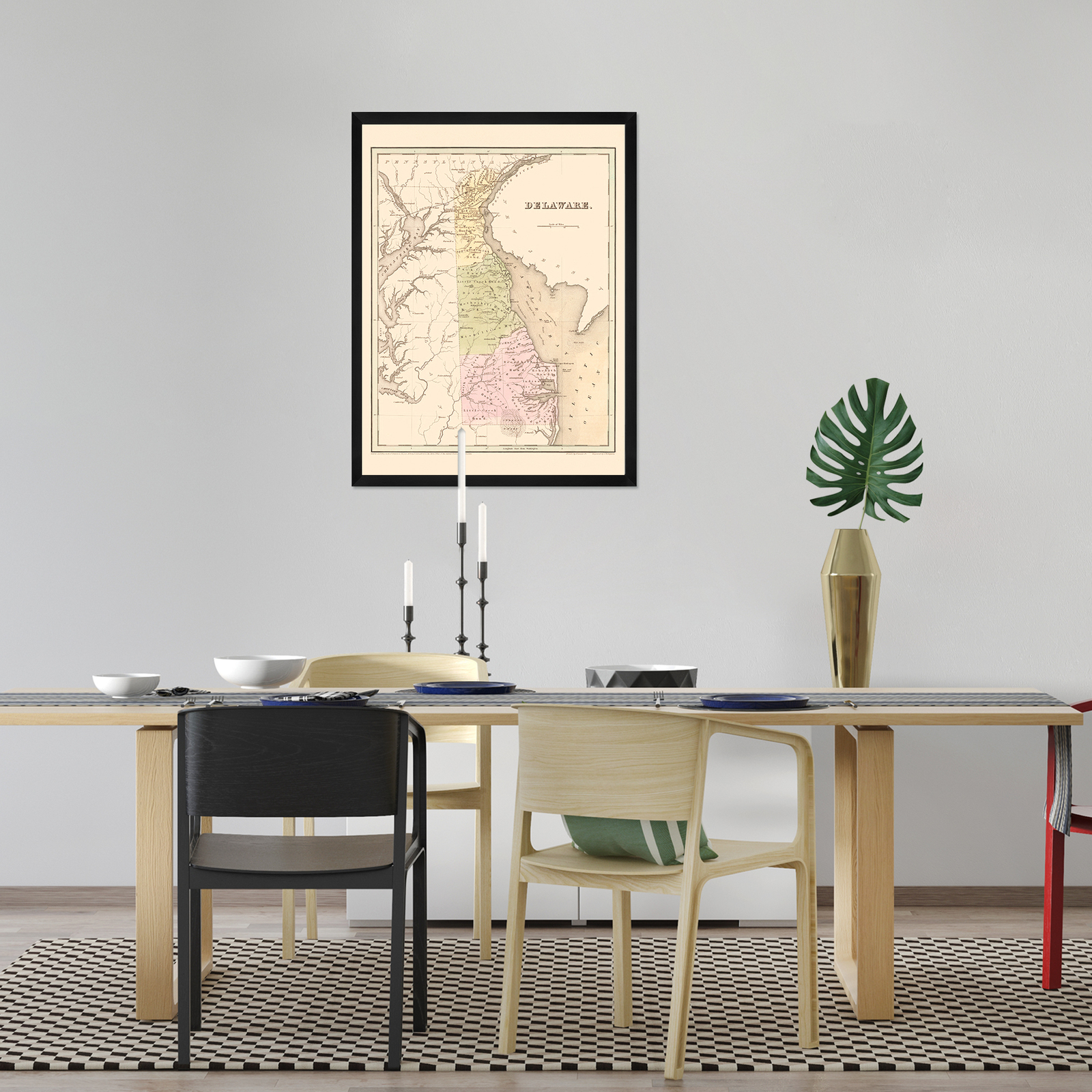
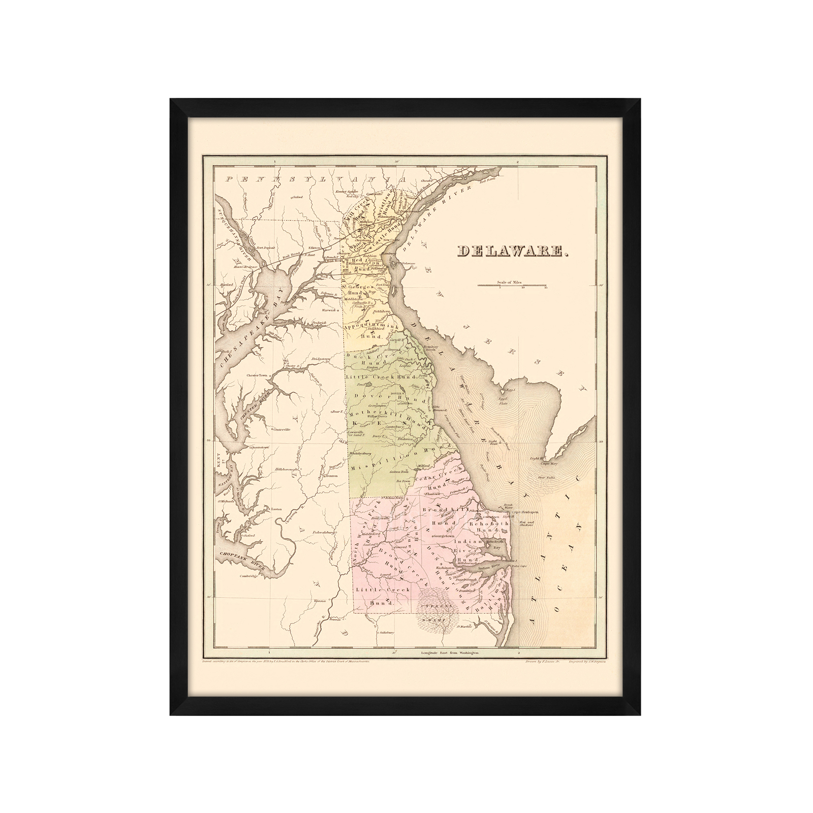
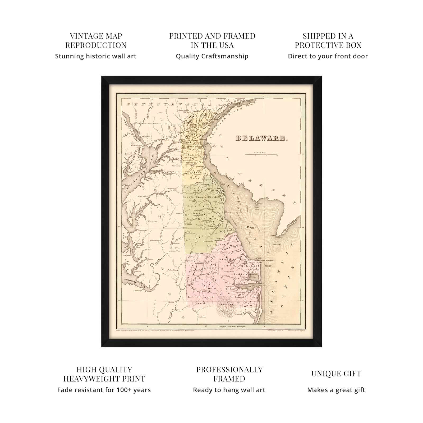
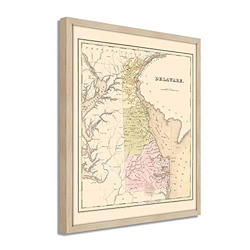
VINTAGE MAP FRAMED: You?ll love this high-quality framed historic reproduction of 1838 Delaware State Map. Our ready-to-hang maps are printed and framed in the USA by professional art framers using the highest quality materials. Each order is inspected for quality. This beautiful artwork is a perfect addition to your themed decor. Vintage maps look great in the home, study or office. They also make an unforgettable gift.
A LOOK BACK AT HISTORY: This is an impressive, historic reproduction of 1838 Delaware Map. A true piece of history. Historic prints beautifully link the past with the present. You may find yourself staring at your historic wall art for hours in amazement. See our product description section for more fascinating information about this historic map and its significance.
PREMIUM QUALITY: To display this amazing piece of history, we use museum-quality heavyweight (230gsm), fine art print matte paper. Our paper is acid-free which allows the print to retain its color quality for generations. Our paper displays vintage map art with accurate color reproduction. This high quality print will be a wonderful addition to your vintage-themed wall.
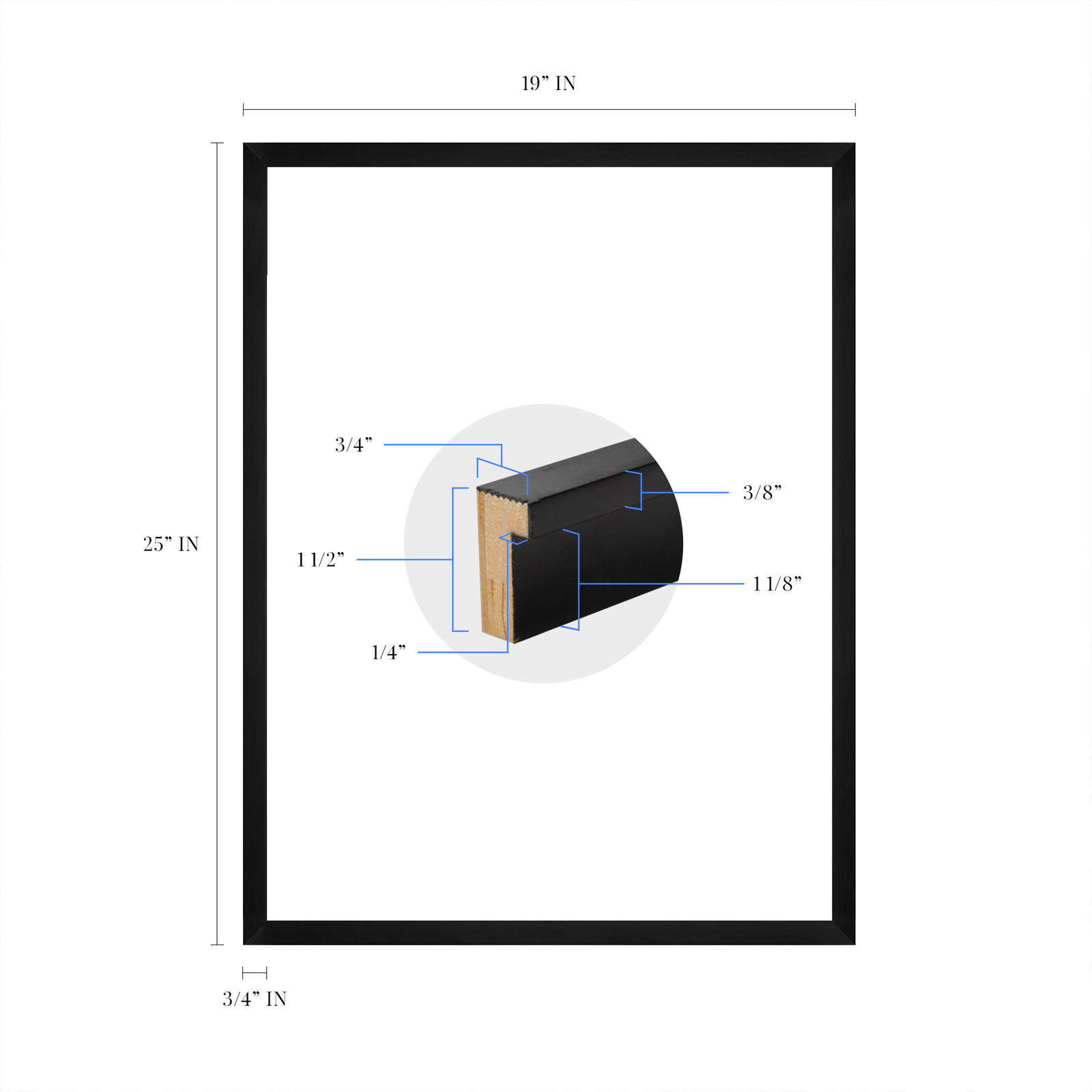
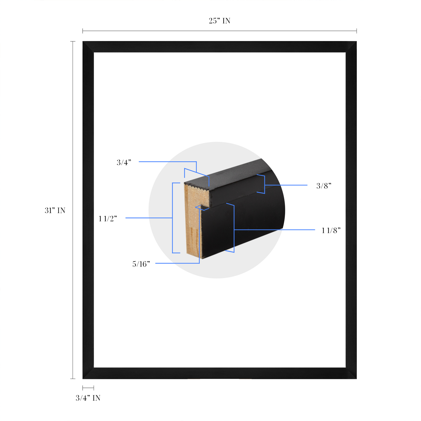
READY TO HANG: This high-quality frame displays art beautifully in almost any environment. The frame is made out of poplar wood (for black and white) and pine wood (for walnut and natural) with a matte finish. The frame profile is 1.5 inches high and 0.75 (for size 18x24) and 1.125 (for size 24x36) inches wide. To protect artwork, we use high-quality, lightweight, shatter-resistant frame-grade acrylic. Frames arrive ready-to-hang, preinstalled with hanging hardware.
HISTORIC PRINTS: We love history and art. Sometimes old maps have tears, folds, stamps, separations and other blemishes. We digitally restore and enhance maps while keeping its historical character. Our framed prints are made-to-order in the USA by professional art framers. Customers all over the world love our historic prints and we know you will too.
Additional Information
Illustrated by noted American artist, cartographer, and publisher Fielding Lucas Jr, this stunning depiction of Delaware shows the State in a period of stability and growth. By the mid-1830s, Delaware's population was nearly one hundred thousand. The states' commercial opportunities had been expanded with the completion of the Chesapeake and Delaware canal in the earlier part of the nineteenth century. Comprised of only three counties, the State was established in 1638 by William Penn and was one of the original thirteen colonies. The Battle of Cooch's Bridge was a significant military engagement between Colonists and British forces during the American Revolution.
The border between Delaware and Maryland forms the Mason-Dixon Line, which is considered the de-facto point between the American north and south. Delaware was the first colony to ratify the United States Constitution. By the early nineteenth century, the ports and waterways allowed the State to import and export numerous goods. These ports would become essential features in the following decades as the American Civil War would rage on the Maryland and Virginia borders, Delaware became an important location for troops and armaments.
Lucas' depictions were among the most prized of the era, and this is truly a piece of American cartographical history. He became the most successful mapmaker in Baltimore, and his contributions to early American mapmaking are considerable. Delaware's mid-atlantic location and coastal geography have contributed to the development of a distinct culture and identity that blends Northern and Southern traditions.
Our ready-to-hang wall art are printed and framed in the USA using the highest quality materials with professional craftsmanship. This beautiful artwork is a perfect addition to your themed decor. Historic prints look great in the home, study or office. They also make an unforgettable gift.
|
Why are we showing these items?
Search Results
Print, art prints"print" Category "Art Prints"
|


-
Refine your browsing experience
We can show you more items that are exactly like the original item, or we can show you items that are similar in spirit. By default we show you a mix.


This item has been added to your cart
 1838 Delaware State Map - Framed Vintage Delaware Wall Art Poster Print added to cart.
16 available in stock
1838 Delaware State Map - Framed Vintage Delaware Wall Art Poster Print added to cart.
16 available in stock
View Cart or continue shopping.
 Please wait while we finish adding this item to your cart.
Get an item reminder
We'll email you a link to your item now and follow up with a single reminder (if you'd like one). That's it! No spam, no hassle.
Already have an account?
Log in and add this item to your wish list.